
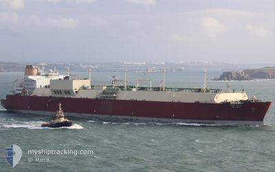
UMM SLAL
Lng Tanker
Current Trip
| Time Travelled | 6 days |
|---|---|
| Remaining Time | 5 days |
| Distance Travelled | 2295.21 nm |
| Remaining Distance | 2229.55 nm |
| AVG Speed | 15.2 Noeuds |
| MAX Speed | 16.7 Noeuds |
| AVG Wind | 9 knots |
| MAX Wind | 18 knots |
| MIN Temp | 20.4°C / 68.72°F |
| MAX Temp | 31.4°C / 88.52°F |
| Tirant d eau | 11.7 m |
| Position reçue | 23 h, 43 m depuis |
Current Position
| Longitude | 80.33330° |
|---|---|
| Latitude | 5.83619° |
| Etat | Under way using engine |
| Vitesse | 16 Noeuds |
| Parcours | 130.5° |
| Zone | Laccadive Sea |
| Station | T-AIS |
| Position reçue | 23 h, 43 m depuis |
Info
Information
The current position of UMM SLAL is in Laccadive Sea with coordinates 5.83619° / 80.33330° as reported on 2025-03-20 12:01 by AIS to our vessel tracker app. The vessel's current speed is 16 Noeuds and is heading at the port of MAP TA PHUT. The estimated time of arrival as calculated by MyShipTracking vessel tracking app is 2025-03-27 03:17 LT
The vessel UMM SLAL (IMO: 9372731, MMSI: 538003300) is a Lng Tanker that was built in 2008 ( 17 Age ). It's sailing under the flag of [MH] Marshall Is.
In this page you can find informations about the vessels current position, last detected port calls, and current voyage information. If the vessels is not in coverage by AIS you will find the latest position.
The current position of UMM SLAL is detected by our AIS receivers and we are not responsible for the reliability of the data. The last position was recorded while the vessel was in Coverage by the Ais receivers of our vessel tracking app.
The current draught of UMM SLAL as reported by AIS is 11.7 meters
Weather
| Temperature | 28.7°C / 83.66°F |
|---|---|
| Wind Speed | 13 knots |
| Direction | 44° NE |
| Pressure | 1010.3 hPa |
| Humidity | 73.6 % |
| Cloud Coverage | 100 % |
Featured Company
Last Port Calls
| Port | Arrival | Departure | Time In Port |
|---|---|---|---|
| 2025-03-13 11:23 | 2025-03-14 15:02 | 1 d | |
| 2025-02-13 22:26 | 2025-02-15 03:15 | 1 d | |
| 2025-01-02 13:32 | 2025-01-03 19:41 | 1 d |
Most Visited Ports (Last year)
| Port | Arrivals | |
|---|---|---|
| 10 | ||
| 1 |
Last Trips
| Origin | Departure | Destination | Arrival | Distance | |
|---|---|---|---|---|---|
| 2025-02-15 03:15 | 2025-03-13 11:23 | 5133.42 nm | |||
| 2025-01-03 19:41 | 2025-02-13 22:26 | 13320.69 nm | |||
| 2024-11-24 21:01 | 2025-01-02 13:32 | 10110.86 nm |
Events
| Heure | Evenement | Détails | Position/ Destination | Info |
|---|---|---|---|---|
| 2025-03-20 12:09 | Etat Changé | Default Under way using engine |
5.81521 / 80.35699
QA RLF>TH MAT
|
Vitesse: 16 kn Parcours: 130.5° |
| 2025-03-20 12:01 | Hors de la zone couverte |
5.83619 / 80.33330
Laccadive Sea
QA RLF>TH MAT
|
Vitesse: 16 kn Parcours: 130.5° |
|
| 2025-03-20 11:14 | Démarrage | 6.04 nm, South of GALLE |
5.92703 / 80.21419
QA RLF>TH MAT
|
Vitesse: 3.2 kn Parcours: 125° |
| 2025-03-20 10:03 | Arret | 6.4 nm, South of GALLE |
5.92174 / 80.20937
QA RLF>TH MAT
|
Vitesse: 0.3 kn Parcours: 21° |
| 2025-03-20 08:00 | Etat Changé | Under way using engine Default |
5.87828 / 80.20752
QA RLF>TH MAT
|
Vitesse: 5.4 kn Parcours: 110° |
| 2025-03-20 07:30 | Etat Changé | Default Under way using engine |
5.89227 / 80.16541
QA RLF>TH MAT
|
Vitesse: 11.8 kn Parcours: 100° |
| 2025-03-20 07:09 | Etat Changé | Under way using engine Default |
5.90379 / 80.09132
QA RLF>TH MAT
|
Vitesse: 15.5 kn Parcours: 120° |
| 2025-03-20 06:53 | Etat Changé | Default Under way using engine |
5.93528 / 80.02895
QA RLF>TH MAT
|
Vitesse: 15.5 kn Parcours: 120.1° |
| 2025-03-20 06:51 | Etat Changé | Under way using engine Default |
5.93816 / 80.02393
QA RLF>TH MAT
|
Vitesse: 15.8 kn Parcours: 120° |
| 2025-03-20 06:51 | Detecté en mer | Sri Lankan part of the Laccadive Sea |
5.93816 / 80.02393
Laccadive Sea
QA RLF>TH MAT
|
Vitesse: 15.5 kn Parcours: 120.1° |