
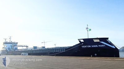
VERTOM ANNE MARIT
Cargo
Current Trip
| Time Travelled | 6 days |
|---|---|
| Remaining Time | --- |
| Distance Travelled | 1195.20 nm |
| Remaining Distance | --- |
| AVG Speed | 7.4 Noeuds |
| MAX Speed | 14.4 Noeuds |
| AVG Wind | 10.4 knots |
| MAX Wind | 20.8 knots |
| MIN Temp | 3.3°C / 37.94°F |
| MAX Temp | 12.4°C / 54.32°F |
| Tirant d eau | 6.6 m |
| Position reçue | 26 m depuis |
Current Position
| Longitude | -1.92069° |
|---|---|
| Latitude | 43.35258° |
| Etat | At anchor |
| Vitesse | |
| Parcours | 161° |
| Zone | Bay of Biscay |
| Station | T-AIS |
| Position reçue | 26 m depuis |
Info
Information
The current position of VERTOM ANNE MARIT is in Bay of Biscay with coordinates 43.35258° / -1.92069° as reported on 2025-02-05 08:16 by AIS to our vessel tracker app. The vessel's current speed is 0 Noeuds
The vessel VERTOM ANNE MARIT (IMO: 9938755, MMSI: 245184000) is a Cargo It's sailing under the flag of [NL] Netherlands.
In this page you can find informations about the vessels current position, last detected port calls, and current voyage information. If the vessels is not in coverage by AIS you will find the latest position.
The current position of VERTOM ANNE MARIT is detected by our AIS receivers and we are not responsible for the reliability of the data. The last position was recorded while the vessel was in Coverage by the Ais receivers of our vessel tracking app.
The current draught of VERTOM ANNE MARIT as reported by AIS is 6.6 meters
Weather
| Temperature | 8.9°C / 48.02°F |
|---|---|
| Wind Speed | 2 knots |
| Direction | 346° NNW |
| Pressure | 1036.3 hPa |
| Humidity | 80.9 % |
| Cloud Coverage | 100 % |
Featured Company
Last Port Calls
| Port | Arrival | Departure | Time In Port |
|---|---|---|---|
| 2025-01-26 08:53 | 2025-01-29 12:57 | 3 d | |
| 2025-01-20 09:43 | 2025-01-25 08:32 | 4 d | |
| 2024-12-23 09:25 | 2025-01-01 07:17 | 8 d | |
| 2024-12-19 21:03 | 2024-12-20 10:21 | 13 h | |
| 2024-12-16 13:52 | 2024-12-18 22:18 | 2 d |
Last Trips
| Origin | Departure | Destination | Arrival | Distance | |
|---|---|---|---|---|---|
| 2025-01-25 09:32 | 2025-01-26 09:53 | 166.71 nm | |||
| 2025-01-01 10:17 | 2025-01-20 10:43 | 3875.91 nm | |||
| 2024-12-20 13:21 | 2024-12-23 12:25 | 184.95 nm | |||
| 2024-12-19 01:18 | 2024-12-20 00:03 | 57.45 nm | |||
| 2024-11-29 23:43 | 2024-12-16 16:52 | 2749.92 nm |
Events
| Heure | Evenement | Détails | Position/ Destination | Info |
|---|---|---|---|---|
| 2025-02-05 08:16 | Etat Changé | At anchor Default |
43.35258 / -1.92069
ESPAS
|
Vitesse: 0.8 kn Parcours: 179° |
| 2025-02-05 07:49 | Etat Changé | Default At anchor |
43.35276 / -1.92027
ESPAS
|
Vitesse: 0.2 kn Parcours: 168° |
| 2025-02-05 07:25 | Etat Changé | At anchor Default |
43.35265 / -1.92044
ESPAS
|
Vitesse: 0.1 kn Parcours: 164° |
| 2025-02-05 07:16 | Dans la zone couverte |
43.35265 / -1.92044
Bay of Biscay
|
Vitesse: 0.2 kn Parcours: 108.1° |
|
| 2025-02-05 04:25 | Etat Changé | Default At anchor |
43.35268 / -1.92056
ESPAS
|
Vitesse: 0.2 kn Parcours: 170° |
| 2025-02-05 04:19 | Hors de la zone couverte |
43.35274 / -1.92049
Bay of Biscay
|
Vitesse: 0.2 kn Parcours: 120.4° |
|
| 2025-02-05 04:07 | Etat Changé | At anchor Default |
43.35274 / -1.92035
ESPAS
|
Vitesse: 0.2 kn Parcours: 172° |
| 2025-02-05 04:01 | Dans la zone couverte |
43.35274 / -1.92035
Bay of Biscay
|
Vitesse: 0.1 kn Parcours: 116.4° |
|
| 2025-02-04 22:13 | Etat Changé | Default At anchor |
43.35259 / -1.92047
ESPAS
|
Vitesse: 0.2 kn Parcours: 164° |
| 2025-02-04 22:10 | Hors de la zone couverte |
43.35256 / -1.92052
Bay of Biscay
|
Vitesse: 0.2 kn Parcours: 53.8° |