
VICENTE MIGUEL PRIME
Fishing
Current Trip
Unknown
| Time Travelled | 2 days |
|---|---|
| Remaining Time | --- |
| Distance Travelled | 148.31 nm |
| Remaining Distance | --- |
| AVG Speed | 5.3 Noeuds |
| MAX Speed | 9.4 Noeuds |
| AVG Wind | 5.9 knots |
| MAX Wind | 10 knots |
| MIN Temp | 10.9°C / 51.62°F |
| MAX Temp | 15.5°C / 59.9°F |
| Tirant d eau | 0 m |
| Position reçue | 5 h, 39 m depuis |
Current Position
| Longitude | -0.24270° |
|---|---|
| Latitude | 39.15207° |
| Etat | Engaged in Fishing |
| Vitesse | 8.5 Noeuds |
| Parcours | 286.4° |
| Zone | Balearic Sea |
| Station | T-AIS |
| Position reçue | 5 h, 39 m depuis |
Info
Information
The current position of VICENTE MIGUEL PRIME is in Balearic Sea with coordinates 39.15207° / -0.24270° as reported on 2025-02-20 15:09 by AIS to our vessel tracker app. The vessel's current speed is 8.5 Noeuds
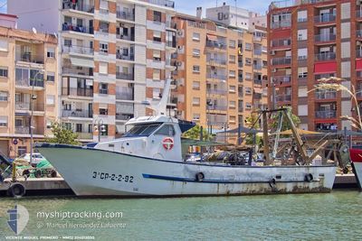
The vessel VICENTE MIGUEL PRIME (MMSI: 224013050) is a Fishing It's sailing under the flag of [ES] Spain.
In this page you can find informations about the vessels current position, last detected port calls, and current voyage information. If the vessels is not in coverage by AIS you will find the latest position.
The current position of VICENTE MIGUEL PRIME is detected by our AIS receivers and we are not responsible for the reliability of the data. The last position was recorded while the vessel was in Coverage by the Ais receivers of our vessel tracking app.
Weather
| Temperature | 15.1°C / 59.18°F |
|---|---|
| Wind Speed | 10 knots |
| Direction | 108° ESE |
| Pressure | 1025.4 hPa |
| Humidity | 78.2 % |
| Cloud Coverage | 10 % |
Featured Company
Events
| Heure | Evenement | Détails | Position/ Destination | Info |
|---|---|---|---|---|
| 2025-02-20 15:09 | Hors de la zone couverte |
39.15207 / -.24270
Balearic Sea
|
Vitesse: 8.5 kn Parcours: 286.4° |
|
| 2025-02-20 04:05 | Dans la zone couverte |
39.15420 / -.22091
Balearic Sea
|
Vitesse: 8.6 kn Parcours: 64.4° |
|
| 2025-02-19 15:11 | Hors de la zone couverte |
39.15286 / -.24522
Balearic Sea
|
Vitesse: 7.4 kn Parcours: 295.9° |
|
| 2025-02-19 09:36 | Démarrage | 14.41 nm, East of VALENCIA |
39.42596 / .00154
|
Vitesse: 8.4 kn Parcours: 291.7° |
| 2025-02-19 09:33 | Arret | 14.53 nm, East of VALENCIA |
39.42268 / .00381
|
Vitesse: 0.3 kn Parcours: 511° |
| 2025-02-19 09:29 | Démarrage | 14.6 nm, East of VALENCIA |
39.42182 / .00536
|
Vitesse: 5.1 kn Parcours: 280.7° |
| 2025-02-19 09:26 | Arret | 14.73 nm, East of VALENCIA |
39.42104 / .00805
|
Vitesse: 0.2 kn Parcours: 511° |
| 2025-02-19 04:07 | Dans la zone couverte |
39.15284 / -.22345
Balearic Sea
|
Vitesse: 9 kn Parcours: 73.6° |
|
| 2025-02-18 15:16 | Hors de la zone couverte |
39.15437 / -.24803
Balearic Sea
|
Vitesse: 7.7 kn Parcours: 310.5° |
|
| 2025-02-18 13:24 | Dans la zone couverte |
39.22791 / .06637
Balearic Sea
|
Vitesse: 9.3 kn Parcours: 248.7° |