

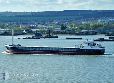
VICTRESS
General Cargo

Current Trip
| Time Travelled | 7 days |
|---|---|
| Remaining Time | --- |
| Distance Travelled | 1152.21 nm |
| Remaining Distance | --- |
| AVG Speed | 7 Noeuds |
| MAX Speed | 10.6 Noeuds |
| AVG Wind | 15.1 knots |
| MAX Wind | 25.7 knots |
| MIN Temp | 7.8°C / 46.04°F |
| MAX Temp | 16.3°C / 61.34°F |
| Tirant d eau | 4.7 m |
| Position reçue | 45 m depuis |
Current Position
| Longitude | -8.82891° |
|---|---|
| Latitude | 38.46175° |
| Etat | At anchor |
| Vitesse | 0.2 Noeuds |
| Parcours | 261° |
| Zone | North Atlantic Ocean |
| Station | T-AIS |
| Position reçue | 45 m depuis |
Information
The current position of VICTRESS is in North Atlantic Ocean with coordinates 38.46175° / -8.82891° as reported on 2025-04-16 13:04 by AIS to our vessel tracker app. The vessel's current speed is 0.2 Noeuds
The vessel VICTRESS (IMO: 9030498, MMSI: 357544000) is a General Cargo that was built in 1992 ( 33 Age ). It's sailing under the flag of [PA] Panama.
In this page you can find informations about the vessels current position, last detected port calls, and current voyage information. If the vessels is not in coverage by AIS you will find the latest position.
The current position of VICTRESS is detected by our AIS receivers and we are not responsible for the reliability of the data. The last position was recorded while the vessel was in Coverage by the Ais receivers of our vessel tracking app.
The current draught of VICTRESS as reported by AIS is 4.7 meters
Weather
| Temperature | 15.1°C / 59.18°F |
|---|---|
| Wind Speed | 13 knots |
| Direction | 254° WSW |
| Pressure | 1019 hPa |
| Humidity | 80.8 % |
| Cloud Coverage | 100 % |


Featured Company
Last Port Calls
| Port | Arrival | Departure | Time In Port |
|---|---|---|---|
| 2025-04-07 14:26 | 2025-04-08 19:08 | 1 d | |
| 2025-03-31 00:57 | 2025-04-03 00:20 | 2 d | |
| 2025-03-27 12:53 | 2025-03-28 18:24 | 1 d | |
| 2025-03-21 21:50 | 2025-03-25 14:23 | 3 d | |
| 2025-03-18 10:33 | 2025-03-19 22:31 | 1 d | |
| 2025-03-12 22:34 | 2025-03-13 10:45 | 12 h | |
| 2025-03-08 08:33 | 2025-03-11 17:04 | 3 d | |
| 2025-03-03 22:53 | 2025-03-05 21:27 | 1 d | |
| 2025-02-22 14:03 | 2025-02-28 17:17 | 6 d | |
| 2025-02-19 21:34 | 2025-02-21 15:35 | 1 d |
Last Trips
| Origin | Departure | Destination | Arrival | Distance | |
|---|---|---|---|---|---|
| 2025-04-03 00:20 | 2025-04-07 14:26 | 807.42 nm | |||
| 2025-03-28 18:24 | 2025-03-31 00:57 | 412.61 nm | |||
| 2025-03-25 14:23 | 2025-03-27 12:53 | 327.76 nm | |||
| 2025-03-19 22:31 | 2025-03-21 21:50 | 291.48 nm | |||
| 2025-03-13 10:45 | 2025-03-18 10:33 | 152.78 nm | |||
| 2025-03-11 17:04 | 2025-03-12 22:34 | 186.93 nm | |||
| 2025-03-05 21:27 | 2025-03-08 08:33 | 303.90 nm | |||
| 2025-02-28 17:17 | 2025-03-03 22:53 | 520.35 nm | |||
| 2025-02-21 15:35 | 2025-02-22 14:03 | 172.86 nm | |||
| 2025-02-18 16:54 | 2025-02-19 21:34 | 58.56 nm |
Events
| Heure | Evenement | Détails | Position/ Destination | Info |
|---|---|---|---|---|
| 2025-04-16 13:09 | Etat Changé | Default At anchor |
38.46162 / -8.82891
PT SET
|
Vitesse: 0.2 kn Parcours: 261° |
| 2025-04-16 13:04 | Etat Changé | At anchor Default |
38.46175 / -8.82891
PT SET
|
Vitesse: 0.2 kn Parcours: 261° |
| 2025-04-16 12:54 | Etat Changé | Default At anchor |
38.46164 / -8.82911
PT SET
|
Vitesse: 0.1 kn Parcours: 286° |
| 2025-04-16 12:48 | Etat Changé | At anchor Default |
38.46163 / -8.82913
PT SET
|
Vitesse: Parcours: 292° |
| 2025-04-16 12:42 | Etat Changé | Default At anchor |
38.46164 / -8.82913
PT SET
|
Vitesse: 0.1 kn Parcours: 285° |
| 2025-04-16 12:36 | Etat Changé | At anchor Default |
38.46160 / -8.82915
PT SET
|
Vitesse: Parcours: 290° |
| 2025-04-16 12:27 | Dans la zone couverte |
38.46160 / -8.82915
North Atlantic Ocean
PT SET
|
Vitesse: 0.1 kn Parcours: 179° |
|
| 2025-04-16 11:33 | Etat Changé | Default At anchor |
38.46179 / -8.82931
PT SET
|
Vitesse: 0.1 kn Parcours: 257° |
| 2025-04-16 11:27 | Etat Changé | At anchor Default |
38.46187 / -8.82936
PT SET
|
Vitesse: Parcours: 263° |
| 2025-04-16 11:27 | Hors de la zone couverte |
38.46187 / -8.82936
North Atlantic Ocean
PT SET
|
Vitesse: 0.1 kn Parcours: 133.9° |