
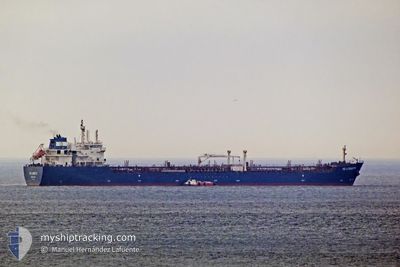
VS LISBETH
Oil Products Tanker
Current Trip
| Trip Time | 1 day |
|---|---|
| Trip Distance | 521.49 nm |
| AVG Speed | 12 Noeuds |
| MAX Speed | 13.1 Noeuds |
| Tirant d eau | 9.6 m |
| AVG Wind | 12.6 knots |
| MAX Wind | 17 knots |
| MIN Temp | 20.7°C / 69.26°F |
| MAX Temp | 23.5°C / 74.3°F |
| Position reçue | 3 d depuis |
Current Position
| Longitude | 26.00249° |
|---|---|
| Latitude | 33.41428° |
| Etat | Under way using engine |
| Vitesse | 12.8 Noeuds |
| Parcours | 232.7° |
| Zone | Mediterranean Sea - Eastern Basin |
| Station | T-AIS |
| Position reçue | 3 d depuis |
Information
The current position of VS LISBETH is in Mediterranean Sea - Eastern Basin with coordinates 33.41428° / 26.00249° as reported on 2025-06-03 21:04 by AIS to our vessel tracker app. The vessel's current speed is 12.8 Noeuds and is currently inside the port of MARSA AL HARIGA.
The vessel VS LISBETH (IMO: 9309978, MMSI: 232005015) is a Oil Products Tanker that was built in 2006 ( 19 Age ). It's sailing under the flag of [GB] United Kingdom.
In this page you can find informations about the vessels current position, last detected port calls, and current voyage information. If the vessels is not in coverage by AIS you will find the latest position.
The current position of VS LISBETH is detected by our AIS receivers and we are not responsible for the reliability of the data. The last position was recorded while the vessel was in Coverage by the Ais receivers of our vessel tracking app.
The current draught of VS LISBETH as reported by AIS is 9.6 meters
Weather
| Temperature | 20.3°C / 68.54°F |
|---|---|
| Wind Speed | 12 knots |
| Direction | 314° NW |
| Pressure | 1015.1 hPa |
| Humidity | 84.4 % |
| Cloud Coverage | --- |
Featured Company
Last Port Calls
| Port | Arrival | Departure | Time In Port |
|---|---|---|---|
| 2025-06-04 11:07 | |||
| 2025-06-01 22:27 | 2025-06-02 16:37 | 18 h | |
| 2025-05-31 04:54 | 2025-06-01 11:43 | 1 d | |
| 2025-05-17 19:50 | 2025-05-20 16:37 | 2 d | |
| 2025-05-13 20:33 | 2025-05-15 10:36 | 1 d | |
| 2025-05-03 12:50 | 2025-05-04 18:16 | 1 d | |
| 2025-04-26 07:03 | 2025-04-28 16:09 | 2 d | |
| 2025-04-21 15:35 | 2025-04-25 04:21 | 3 d | |
| 2025-04-18 06:13 | |||
| 2025-04-13 16:19 | 2025-04-16 08:46 | 2 d |
Most Visited Ports (Last year)
| Port | Arrivals | |
|---|---|---|
| 5 | ||
| 4 | ||
| 3 | ||
| 2 | ||
| 2 | ||
| 2 |
Last Trips
| Origin | Departure | Destination | Arrival | Distance | |
|---|---|---|---|---|---|
| 2025-06-02 16:37 | 2025-06-04 11:07 | 521.49 nm | |||
| 2025-06-01 11:43 | 2025-06-01 22:27 | 7.02 nm | |||
| 2025-05-20 16:37 | 2025-05-31 04:54 | 1818.24 nm | |||
| 2025-05-15 10:36 | 2025-05-17 19:50 | 518.28 nm | |||
| 2025-05-04 18:16 | 2025-05-13 20:33 | 1416.98 nm | |||
| 2025-04-28 16:09 | 2025-05-03 12:50 | 702.73 nm | |||
| 2025-04-25 04:21 | 2025-04-26 07:03 | 348.25 nm | |||
| 2025-04-18 06:13 | 2025-04-21 15:35 | 915.29 nm | |||
| 2025-04-10 06:07 | 2025-04-13 16:19 | 796.84 nm | |||
| 2025-04-05 06:23 | 2025-04-09 00:58 | 607.92 nm |
Events
| Heure | Evenement | Détails | Position/ Destination | Info |
|---|---|---|---|---|
| 2025-06-04 09:14 | Arret |
32.06230 / 23.99626
[LY] MARSA AL HARIGA
|
Vitesse: 0.3 kn Parcours: 111° |
|
| 2025-06-04 09:07 | Port d'arrivée |
|
32.06268 / 23.99617
[LY] MARSA AL HARIGA
|
Vitesse: 0.8 kn Parcours: 78° |
| 2025-06-03 21:04 | Etat Changé | Default Under way using engine |
33.41320 / 26.00081
TRIPOLI
|
Vitesse: 12.8 kn Parcours: 232.7° |
| 2025-06-03 21:04 | Hors de la zone couverte |
33.41428 / 26.00249
Mediterranean Sea - Eastern Basin
TRIPOLI
|
Vitesse: 12.8 kn Parcours: 232.7° |
|
| 2025-06-03 20:52 | Dans la zone couverte |
33.43822 / 26.03973
Mediterranean Sea - Eastern Basin
TRIPOLI
|
Vitesse: 12.8 kn Parcours: 231.9° |
|
| 2025-06-03 20:51 | Etat Changé | Under way using engine Default |
33.44300 / 26.04700
TRIPOLI
|
Vitesse: 12.5 kn Parcours: 232° |
| 2025-06-03 19:55 | Etat Changé | Default Under way using engine |
33.56069 / 26.22813
TRIPOLI
|
Vitesse: 12.2 kn Parcours: 234.3° |
| 2025-06-03 19:48 | Hors de la zone couverte |
33.57468 / 26.25060
Mediterranean Sea - Eastern Basin
TRIPOLI
|
Vitesse: 12.2 kn Parcours: 234.3° |
|
| 2025-06-03 19:06 | Etat Changé | Under way using engine Default |
33.65779 / 26.38632
TRIPOLI
|
Vitesse: 12.1 kn Parcours: 234° |
| 2025-06-03 19:01 | Etat Changé | Default Under way using engine |
33.66898 / 26.40485
TRIPOLI
|
Vitesse: 12.1 kn Parcours: 234° |