
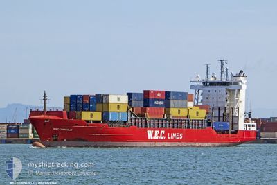
WEC CORNEILLE
Container Ship
Current Trip
| Trip Time | 4 days |
|---|---|
| Trip Distance | 1374.16 nm |
| AVG Speed | 12.5 Noeuds |
| MAX Speed | 16.6 Noeuds |
| Tirant d eau | 8.6 m |
| AVG Wind | 20.4 knots |
| MAX Wind | 37 knots |
| MIN Temp | 11.5°C / 52.7°F |
| MAX Temp | 18.2°C / 64.76°F |
| Position reçue | 4 m depuis |
Current Position
| Longitude | -15.41772° |
|---|---|
| Latitude | 28.13192° |
| Etat | Moored |
| Vitesse | |
| Parcours | 359° |
| Zone | North Atlantic Ocean |
| Station | T-AIS |
| Position reçue | 4 m depuis |
Info
Information
The current position of WEC CORNEILLE is in North Atlantic Ocean with coordinates 28.13192° / -15.41772° as reported on 2025-02-01 01:03 by AIS to our vessel tracker app. The vessel's current speed is 0 Noeuds and is currently inside the port of LAS PALMAS.
The vessel WEC CORNEILLE (IMO: 9326940, MMSI: 255805802) is a Container Ship that was built in 2005 ( 20 Age ). It's sailing under the flag of [PT] Portugal.
In this page you can find informations about the vessels current position, last detected port calls, and current voyage information. If the vessels is not in coverage by AIS you will find the latest position.
The current position of WEC CORNEILLE is detected by our AIS receivers and we are not responsible for the reliability of the data. The last position was recorded while the vessel was in Coverage by the Ais receivers of our vessel tracking app.
The current draught of WEC CORNEILLE as reported by AIS is 8.6 meters
Weather
| Temperature | 17.9°C / 64.22°F |
|---|---|
| Wind Speed | 18 knots |
| Direction | 28° NNE |
| Pressure | 1028.8 hPa |
| Humidity | 74.2 % |
| Cloud Coverage | 100 % |
Featured Company
Last Port Calls
| Port | Arrival | Departure | Time In Port |
|---|---|---|---|
| 2025-02-01 00:32 | |||
| 2025-01-26 23:31 | 2025-01-27 10:46 | 11 h | |
| 2025-01-25 12:09 | 2025-01-26 06:49 | 18 h | |
| 2025-01-23 10:02 | 2025-01-23 21:02 | 11 h | |
| 2025-01-19 11:33 | 2025-01-20 22:05 | 1 d | |
| 2025-01-17 07:27 | 2025-01-18 03:01 | 19 h | |
| 2025-01-16 19:20 | 2025-01-17 04:00 | 8 h | |
| 2025-01-13 11:09 | 2025-01-14 00:24 | 13 h | |
| 2025-01-12 06:39 | 2025-01-12 23:59 | 17 h | |
| 2025-01-08 19:43 | 2025-01-09 07:38 | 11 h |
Last Trips
| Origin | Departure | Destination | Arrival | Distance | |
|---|---|---|---|---|---|
| 2025-01-27 11:46 | 2025-02-01 00:32 | 1374.16 nm | |||
| 2025-01-26 07:49 | 2025-01-27 00:31 | 180.70 nm | |||
| 2025-01-23 21:02 | 2025-01-25 13:09 | 697.64 nm | |||
| 2025-01-20 23:05 | 2025-01-23 10:02 | 648.76 nm | |||
| 2025-01-18 03:01 | 2025-01-19 12:33 | 353.03 nm | |||
| 2025-01-17 04:00 | 2025-01-17 07:27 | 54.69 nm | |||
| 2025-01-14 01:24 | 2025-01-16 19:20 | 1118.78 nm | |||
| 2025-01-13 00:59 | 2025-01-13 12:09 | 164.37 nm | |||
| 2025-01-09 07:38 | 2025-01-12 07:39 | 1161.29 nm | |||
| 2025-01-08 15:22 | 2025-01-08 19:43 | 34.66 nm |
Events
| Heure | Evenement | Détails | Position/ Destination | Info |
|---|---|---|---|---|
| 2025-02-01 01:00 | Etat Changé | Moored Under way using engine |
28.13198 / -15.41773
[ES] LAS PALMAS
|
Vitesse: Parcours: 359° |
| 2025-02-01 00:51 | Arret |
28.13185 / -15.41782
[ES] LAS PALMAS
|
Vitesse: 0.3 kn Parcours: 2° |
|
| 2025-02-01 00:32 | Port d'arrivée |
|
28.11654 / -15.40884
[ES] LAS PALMAS
|
Vitesse: 6.6 kn Parcours: 294° |
| 2025-02-01 00:07 | Changement d'ETA | 2026/01/31 23:59 2025/01/31 23:59 |
28.12498 / -15.36832
ESLPA
|
Vitesse: 2.1 kn Parcours: 126° |
| 2025-01-31 20:12 | Changement d'ETA | 2025/01/31 23:59 2025/01/31 17:00 |
28.72038 / -14.77167
ESLPA
|
Vitesse: 14.3 kn Parcours: 223.9° |
| 2025-01-31 20:03 | Etat Changé | Under way using engine Default |
28.73833 / -14.75196
ESLPA
|
Vitesse: 14.4 kn Parcours: 226° |
| 2025-01-31 19:55 | Etat Changé | Default Under way using engine |
28.76240 / -14.72552
ESLPA
|
Vitesse: 14.3 kn Parcours: 223.1° |
| 2025-01-31 19:55 | Etat Changé | Under way using engine Default |
28.76364 / -14.72413
ESLPA
|
Vitesse: 14.4 kn Parcours: 221° |
| 2025-01-31 19:55 | Dans la zone couverte |
28.76364 / -14.72413
North Atlantic Ocean
ESLPA
|
Vitesse: 14.3 kn Parcours: 223.1° |
|
| 2025-01-31 19:55 | Changement de zone | Spanish (Canary Islands) part of the North Atlantic Ocean Moroccan part of the North Atlantic Ocean |
28.76364 / -14.72413
North Atlantic Ocean
ESLPA
|
Vitesse: 14.3 kn Parcours: 223.1° |