

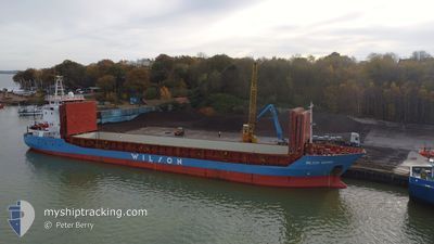
WILSON GDYNIA
General Cargo
Current Trip
| Time Travelled | 8 days |
|---|---|
| Remaining Time | 1 day |
| Distance Travelled | 796.30 nm |
| Remaining Distance | 307.38 nm |
| AVG Speed | 6.4 Noeuds |
| MAX Speed | 9.8 Noeuds |
| AVG Wind | 21.1 knots |
| MAX Wind | 29 knots |
| MIN Temp | 9.5°C / 49.1°F |
| MAX Temp | 15.2°C / 59.36°F |
| Tirant d eau | 5.8 m |
| Position reçue | Maintenant |
Current Position
| Longitude | -9.94699° |
|---|---|
| Latitude | 38.26098° |
| Etat | Under way using engine |
| Vitesse | 8.3 Noeuds |
| Parcours | 157.8° |
| Zone | North Atlantic Ocean |
| Station | T-AIS |
| Position reçue | Maintenant |
Information
The current position of WILSON GDYNIA is in North Atlantic Ocean with coordinates 38.26098° / -9.94699° as reported on 2025-04-26 20:04 by AIS to our vessel tracker app. The vessel's current speed is 8.3 Noeuds and is heading at the port of CEUTA. The estimated time of arrival as calculated by MyShipTracking vessel tracking app is 2025-04-28 08:50 LT
The vessel WILSON GDYNIA (IMO: 9056064, MMSI: 314192000) is a General Cargo that was built in 1994 ( 31 Age ). It's sailing under the flag of [BB] Barbados.
In this page you can find informations about the vessels current position, last detected port calls, and current voyage information. If the vessels is not in coverage by AIS you will find the latest position.
The current position of WILSON GDYNIA is detected by our AIS receivers and we are not responsible for the reliability of the data. The last position was recorded while the vessel was in Coverage by the Ais receivers of our vessel tracking app.
The current draught of WILSON GDYNIA as reported by AIS is 5.8 meters
Weather
| Temperature | 15.1°C / 59.18°F |
|---|---|
| Wind Speed | 23 knots |
| Direction | 1° N |
| Pressure | 1022.8 hPa |
| Humidity | 77.9 % |
| Cloud Coverage | 4 % |
Featured Company
Last Port Calls
| Port | Arrival | Departure | Time In Port |
|---|---|---|---|
| 2025-04-18 15:53 | 2025-04-18 16:00 | 7 m | |
| 2025-04-03 15:00 | 2025-04-05 19:05 | 2 d | |
| 2025-03-30 17:57 | 2025-04-01 11:10 | 1 d | |
| 2025-03-26 21:20 | 2025-03-28 14:46 | 1 d | |
| 2025-03-20 12:56 | 2025-03-21 07:43 | 18 h | |
| 2025-03-17 16:29 | 2025-03-20 00:40 | 2 d | |
| 2025-03-12 14:47 | 2025-03-13 18:28 | 1 d | |
| 2025-03-11 19:15 | 2025-03-12 13:56 | 18 h | |
| 2025-03-09 00:39 | 2025-03-10 15:41 | 1 d | |
| 2025-03-07 00:42 | 2025-03-07 23:39 | 22 h |
Last Trips
| Origin | Departure | Destination | Arrival | Distance | |
|---|---|---|---|---|---|
| 2025-04-05 19:05 | 2025-04-18 15:53 | 1613.77 nm | |||
| 2025-04-01 11:10 | 2025-04-03 15:00 | 401.85 nm | |||
| 2025-03-28 14:46 | 2025-03-30 17:57 | 11.22 nm | |||
| 2025-03-21 07:43 | 2025-03-26 21:20 | 1075.24 nm | |||
| 2025-03-20 00:40 | 2025-03-20 12:56 | 129.91 nm | |||
| 2025-03-13 18:28 | 2025-03-17 16:29 | 691.93 nm | |||
| 2025-03-12 13:56 | 2025-03-12 14:47 | 7.78 nm | |||
| 2025-03-10 15:41 | 2025-03-11 19:15 | 263.61 nm | |||
| 2025-03-07 23:39 | 2025-03-09 00:39 | 233.63 nm | |||
| 2025-03-06 22:15 | 2025-03-07 00:42 | 14.34 nm |
Events
| Heure | Evenement | Détails | Position/ Destination | Info |
|---|---|---|---|---|
| 2025-04-26 16:27 | Etat Changé | Under way using engine Default |
38.77212 / -10.10450
ES CEU
|
Vitesse: 8.9 kn Parcours: 180° |
| 2025-04-26 16:08 | Etat Changé | Default Under way using engine |
38.81824 / -10.10368
ES CEU
|
Vitesse: 8.8 kn Parcours: 181.1° |
| 2025-04-26 15:11 | Tirant d'eau modifié | 5.8 5.7 |
38.96701 / -10.10198
ES CEU
|
Vitesse: 9.3 kn Parcours: 180° |
| 2025-04-26 15:11 | Changement d'ETA | 2025/04/28 08:00 2025/04/28 06:00 |
38.96701 / -10.10198
ES CEU
|
Vitesse: 9.3 kn Parcours: 180° |
| 2025-04-26 15:09 | Etat Changé | Under way using engine Default |
38.97091 / -10.10197
ES CEU
|
Vitesse: 9.1 kn Parcours: 180° |
| 2025-04-26 15:08 | Etat Changé | Default Under way using engine |
38.97201 / -10.10199
ES CEU
|
Vitesse: 8.9 kn Parcours: 178.8° |
| 2025-04-26 14:55 | Changement de zone | Portuguese part of the North Atlantic Ocean French part of the Celtic Sea |
39.00560 / -10.10231
North Atlantic Ocean
ES CEU
|
Vitesse: 8.6 kn Parcours: 178.4° |
| 2025-04-26 14:55 | Etat Changé | Under way using engine Default |
39.00560 / -10.10231
ES CEU
|
Vitesse: 8.3 kn Parcours: 182° |
| 2025-04-26 14:40 | Dans la zone couverte |
39.00560 / -10.10231
North Atlantic Ocean
ES CEU
|
Vitesse: 8.6 kn Parcours: 178.4° |
|
| 2025-04-23 17:01 | Hors de la zone couverte |
48.68030 / -5.95311
Celtic Sea
ES CEU
|
Vitesse: 8.1 kn Parcours: 210.1° |