
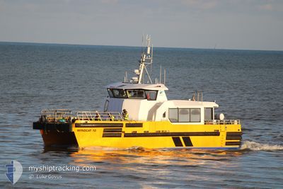
WINDCAT 10
High speed craft A
Current Trip
| Trip Time | 8 h, 28 mins |
|---|---|
| Trip Distance | 45.40 nm |
| AVG Speed | 16.5 Noeuds |
| MAX Speed | 23.2 Noeuds |
| Tirant d eau | 2 m |
| AVG Wind | 12.9 knots |
| MAX Wind | 14 knots |
| MIN Temp | 5.1°C / 41.18°F |
| MAX Temp | 5.8°C / 42.44°F |
| Position reçue | 7 h, 16 m depuis |
Current Position
| Longitude | 0.05301° |
|---|---|
| Latitude | 50.76836° |
| Etat | Under way sailing |
| Vitesse | 20.4 Noeuds |
| Parcours | 49.9° |
| Zone | English Channel |
| Station | T-AIS |
| Position reçue | 7 h, 16 m depuis |
Info
Information
The current position of WINDCAT 10 is in English Channel with coordinates 50.76836° / 0.05301° as reported on 2025-02-15 15:57 by AIS to our vessel tracker app. The vessel's current speed is 20.4 Noeuds and is currently inside the port of NEWHAVEN.
The vessel WINDCAT 10 (MMSI: 235064453) is a High speed craft A It's sailing under the flag of [GB] United Kingdom.
In this page you can find informations about the vessels current position, last detected port calls, and current voyage information. If the vessels is not in coverage by AIS you will find the latest position.
The current position of WINDCAT 10 is detected by our AIS receivers and we are not responsible for the reliability of the data. The last position was recorded while the vessel was in Coverage by the Ais receivers of our vessel tracking app.
The current draught of WINDCAT 10 as reported by AIS is 2 meters
Weather
| Temperature | 5.2°C / 41.36°F |
|---|---|
| Wind Speed | 13 knots |
| Direction | 96° E |
| Pressure | 1018.9 hPa |
| Humidity | 68.6 % |
| Cloud Coverage | 100 % |
Featured Company
Last Port Calls
| Port | Arrival | Departure | Time In Port |
|---|---|---|---|
| 2025-02-15 16:05 | |||
| 2025-02-13 17:57 | 2025-02-15 07:37 | 1 d | |
| 2025-02-12 17:41 | 2025-02-13 07:21 | 13 h | |
| 2025-02-11 17:37 | 2025-02-12 07:47 | 14 h | |
| 2025-02-09 17:37 | 2025-02-11 07:33 | 1 d | |
| 2025-02-08 16:41 | 2025-02-09 07:49 | 15 h | |
| 2025-02-07 09:37 | 2025-02-08 07:25 | 21 h | |
| 2025-02-06 17:17 | 2025-02-07 06:37 | 13 h | |
| 2025-02-05 17:45 | 2025-02-06 07:21 | 13 h | |
| 2025-02-03 13:38 | 2025-02-05 07:53 | 1 d |
Most Visited Ports (Last year)
| Port | Arrivals | |
|---|---|---|
| 311 | ||
| 3 | ||
| 3 | ||
| 2 | ||
| 1 |
Last Trips
| Origin | Departure | Destination | Arrival | Distance | |
|---|---|---|---|---|---|
| 2025-02-15 07:37 | 2025-02-15 16:05 | 45.40 nm | |||
| 2025-02-13 07:21 | 2025-02-13 17:57 | 32.80 nm | |||
| 2025-02-12 07:47 | 2025-02-12 17:41 | 33.44 nm | |||
| 2025-02-11 07:33 | 2025-02-11 17:37 | 50.69 nm | |||
| 2025-02-09 07:49 | 2025-02-09 17:37 | 45.59 nm | |||
| 2025-02-08 07:25 | 2025-02-08 16:41 | 46.12 nm | |||
| 2025-02-07 06:37 | 2025-02-07 09:37 | 41.90 nm | |||
| 2025-02-06 07:21 | 2025-02-06 17:17 | 62.28 nm | |||
| 2025-02-05 07:53 | 2025-02-05 17:45 | 58.99 nm | |||
| 2025-02-03 12:17 | 2025-02-03 13:38 | 22.77 nm |
Events
| Heure | Evenement | Détails | Position/ Destination | Info |
|---|---|---|---|---|
| 2025-02-15 16:05 | Etat Changé | Default Under way sailing |
50.78475 / .05710
[GB] NEWHAVEN
|
Vitesse: 20.4 kn Parcours: 49.9° |
| 2025-02-15 16:05 | Arret |
50.78475 / .05710
[GB] NEWHAVEN
|
Vitesse: Parcours: -1° |
|
| 2025-02-15 16:05 | Port d'arrivée |
|
50.78475 / .05710
[GB] NEWHAVEN
|
Vitesse: 20.4 kn Parcours: 49.9° |
| 2025-02-15 15:57 | Hors de la zone couverte |
50.76836 / .05301
English Channel
[GB] NEWHAVEN
|
Vitesse: 20.4 kn Parcours: 49.9° |
|
| 2025-02-15 15:18 | Démarrage | 10.13 nm, South of SHOREHAM |
50.65903 / -.23767
NEWHAVEN.RAMPIONOWF
|
Vitesse: 15.5 kn Parcours: 32.2° |
| 2025-02-15 15:07 | Arret | 10.27 nm, South of SHOREHAM |
50.65674 / -.23863
NEWHAVEN.RAMPIONOWF
|
Vitesse: 0.3 kn Parcours: 511° |
| 2025-02-15 15:05 | Démarrage | 10.32 nm, South of SHOREHAM |
50.65601 / -.23721
NEWHAVEN.RAMPIONOWF
|
Vitesse: 7.7 kn Parcours: 327° |
| 2025-02-15 14:49 | Arret | 10.35 nm, South of SHOREHAM |
50.65556 / -.23444
NEWHAVEN.RAMPIONOWF
|
Vitesse: 0.2 kn Parcours: 511° |
| 2025-02-15 14:20 | Démarrage | 8.36 nm, South West of BRIGHTON MARINA |
50.68772 / -.20995
NEWHAVEN.RAMPIONOWF
|
Vitesse: 6.7 kn Parcours: 189.3° |
| 2025-02-15 13:25 | Arret | 8.27 nm, South West of BRIGHTON MARINA |
50.68972 / -.21042
NEWHAVEN.RAMPIONOWF
|
Vitesse: 0.3 kn Parcours: 511° |