
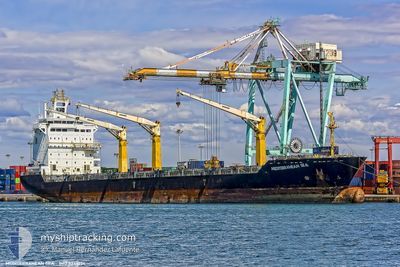
X PRESS NETRAVATI
Container Ship
Current Trip
| Time Travelled | 5 days |
|---|---|
| Remaining Time | --- |
| Distance Travelled | 1315.03 nm |
| Remaining Distance | --- |
| AVG Speed | 11.3 Noeuds |
| MAX Speed | 15.4 Noeuds |
| AVG Wind | 10.8 knots |
| MAX Wind | 25 knots |
| MIN Temp | 10.9°C / 51.62°F |
| MAX Temp | 16.6°C / 61.88°F |
| Tirant d eau | 8.6 m |
| Position reçue | 9 h, 34 m depuis |
Current Position
| Longitude | 14.44745° |
|---|---|
| Latitude | 36.45931° |
| Etat | Under way using engine |
| Vitesse | 13 Noeuds |
| Parcours | 101.5° |
| Zone | Mediterranean Sea - Eastern Basin |
| Station | T-AIS |
| Position reçue | 9 h, 34 m depuis |
Info
Information
The current position of X PRESS NETRAVATI is in Mediterranean Sea - Eastern Basin with coordinates 36.45931° / 14.44745° as reported on 2025-02-11 19:29 by AIS to our vessel tracker app. The vessel's current speed is 13 Noeuds and is heading at the port of ISTANBUL. The estimated time of arrival as calculated by MyShipTracking vessel tracking app is 2025-02-14 23:00 LT
The vessel X PRESS NETRAVATI (IMO: 9348194, MMSI: 563139800) is a Container Ship that was built in 2006 ( 19 Age ). It's sailing under the flag of [SG] Singapore.
In this page you can find informations about the vessels current position, last detected port calls, and current voyage information. If the vessels is not in coverage by AIS you will find the latest position.
The current position of X PRESS NETRAVATI is detected by our AIS receivers and we are not responsible for the reliability of the data. The last position was recorded while the vessel was in Coverage by the Ais receivers of our vessel tracking app.
The current draught of X PRESS NETRAVATI as reported by AIS is 8.6 meters
Weather
| Temperature | 14.5°C / 58.1°F |
|---|---|
| Wind Speed | 8 knots |
| Direction | 99° E |
| Pressure | 1023.9 hPa |
| Humidity | 69.8 % |
| Cloud Coverage | 100 % |
Featured Company
Last Port Calls
| Port | Arrival | Departure | Time In Port |
|---|---|---|---|
| 2025-02-06 12:22 | 2025-02-07 01:57 | 13 h | |
| 2025-01-19 12:29 | 2025-01-24 08:02 | 4 d | |
| 2025-01-16 08:55 | 2025-01-16 22:59 | 14 h | |
| 2025-01-12 10:41 | 2025-01-14 12:57 | 2 d | |
| 2025-01-10 16:55 | 2025-01-11 14:43 | 21 h | |
| 2025-01-03 19:17 | 2025-01-04 14:44 | 19 h | |
| 2025-01-02 07:11 | 2025-01-02 20:52 | 13 h | |
| 2024-12-30 14:05 | 2024-12-31 12:16 | 22 h | |
| 2024-12-22 12:46 | 2024-12-27 08:21 | 4 d | |
| 2024-12-20 15:38 | 2024-12-20 15:47 | 8 m |
Most Visited Ports (Last year)
| Port | Arrivals | |
|---|---|---|
| 18 | ||
| 14 | ||
| 12 | ||
| 12 | ||
| 12 | ||
| 11 |
Last Trips
| Origin | Departure | Destination | Arrival | Distance | |
|---|---|---|---|---|---|
| 2025-01-24 08:02 | 2025-02-06 12:22 | 4043.21 nm | |||
| 2025-01-16 22:59 | 2025-01-19 12:29 | 723.13 nm | |||
| 2025-01-14 12:57 | 2025-01-16 08:55 | 187.59 nm | |||
| 2025-01-11 14:43 | 2025-01-12 10:41 | 186.04 nm | |||
| 2025-01-04 14:44 | 2025-01-10 16:55 | 1231.15 nm | |||
| 2025-01-02 20:52 | 2025-01-03 19:17 | 236.61 nm | |||
| 2024-12-31 12:16 | 2025-01-02 07:11 | 465.73 nm | |||
| 2024-12-27 08:21 | 2024-12-30 14:05 | 825.47 nm | |||
| 2024-12-20 15:47 | 2024-12-22 12:46 | 183.10 nm | |||
| 2024-12-20 04:03 | 2024-12-20 15:38 | 9.25 nm |
Events
| Heure | Evenement | Détails | Position/ Destination | Info |
|---|---|---|---|---|
| 2025-02-11 19:34 | Etat Changé | Default Under way using engine |
36.45593 / 14.47027
TRIST
|
Vitesse: 13 kn Parcours: 101.5° |
| 2025-02-11 19:29 | Hors de la zone couverte |
36.45931 / 14.44745
Mediterranean Sea - Eastern Basin
TRIST
|
Vitesse: 13 kn Parcours: 101.5° |
|
| 2025-02-11 19:10 | Etat Changé | Under way using engine Default |
36.48324 / 14.36772
TRIST
|
Vitesse: 12.5 kn Parcours: 116° |
| 2025-02-11 18:52 | Etat Changé | Default Under way using engine |
36.50964 / 14.29856
TRIST
|
Vitesse: 12.5 kn Parcours: 114.9° |
| 2025-02-11 18:50 | Etat Changé | Under way using engine Default |
36.51263 / 14.29074
TRIST
|
Vitesse: 12.3 kn Parcours: 114° |
| 2025-02-11 18:14 | Etat Changé | Default Under way using engine |
36.56129 / 14.14985
TRIST
|
Vitesse: 12.5 kn Parcours: 108.8° |
| 2025-02-11 18:11 | Etat Changé | Under way using engine Default |
36.56572 / 14.13413
TRIST
|
Vitesse: 12.5 kn Parcours: 109° |
| 2025-02-11 18:11 | Changement de zone | Italian part of the Mediterranean Sea - Eastern Basin Spanish part of the Mediterranean Sea - Western Basin |
36.56572 / 14.13413
Mediterranean Sea - Eastern Basin
TRIST
|
Vitesse: 12.5 kn Parcours: 108.8° |
| 2025-02-11 17:56 | Dans la zone couverte |
36.56572 / 14.13413
Mediterranean Sea - Eastern Basin
TRIST
|
Vitesse: 12.5 kn Parcours: 108.8° |
|
| 2025-02-08 23:58 | Hors de la zone couverte |
36.54119 / -1.34490
Mediterranean Sea - Western Basin
TRIST
|
Vitesse: 11.7 kn Parcours: 75.9° |