
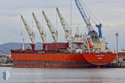
XIN HAI TONG 21
Bulk Carrier
Current Trip
| Time Travelled | 13 days |
|---|---|
| Remaining Time | 3 h, 3 mins |
| Distance Travelled | 2570.54 nm |
| Remaining Distance | 31.13 nm |
| AVG Speed | 9.4 Noeuds |
| MAX Speed | 10.6 Noeuds |
| AVG Wind | 12.1 knots |
| MAX Wind | 22 knots |
| MIN Temp | 22.3°C / 72.14°F |
| MAX Temp | 27.8°C / 82.04°F |
| Tirant d eau | 9.2 m |
| Position reçue | 18 h, 21 m depuis |
Current Position
| Longitude | 79.63653° |
|---|---|
| Latitude | 6.97810° |
| Etat | At anchor |
| Vitesse | |
| Parcours | 90° |
| Zone | Laccadive Sea |
| Station | T-AIS |
| Position reçue | 18 h, 21 m depuis |
Info
Information
The current position of XIN HAI TONG 21 is in Laccadive Sea with coordinates 6.97810° / 79.63653° as reported on 2025-02-13 21:55 by AIS to our vessel tracker app. The vessel's current speed is 0 Noeuds and is heading at the port of COLOMBO. The estimated time of arrival as calculated by MyShipTracking vessel tracking app is 2025-02-14 19:20 LT
The vessel XIN HAI TONG 21 (IMO: 9493688, MMSI: 538006687) is a Bulk Carrier that was built in 2011 ( 14 Age ). It's sailing under the flag of [MH] Marshall Is.
In this page you can find informations about the vessels current position, last detected port calls, and current voyage information. If the vessels is not in coverage by AIS you will find the latest position.
The current position of XIN HAI TONG 21 is detected by our AIS receivers and we are not responsible for the reliability of the data. The last position was recorded while the vessel was in Coverage by the Ais receivers of our vessel tracking app.
The current draught of XIN HAI TONG 21 as reported by AIS is 9.2 meters
Weather
| Temperature | 26.6°C / 79.88°F |
|---|---|
| Wind Speed | 2 knots |
| Direction | 242° WSW |
| Pressure | 1013.1 hPa |
| Humidity | 72.4 % |
| Cloud Coverage | 65 % |
Featured Company
Last Port Calls
| Port | Arrival | Departure | Time In Port |
|---|---|---|---|
| 2025-01-29 15:27 | 2025-02-01 10:07 | 2 d | |
| 2025-01-14 07:55 | 2025-01-17 14:41 | 3 d | |
| 2025-01-03 13:50 | 2025-01-11 20:31 | 8 d | |
| 2024-12-24 16:34 | 2024-12-30 21:45 | 6 d |
Most Visited Ports (Last year)
| Port | Arrivals | |
|---|---|---|
| 2 | ||
| 2 | ||
| 1 | ||
| 1 | ||
| 1 | ||
| 1 |
Last Trips
| Origin | Departure | Destination | Arrival | Distance | |
|---|---|---|---|---|---|
| 2025-01-17 17:41 | 2025-01-29 18:27 | 11.67 nm | |||
| 2025-01-11 23:31 | 2025-01-14 10:55 | 437.68 nm | |||
| 2024-12-31 00:45 | 2025-01-03 16:50 | 191.62 nm | |||
| 2024-11-18 01:31 | 2024-12-24 19:34 | 7480.10 nm |
Events
| Heure | Evenement | Détails | Position/ Destination | Info |
|---|---|---|---|---|
| 2025-02-14 13:37 | Démarrage | 11.85 nm, West of COLOMBO |
6.97778 / 79.63957
LK CMB
|
Vitesse: 3.1 kn Parcours: 165° |
| 2025-02-13 22:01 | Etat Changé | Default At anchor |
6.97813 / 79.63658
LK CMB
|
Vitesse: Parcours: 90° |
| 2025-02-13 21:55 | Etat Changé | At anchor Default |
6.97810 / 79.63653
LK CMB
|
Vitesse: Parcours: 90° |
| 2025-02-13 21:55 | Hors de la zone couverte |
6.97810 / 79.63653
Laccadive Sea
|
Vitesse: Parcours: 273° |
|
| 2025-02-13 21:37 | Dans la zone couverte |
6.97810 / 79.63653
Laccadive Sea
|
Vitesse: Parcours: 273° |
|
| 2025-02-13 11:31 | Etat Changé | Default At anchor |
6.97867 / 79.63935
LK CMB
|
Vitesse: 0.1 kn Parcours: 255° |
| 2025-02-13 11:28 | Changement de zone | Sri Lankan part of the Laccadive Sea Indian part of the Laccadive Sea |
6.97875 / 79.63935
Laccadive Sea
|
Vitesse: 0.1 kn Parcours: 176° |
| 2025-02-13 11:28 | Etat Changé | At anchor Default |
6.97875 / 79.63935
LK CMB
|
Vitesse: 0.2 kn Parcours: 252° |
| 2025-02-13 11:28 | Hors de la zone couverte |
6.97875 / 79.63935
Laccadive Sea
|
Vitesse: 0.1 kn Parcours: 176° |
|
| 2025-02-13 11:25 | Dans la zone couverte |
6.97875 / 79.63935
Laccadive Sea
|
Vitesse: 0.1 kn Parcours: 176° |