
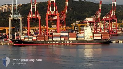
YM IDEALS
Container Ship
Current Trip
| Trip Time | 2 days |
|---|---|
| Trip Distance | 416.47 nm |
| AVG Speed | 10.4 Noeuds |
| MAX Speed | 14 Noeuds |
| Tirant d eau | 8.5 m |
| AVG Wind | 12.6 knots |
| MAX Wind | 28.5 knots |
| MIN Temp | 3°C / 37.4°F |
| MAX Temp | 13.2°C / 55.76°F |
| Position reçue | 3 d depuis |
Current Position
| Longitude | 121.76515° |
|---|---|
| Latitude | 25.19107° |
| Etat | Under way using engine |
| Vitesse | 13.7 Noeuds |
| Parcours | 31.4° |
| Zone | Eastern China Sea |
| Station | T-AIS |
| Position reçue | 3 d depuis |
Info
Information
The current position of YM IDEALS is in Eastern China Sea with coordinates 25.19107° / 121.76515° as reported on 2025-02-03 07:11 by AIS to our vessel tracker app. The vessel's current speed is 13.7 Noeuds and is currently inside the port of SHANGHAI.
The vessel YM IDEALS (IMO: 9319129, MMSI: 416488000) is a Container Ship that was built in 2006 ( 19 Age ). It's sailing under the flag of [TW] Taiwan.
In this page you can find informations about the vessels current position, last detected port calls, and current voyage information. If the vessels is not in coverage by AIS you will find the latest position.
The current position of YM IDEALS is detected by our AIS receivers and we are not responsible for the reliability of the data. The last position was recorded while the vessel was in Coverage by the Ais receivers of our vessel tracking app.
The current draught of YM IDEALS as reported by AIS is 8.5 meters
Weather
| Temperature | 4.9°C / 40.82°F |
|---|---|
| Wind Speed | 3 knots |
| Direction | 49° NE |
| Pressure | 1023.4 hPa |
| Humidity | 30.2 % |
| Cloud Coverage | 32 % |
Featured Company
Last Port Calls
| Port | Arrival | Departure | Time In Port |
|---|---|---|---|
| 2025-02-06 12:04 | |||
| 2025-02-03 07:25 | 2025-02-03 15:06 | 7 h | |
| 2025-02-02 11:49 | 2025-02-02 20:57 | 9 h | |
| 2025-02-01 06:49 | 2025-02-02 00:50 | 18 h | |
| 2025-01-27 21:08 | 2025-01-28 10:05 | 12 h | |
| 2025-01-26 19:49 | 2025-01-27 11:41 | 15 h | |
| 2025-01-24 18:37 | 2025-01-25 07:40 | 13 h | |
| 2025-01-21 23:01 | 2025-01-22 06:45 | 7 h | |
| 2025-01-18 10:57 | 2025-01-19 07:01 | 20 h | |
| 2025-01-17 09:33 | 2025-01-17 18:41 | 9 h |
Last Trips
| Origin | Departure | Destination | Arrival | Distance | |
|---|---|---|---|---|---|
| 2025-02-03 15:06 | 2025-02-06 12:04 | 416.47 nm | |||
| 2025-02-02 20:57 | 2025-02-03 07:25 | 117.07 nm | |||
| 2025-02-02 00:50 | 2025-02-02 11:49 | 129.39 nm | |||
| 2025-01-28 10:05 | 2025-02-01 06:49 | 938.12 nm | |||
| 2025-01-27 11:41 | 2025-01-27 21:08 | 75.24 nm | |||
| 2025-01-25 07:40 | 2025-01-26 19:49 | 490.86 nm | |||
| 2025-01-22 06:45 | 2025-01-24 18:37 | 702.50 nm | |||
| 2025-01-19 07:01 | 2025-01-21 23:01 | 479.36 nm | |||
| 2025-01-17 18:41 | 2025-01-18 10:57 | 132.64 nm | |||
| 2025-01-16 23:47 | 2025-01-17 09:33 | 131.69 nm |
Events
| Heure | Evenement | Détails | Position/ Destination | Info |
|---|---|---|---|---|
| 2025-02-06 04:04 | Port d'arrivée |
|
31.34109 / 121.64786
[CN] SHANGHAI
|
Vitesse: 5 kn Parcours: 296° |
| 2025-02-03 07:17 | Etat Changé | Default Under way using engine |
25.21125 / 121.77515
TW_KEL>CN_SHA
|
Vitesse: 13.7 kn Parcours: 31.4° |
| 2025-02-03 07:11 | Hors de la zone couverte |
25.19107 / 121.76515
Eastern China Sea
TW_KEL>CN_SHA
|
Vitesse: 13.7 kn Parcours: 31.4° |
|
| 2025-02-03 07:07 | Tirant d'eau modifié | 8.5 8.8 |
25.17876 / 121.75596
TW_KEL>CN_SHA
|
Vitesse: 11.6 kn Parcours: 35.5° |
| 2025-02-03 07:07 | Changement de destination | TW_KEL>CN_SHA TW TXG>TW KEL |
25.17876 / 121.75596
TW_KEL>CN_SHA
|
Vitesse: 11.6 kn Parcours: 35.5° |
| 2025-02-03 07:07 | Changement d'ETA | 2025/02/04 11:00 2025/02/02 23:00 |
25.17876 / 121.75596
TW_KEL>CN_SHA
|
Vitesse: 11.6 kn Parcours: 35.5° |
| 2025-02-03 07:06 | Etat Changé | Under way using engine Default |
25.17624 / 121.75375
TW TXG>TW KEL
|
Vitesse: 12.6 kn Parcours: 342° |
| 2025-02-03 07:06 | PORT DE DEPART |
|
25.17624 / 121.75375
TW TXG>TW KEL
|
Vitesse: 12.6 kn Parcours: 342° |
| 2025-02-03 06:53 | Démarrage |
25.14991 / 121.75593
[TW] KEELUNG
|
Vitesse: 3.8 kn Parcours: 233° |
|
| 2025-02-03 06:49 | Dans la zone couverte |
25.17876 / 121.75596
Eastern China Sea
|
Vitesse: 11.6 kn Parcours: 35.5° |