
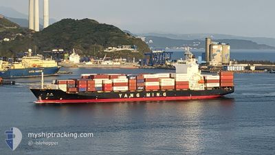
YM IMAGE
Container Ship
Current Trip
| Time Travelled | 3 days |
|---|---|
| Remaining Time | --- |
| Distance Travelled | 744.40 nm |
| Remaining Distance | 1716.62 nm |
| AVG Speed | 9.3 Noeuds |
| MAX Speed | 15.1 Noeuds |
| AVG Wind | 19.1 knots |
| MAX Wind | 37 knots |
| MIN Temp | 12.1°C / 53.78°F |
| MAX Temp | 18.9°C / 66.02°F |
| Tirant d eau | 7 m |
| Position reçue | 7 d depuis |
Current Position
| Longitude | 100.82228° |
|---|---|
| Latitude | 13.07352° |
| Etat | Under way using engine |
| Vitesse | 15.6 Noeuds |
| Parcours | 255° |
| Zone | Gulf of Thailand |
| Station | T-AIS |
| Position reçue | 7 d depuis |
Info
Information
The current position of YM IMAGE is in Gulf of Thailand with coordinates 13.07352° / 100.82228° as reported on 2025-01-30 20:06 by AIS to our vessel tracker app. The vessel's current speed is 15.6 Noeuds and is heading at the port of LAEM CHABANG. The estimated time of arrival as calculated by MyShipTracking vessel tracking app is 2025-01-30 07:00 LT
The vessel YM IMAGE (IMO: 9319088, MMSI: 636012796) is a Container Ship that was built in 2006 ( 19 Age ). It's sailing under the flag of [LR] Liberia.
In this page you can find informations about the vessels current position, last detected port calls, and current voyage information. If the vessels is not in coverage by AIS you will find the latest position.
The current position of YM IMAGE is detected by our AIS receivers and we are not responsible for the reliability of the data. The last position was recorded while the vessel was in Coverage by the Ais receivers of our vessel tracking app.
The current draught of YM IMAGE as reported by AIS is 7 meters
Weather
| Temperature | 12.1°C / 53.78°F |
|---|---|
| Wind Speed | 34 knots |
| Direction | 41° NE |
| Pressure | 1026.7 hPa |
| Humidity | 70.6 % |
| Cloud Coverage | 99 % |
Featured Company
Last Port Calls
| Port | Arrival | Departure | Time In Port |
|---|---|---|---|
| 2025-02-03 16:48 | 2025-02-04 03:45 | 10 h | |
| 2025-01-30 05:33 | 2025-01-30 19:54 | 14 h | |
| 2025-01-28 21:55 | 2025-01-29 21:49 | 23 h | |
| 2025-01-27 02:09 | 2025-01-27 18:24 | 16 h | |
| 2025-01-21 04:56 | 2025-01-21 15:29 | 10 h | |
| 2025-01-18 03:21 | 2025-01-18 20:47 | 17 h | |
| 2025-01-11 23:29 | 2025-01-12 12:25 | 12 h | |
| 2025-01-07 04:17 | 2025-01-07 16:25 | 12 h | |
| 2025-01-05 10:14 | 2025-01-07 00:59 | 1 d | |
| 2025-01-04 04:59 | 2025-01-04 16:14 | 11 h |
Last Trips
| Origin | Departure | Destination | Arrival | Distance | |
|---|---|---|---|---|---|
| 2025-01-31 02:54 | 2025-02-04 00:48 | 1408.77 nm | |||
| 2025-01-30 04:49 | 2025-01-30 12:33 | 43.03 nm | |||
| 2025-01-28 01:24 | 2025-01-29 04:55 | 283.46 nm | |||
| 2025-01-21 23:29 | 2025-01-27 09:09 | 2077.37 nm | |||
| 2025-01-19 04:47 | 2025-01-21 12:56 | 267.46 nm | |||
| 2025-01-12 20:25 | 2025-01-18 11:21 | 1205.51 nm | |||
| 2025-01-07 23:25 | 2025-01-12 07:29 | 1426.16 nm | |||
| 2025-01-07 07:59 | 2025-01-07 11:17 | 39.95 nm | |||
| 2025-01-04 23:14 | 2025-01-05 17:14 | 285.53 nm | |||
| 2024-12-29 21:17 | 2025-01-04 11:59 | 2087.13 nm |
Events
| Heure | Evenement | Détails | Position/ Destination | Info |
|---|---|---|---|---|
| 2025-02-04 03:45 | PORT DE DEPART |
|
21.60022 / 108.65642
TH LCB
|
Vitesse: 9.5 kn Parcours: 199° |
| 2025-02-04 03:21 | Démarrage |
21.66100 / 108.64498
[CN] QINZHOU
|
Vitesse: 6.8 kn Parcours: 154° |
|
| 2025-02-03 16:48 | Arret |
21.66733 / 108.64757
[CN] QINZHOU
|
Vitesse: Parcours: 323° |
|
| 2025-02-03 16:48 | Port d'arrivée |
|
21.66733 / 108.64757
[CN] QINZHOU
|
Vitesse: 0.8 kn Parcours: 333° |
| 2025-01-30 20:13 | Etat Changé | Default Under way using engine |
13.05880 / 100.79318
TH LCB
|
Vitesse: 15.6 kn Parcours: 255° |
| 2025-01-30 20:06 | Hors de la zone couverte |
13.07352 / 100.82228
Gulf of Thailand
|
Vitesse: 15.6 kn Parcours: 255° |
|
| 2025-01-30 19:54 | PORT DE DEPART |
|
13.07357 / 100.86623
TH LCB
|
Vitesse: 11.3 kn Parcours: 275° |
| 2025-01-30 19:47 | Etat Changé | Under way using engine Default |
13.06287 / 100.88105
[TH] LAEM CHABANG
|
Vitesse: 7.2 kn Parcours: 282° |
| 2025-01-30 19:45 | Démarrage |
13.06195 / 100.88348
[TH] LAEM CHABANG
|
Vitesse: 7.2 kn Parcours: 282° |
|
| 2025-01-30 19:45 | Dans la zone couverte |
13.06287 / 100.88105
Gulf of Thailand
[TH] LAEM CHABANG
|
Vitesse: 6.2 kn Parcours: 304° |