
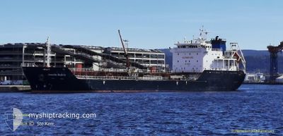
ACACIA RUBRA
Asphalt/Bitumen Tanker
Current Trip
| Time Travelled | 7 days |
|---|---|
| Remaining Time | 17 h, 17 mins |
| Distance Travelled | 1310.70 морская миля |
| Remaining Distance | 210.17 морская миля |
| AVG Speed | 8.3 Узлы |
| MAX Speed | 12 Узлы |
| AVG Wind | 10.6 knots |
| MAX Wind | 25 knots |
| MIN Temp | 7.5°C / 45.5°F |
| MAX Temp | 15.4°C / 59.72°F |
| Осадка | 4.7 м |
| Позиция Получена | 20 h, 42 m тому назад |
Current Position
| Долгота | 14.57297° |
|---|---|
| Широта | 36.36608° |
| Статус | Under way using engine |
| Скорость | 8 Узлы |
| Курс | 105.3° |
| Район | Mediterranean Sea - Eastern Basin |
| Станция | T-AIS |
| Позиция Получена | 20 h, 42 m тому назад |
Info
Information
The current position of ACACIA RUBRA is in Mediterranean Sea - Eastern Basin with coordinates 36.36608° / 14.57297° as reported on 2025-02-06 17:22 by AIS to our vessel tracker app. The vessel's current speed is 8 Узлы and is heading at the port of TARANTO. The estimated time of arrival as calculated by MyShipTracking vessel tracking app is 2025-02-08 08:21 LT
The vessel ACACIA RUBRA (IMO: 9468530, MMSI: 249374000) is a Asphalt/Bitumen Tanker that was built in 2011 ( 14 лет ). It's sailing under the flag of [MT] Malta.
In this page you can find informations about the vessels current position, last detected port calls, and current voyage information. If the vessels is not in coverage by AIS you will find the latest position.
The current position of ACACIA RUBRA is detected by our AIS receivers and we are not responsible for the reliability of the data. The last position was recorded while the vessel was in Coverage by the Ais receivers of our vessel tracking app.
The current draught of ACACIA RUBRA as reported by AIS is 4.7 meters
Weather
| Temperature | 13.9°C / 57.02°F |
|---|---|
| Wind Speed | 9 knots |
| Direction | 79° E |
| Pressure | 1027.9 hPa |
| Humidity | 70.1 % |
| Cloud Coverage | 9 % |
Featured Company
Last Port Calls
| Port | Arrival | Departure | Time In Port |
|---|---|---|---|
| 2025-01-29 13:17 | 2025-01-31 14:25 | 2 d | |
| 2025-01-23 22:13 | 2025-01-24 17:03 | 18 h | |
| 2025-01-18 11:02 | 2025-01-19 11:25 | 1 d | |
| 2025-01-13 10:45 | 2025-01-14 08:11 | 21 h | |
| 2025-01-10 21:05 | 2025-01-11 04:28 | 7 h | |
| 2025-01-08 09:37 | 2025-01-10 01:10 | 1 d | |
| 2024-12-31 04:07 | 2025-01-01 05:15 | 1 d | |
| 2024-12-26 06:49 | 2024-12-26 19:17 | 12 h | |
| 2024-12-25 13:28 | |||
| 2024-12-16 13:25 | 2024-12-19 15:24 | 3 d |
Most Visited Ports (Last year)
| Port | Arrivals | |
|---|---|---|
| 4 | ||
| 4 | ||
| 4 | ||
| 3 | ||
| 3 | ||
| 3 |
Last Trips
| Origin | Departure | Destination | Arrival | Distance | |
|---|---|---|---|---|---|
| 2025-01-24 17:03 | 2025-01-29 13:17 | 754.42 морская миля | |||
| 2025-01-19 11:25 | 2025-01-23 22:13 | 1026.42 морская миля | |||
| 2025-01-14 08:11 | 2025-01-18 11:02 | 1019.07 морская миля | |||
| 2025-01-11 04:28 | 2025-01-13 10:45 | 518.38 морская миля | |||
| 2025-01-10 01:10 | 2025-01-10 21:05 | 207.47 морская миля | |||
| 2025-01-01 05:15 | 2025-01-08 09:37 | 1724.73 морская миля | |||
| 2024-12-26 19:17 | 2024-12-31 04:07 | 1041.09 морская миля | |||
| 2024-12-25 13:28 | 2024-12-26 06:49 | 134.52 морская миля | |||
| 2024-12-12 01:08 | 2024-12-16 13:25 | 608.03 морская миля | |||
| 2024-12-10 21:53 | 2024-12-11 10:16 | 115.52 морская миля |
Events
| Время | Событие | Детали | Позиция / Направление | Информация |
|---|---|---|---|---|
| 2025-02-06 17:27 | Статус изменился | Default Under way using engine |
36.36268 / 14.58804
IT TAR
|
Скорость: 8 kn Курс: 105.3° |
| 2025-02-06 17:22 | Обнаружено в море | Italian part of the Mediterranean Sea - Eastern Basin |
36.36608 / 14.57297
Mediterranean Sea - Eastern Basin
|
Скорость: 8 kn Курс: 105.3° |
| 2025-02-06 17:22 | Вне покрытия |
36.36608 / 14.57297
Mediterranean Sea - Eastern Basin
|
Скорость: 8 kn Курс: 105.3° |
|
| 2025-02-06 17:07 | Статус изменился | Under way using engine Default |
36.37519 / 14.53318
IT TAR
|
Скорость: 8 kn Курс: 105° |
| 2025-02-06 16:17 | Статус изменился | Default Under way using engine |
36.40488 / 14.39881
IT TAR
|
Скорость: 8.2 kn Курс: 103.3° |
| 2025-02-06 15:53 | Обнаружено в море | Maltese part of the Mediterranean Sea - Eastern Basin |
36.41866 / 14.33169
Mediterranean Sea - Eastern Basin
|
Скорость: 8.3 kn Курс: 106.3° |
| 2025-02-06 15:53 | Статус изменился | Under way using engine Default |
36.41866 / 14.33169
IT TAR
|
Скорость: 8.3 kn Курс: 106° |
| 2025-02-06 15:47 | В покрытии |
36.41866 / 14.33169
Mediterranean Sea - Eastern Basin
|
Скорость: 8.3 kn Курс: 106.3° |
|
| 2025-02-01 23:01 | Статус изменился | Default Under way using engine |
36.04586 / -4.75950
IT TAR
|
Скорость: 8.2 kn Курс: 82.9° |
| 2025-02-01 22:56 | Вне покрытия |
36.04464 / -4.77307
Alboran Sea
|
Скорость: 8.2 kn Курс: 82.9° |