
AIFER
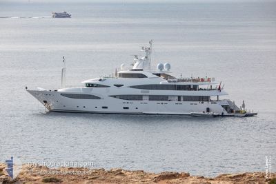
Yacht
Current Trip
| Trip Time | 1 day |
|---|---|
| Trip Distance | 129.03 морская миля |
| AVG Speed | 12 Узлы |
| MAX Speed | 13.6 Узлы |
| Осадка | 3.6 м |
| AVG Wind | 3.7 knots |
| MAX Wind | 9 knots |
| MIN Temp | 6.3°C / 43.34°F |
| MAX Temp | 13°C / 55.4°F |
| Позиция Получена | 5 d тому назад |
Current Position
| Долгота | 5.61290° |
|---|---|
| Широта | 43.17012° |
| Статус | Under way using engine |
| Скорость | |
| Курс | 223° |
| Район | Mediterranean Sea - Western Basin |
| Станция | T-AIS |
| Позиция Получена | 5 d тому назад |
Info
Information
The current position of AIFER is in Mediterranean Sea - Western Basin with coordinates 43.17012° / 5.61290° as reported on 2025-02-06 07:34 by AIS to our vessel tracker app. The vessel's current speed is 0 Узлы and is currently inside the port of LA CIOTAT.
The vessel AIFER (IMO: 1010844, MMSI: 319109900) is a Yacht that was built in 2010 ( 15 лет ). It's sailing under the flag of [KY] Cayman Is.
In this page you can find informations about the vessels current position, last detected port calls, and current voyage information. If the vessels is not in coverage by AIS you will find the latest position.
The current position of AIFER is detected by our AIS receivers and we are not responsible for the reliability of the data. The last position was recorded while the vessel was in Coverage by the Ais receivers of our vessel tracking app.
The current draught of AIFER as reported by AIS is 3.6 meters
Weather
| Temperature | 9.5°C / 49.1°F |
|---|---|
| Wind Speed | 4 knots |
| Direction | 26° NNE |
| Pressure | 1029.6 hPa |
| Humidity | 56.6 % |
| Cloud Coverage | --- |
Featured Company
Events
| Время | Событие | Детали | Позиция / Направление | Информация |
|---|---|---|---|---|
| 2025-02-06 07:34 | Вне покрытия |
43.17012 / 5.61290
Mediterranean Sea - Western Basin
[FR] LA CIOTAT
|
Скорость: Курс: 223.3° |
|
| 2025-02-06 07:32 | Окончание движения |
43.17012 / 5.61290
[FR] LA CIOTAT
|
Скорость: Курс: 222° |
|
| 2025-02-06 07:32 | Порт |
|
43.17012 / 5.61290
[FR] LA CIOTAT
|
Скорость: 0.4 kn Курс: 356° |
| 2025-02-06 07:08 | В покрытии |
43.16778 / 5.62915
Mediterranean Sea - Western Basin
|
Скорость: 0.5 kn Курс: 69.5° |
|
| 2025-02-05 17:52 | Вне покрытия |
43.16608 / 5.63122
Mediterranean Sea - Western Basin
FR LA CIOTAT
|
Скорость: 3.6 kn Курс: 323.1° |
|
| 2025-02-05 15:46 | В покрытии |
42.97970 / 6.10365
Mediterranean Sea - Western Basin
FR LA CIOTAT
|
Скорость: 12.1 kn Курс: 282.1° |
|
| 2025-02-05 13:08 | Вне покрытия |
43.06770 / 6.79787
Mediterranean Sea - Western Basin
FR LA CIOTAT
|
Скорость: 13 kn Курс: 229.3° |
|
| 2025-02-05 09:53 | Изменение морского района | French part of the Mediterranean Sea - Western Basin Mon�gasque part of the Mediterranean Sea - Western Basin |
43.52677 / 7.49708
Mediterranean Sea - Western Basin
FR LA CIOTAT
|
Скорость: 12.6 kn Курс: 228.7° |
| 2025-02-05 09:44 | Изменение морского района | Mon�gasque part of the Mediterranean Sea - Western Basin French part of the Mediterranean Sea - Western Basin |
43.54777 / 7.52958
Mediterranean Sea - Western Basin
FR LA CIOTAT
|
Скорость: 12.6 kn Курс: 228.3° |
| 2025-02-05 09:19 | Изменение морского района | French part of the Mediterranean Sea - Western Basin Italian part of the Mediterranean Sea - Western Basin |
43.60520 / 7.61932
Mediterranean Sea - Western Basin
FR LA CIOTAT
|
Скорость: 12.4 kn Курс: 229° |