

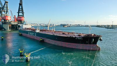
AL AGAILA
Tanker
Current Trip
AEJDH
| Time Travelled | 26 days |
|---|---|
| Remaining Time | --- |
| Distance Travelled | 4214.64 морская миля |
| Remaining Distance | --- |
| AVG Speed | 11.6 Узлы |
| MAX Speed | 15.3 Узлы |
| AVG Wind | 8.8 knots |
| MAX Wind | 20.3 knots |
| MIN Temp | 23.7°C / 74.66°F |
| MAX Temp | 32.2°C / 89.96°F |
| Осадка | 9.5 м |
| Позиция Получена | 1 h, 44 m тому назад |
Current Position
| Долгота | 55.27934° |
|---|---|
| Широта | 26.32199° |
| Статус | Under way using engine |
| Скорость | 14 Узлы |
| Курс | 259.6° |
| Район | Persian Gulf |
| Станция | T-AIS |
| Позиция Получена | 1 h, 44 m тому назад |
Information
The current position of AL AGAILA is in Persian Gulf with coordinates 26.32199° / 55.27934° as reported on 2025-04-25 20:46 by AIS to our vessel tracker app. The vessel's current speed is 14 Узлы
The vessel AL AGAILA (IMO: 9415404, MMSI: 642122016) is a Tanker It's sailing under the flag of [LY] Libya.
In this page you can find informations about the vessels current position, last detected port calls, and current voyage information. If the vessels is not in coverage by AIS you will find the latest position.
The current position of AL AGAILA is detected by our AIS receivers and we are not responsible for the reliability of the data. The last position was recorded while the vessel was in Coverage by the Ais receivers of our vessel tracking app.
The current draught of AL AGAILA as reported by AIS is 9.5 meters
Weather
| Temperature | 27.3°C / 81.14°F |
|---|---|
| Wind Speed | 5 knots |
| Direction | 230° SW |
| Pressure | 1005.5 hPa |
| Humidity | 72.4 % |
| Cloud Coverage | 83 % |
Featured Company
Last Port Calls
| Port | Arrival | Departure | Time In Port |
|---|---|---|---|
| 2025-03-30 07:27 | 2025-03-31 04:36 | 21 h | |
| 2025-03-24 23:14 | 2025-03-26 02:01 | 1 d | |
| 2025-03-22 19:02 | 2025-03-24 08:55 | 1 d | |
| 2025-03-09 21:08 | 2025-03-10 23:53 | 1 d | |
| 2025-02-26 23:36 | 2025-02-28 20:20 | 1 d |
Most Visited Ports (Last year)
| Port | Arrivals | |
|---|---|---|
| 2 | ||
| 2 | ||
| 1 | ||
| 1 | ||
| 1 | ||
| 1 |
Last Trips
| Origin | Departure | Destination | Arrival | Distance | |
|---|---|---|---|---|---|
| 2025-03-26 02:01 | 2025-03-30 07:27 | 52.45 морская миля | |||
| 2025-03-24 08:55 | 2025-03-24 23:14 | 14.44 морская миля | |||
| 2025-03-10 23:53 | 2025-03-22 19:02 | 3379.86 морская миля | |||
| 2025-02-28 20:20 | 2025-03-09 21:08 | 744.06 морская миля | |||
| 2024-12-19 14:43 | 2025-02-26 23:36 | 12023.21 морская миля |
Events
| Время | Событие | Детали | Позиция / Направление | Информация |
|---|---|---|---|---|
| 2025-04-25 20:54 | Статус изменился | Default Under way using engine |
26.31593 / 55.24524
AEJDH
|
Скорость: 14 kn Курс: 259.6° |
| 2025-04-25 20:46 | Вне покрытия |
26.32199 / 55.27934
Persian Gulf
AEJDH
|
Скорость: 14 kn Курс: 259.6° |
|
| 2025-04-25 19:52 | Изменение морского района | Iranian part of the Persian Gulf Omani part of the Gulf of Oman |
26.36259 / 55.50297
Persian Gulf
AEJDH
|
Скорость: 13.6 kn Курс: 248.5° |
| 2025-04-25 19:50 | Статус изменился | Under way using engine Default |
26.36585 / 55.51205
AEJDH
|
Скорость: 13.4 kn Курс: 248° |
| 2025-04-25 19:50 | В покрытии |
26.36259 / 55.50297
Persian Gulf
AEJDH
|
Скорость: 13.6 kn Курс: 248.5° |
|
| 2025-04-25 12:06 | Статус изменился | Default Under way using engine |
25.92911 / 56.79252
AEJDH
|
Скорость: 13.1 kn Курс: 8.8° |
| 2025-04-25 12:00 | Вне покрытия |
25.90704 / 56.78730
Gulf of Oman
AEJDH
|
Скорость: 13.1 kn Курс: 8.8° |
|
| 2025-04-25 10:55 | Изменение морского района | Omani part of the Gulf of Oman United Arab Emirates part of the Gulf of Oman |
25.67531 / 56.76591
Gulf of Oman
AEJDH
|
Скорость: 12.7 kn Курс: 357.6° |
| 2025-04-25 09:22 | Осадка изменилась | 9.5 9 |
25.36124 / 56.73319
AEJDH
|
Скорость: 11.9 kn Курс: 358.8° |
| 2025-04-25 07:28 | Начало движения | 10.25 nm, East of FUJAIRAH |
25.17416 / 56.55052
AEJDH
|
Скорость: 3.1 kn Курс: 92° |