
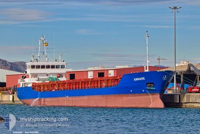
ANMARE
General Cargo
Current Trip
| Time Travelled | 6 h, 3 mins |
|---|---|
| Remaining Time | 12 h, 14 mins |
| Distance Travelled | 69.47 морская миля |
| Remaining Distance | 159.89 морская миля |
| AVG Speed | 9.9 Узлы |
| MAX Speed | 14.8 Узлы |
| AVG Wind | 6.1 knots |
| MAX Wind | 10 knots |
| MIN Temp | 3.7°C / 38.66°F |
| MAX Temp | 8.4°C / 47.12°F |
| Осадка | 3.5 м |
| Позиция Получена | 1 m тому назад |
Current Position
| Долгота | -4.59830° |
|---|---|
| Широта | 51.07624° |
| Статус | Under way using engine |
| Скорость | 11.3 Узлы |
| Курс | 229.1° |
| Район | Bristol Channel |
| Станция | T-AIS |
| Позиция Получена | 1 m тому назад |
Info
Information
The current position of ANMARE is in Bristol Channel with coordinates 51.07624° / -4.59830° as reported on 2025-02-03 01:48 by AIS to our vessel tracker app. The vessel's current speed is 11.3 Узлы and is heading at the port of PLYMOUTH. The estimated time of arrival as calculated by MyShipTracking vessel tracking app is 2025-02-03 14:03 LT
The vessel ANMARE (IMO: 9434589, MMSI: 305493000) is a General Cargo that was built in 2009 ( 16 лет ). It's sailing under the flag of [AG] Antigua Barbuda.
In this page you can find informations about the vessels current position, last detected port calls, and current voyage information. If the vessels is not in coverage by AIS you will find the latest position.
The current position of ANMARE is detected by our AIS receivers and we are not responsible for the reliability of the data. The last position was recorded while the vessel was in Coverage by the Ais receivers of our vessel tracking app.
The current draught of ANMARE as reported by AIS is 3.5 meters
Weather
| Temperature | 7.2°C / 44.96°F |
|---|---|
| Wind Speed | 4 knots |
| Direction | 147° SSE |
| Pressure | 1023.2 hPa |
| Humidity | 89.4 % |
| Cloud Coverage | 100 % |
Featured Company
Last Port Calls
| Port | Arrival | Departure | Time In Port |
|---|---|---|---|
| 2025-02-01 19:44 | 2025-02-02 19:46 | 1 d | |
| 2025-01-25 17:47 | 2025-01-28 09:01 | 2 d | |
| 2025-01-25 16:37 | 2025-01-25 16:46 | 9 m | |
| 2025-01-16 21:22 | 2025-01-18 01:44 | 1 d | |
| 2025-01-04 14:10 | 2025-01-08 11:26 | 3 d | |
| 2025-01-03 05:25 | 2025-01-03 14:12 | 8 h | |
| 2024-12-19 13:05 | 2024-12-23 17:00 | 4 d | |
| 2024-12-19 11:56 | 2024-12-19 12:07 | 11 m | |
| 2024-12-17 12:51 | |||
| 2024-12-17 02:04 |
Last Trips
| Origin | Departure | Destination | Arrival | Distance | |
|---|---|---|---|---|---|
| 2025-01-28 09:01 | 2025-02-01 19:44 | 511.74 морская миля | |||
| 2025-01-25 16:46 | 2025-01-25 17:47 | 1.34 морская миля | |||
| 2025-01-18 01:44 | 2025-01-25 16:37 | 328.50 морская миля | |||
| 2025-01-08 11:26 | 2025-01-16 21:22 | 1896.16 морская миля | |||
| 2025-01-03 14:12 | 2025-01-04 14:10 | 7.44 морская миля | |||
| 2024-12-23 17:00 | 2025-01-03 05:25 | 1828.37 морская миля | |||
| 2024-12-19 12:07 | 2024-12-19 13:05 | 8.29 морская миля | |||
| 2024-12-17 12:51 | 2024-12-19 11:56 | 308.28 морская миля | |||
| 2024-12-16 20:27 | 2024-12-17 02:04 | 30.38 морская миля | |||
| 2024-12-16 20:27 | 2024-12-16 23:37 | 29.76 морская миля |
Events
| Время | Событие | Детали | Позиция / Направление | Информация |
|---|---|---|---|---|
| 2025-02-03 01:44 | Обнаружено в море | United Kingdom part of the Celtic Sea |
51.08399 / -4.58313
Celtic Sea
GBPLY
|
Скорость: 10.5 kn Курс: 234.7° |
| 2025-02-03 00:44 | Статус изменился | Under way using engine Default |
51.20664 / -4.33214
GBPLY
|
Скорость: 12.9 kn Курс: 228° |
| 2025-02-03 00:27 | Статус изменился | Default Under way using engine |
51.24596 / -4.25721
GBPLY
|
Скорость: 14.3 kn Курс: 240.7° |
| 2025-02-03 00:21 | Статус изменился | Under way using engine Default |
51.25840 / -4.22845
GBPLY
|
Скорость: 14.3 kn Курс: 248° |
| 2025-02-02 23:45 | Статус изменился | Default Under way using engine |
51.28810 / -4.00104
GBPLY
|
Скорость: 14.7 kn Курс: 258.7° |
| 2025-02-02 23:31 | Статус изменился | Under way using engine Default |
51.29825 / -3.91071
GBPLY
|
Скорость: 14.1 kn Курс: 259° |
| 2025-02-02 23:24 | В покрытии |
51.29825 / -3.91071
Bristol Channel
GBPLY
|
Скорость: 14.7 kn Курс: 258.7° |
|
| 2025-02-02 21:48 | Статус изменился | Default Under way using engine |
51.34953 / -3.32456
GBPLY
|
Скорость: 11.1 kn Курс: 264.4° |
| 2025-02-02 21:45 | Вне покрытия |
51.35050 / -3.30827
Bristol Channel
GBPLY
|
Скорость: 11.1 kn Курс: 264.4° |
|
| 2025-02-02 19:46 | ПОРТ ОТПРАВЛЕНИЯ |
|
51.54761 / -2.98635
GBPLY
|
Скорость: 5.9 kn Курс: 188° |