
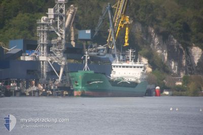
ARKLOW RAIDER
General Cargo
Current Trip
| Time Travelled | 6 days |
|---|---|
| Remaining Time | --- |
| Distance Travelled | 1204.12 морская миля |
| Remaining Distance | --- |
| AVG Speed | 10.5 Узлы |
| MAX Speed | 14.6 Узлы |
| AVG Wind | 16.2 knots |
| MAX Wind | 34 knots |
| MIN Temp | -8.8°C / 16.16°F |
| MAX Temp | 8.4°C / 47.12°F |
| Осадка | 6.1 м |
| Позиция Получена | 1 d тому назад |
Current Position
| Долгота | -5.92550° |
|---|---|
| Широта | 52.67850° |
| Статус | Under way using engine |
| Скорость | 10.4 Узлы |
| Курс | 193° |
| Район | Irish Sea and St. George's Channel |
| Станция | T-AIS |
| Позиция Получена | 1 d тому назад |
Info
Information
The current position of ARKLOW RAIDER is in Irish Sea and St. George's Channel with coordinates 52.67850° / -5.92550° as reported on 2025-02-08 15:17 by AIS to our vessel tracker app. The vessel's current speed is 10.4 Узлы
The vessel ARKLOW RAIDER (IMO: 9344540, MMSI: 250001268) is a General Cargo that was built in 2007 ( 18 лет ). It's sailing under the flag of [IE] Ireland.
In this page you can find informations about the vessels current position, last detected port calls, and current voyage information. If the vessels is not in coverage by AIS you will find the latest position.
The current position of ARKLOW RAIDER is detected by our AIS receivers and we are not responsible for the reliability of the data. The last position was recorded while the vessel was in Coverage by the Ais receivers of our vessel tracking app.
The current draught of ARKLOW RAIDER as reported by AIS is 6.1 meters
Weather
| Temperature | 3.4°C / 38.12°F |
|---|---|
| Wind Speed | 7 knots |
| Direction | 2° N |
| Pressure | 1026.6 hPa |
| Humidity | 87.3 % |
| Cloud Coverage | 100 % |
Featured Company
Last Port Calls
| Port | Arrival | Departure | Time In Port |
|---|---|---|---|
| 2025-02-03 14:35 | 2025-02-03 17:21 | 2 h | |
| 2025-01-28 23:54 | 2025-02-03 08:23 | 5 d | |
| 2025-01-18 17:08 | 2025-01-19 12:25 | 19 h | |
| 2025-01-13 17:09 | 2025-01-17 08:33 | 3 d | |
| 2025-01-12 17:14 | 2025-01-12 21:05 | 3 h | |
| 2025-01-03 20:11 | 2025-01-11 02:56 | 7 d | |
| 2024-12-31 14:08 | 2025-01-03 17:41 | 3 d | |
| 2024-12-22 21:03 | 2024-12-24 12:45 | 1 d | |
| 2024-12-20 14:05 | 2024-12-22 17:02 | 2 d | |
| 2024-12-16 11:41 | 2024-12-17 19:10 | 1 d |
Last Trips
| Origin | Departure | Destination | Arrival | Distance | |
|---|---|---|---|---|---|
| 2025-02-03 08:23 | 2025-02-03 14:35 | 64.50 морская миля | |||
| 2025-01-19 12:25 | 2025-01-28 23:54 | 2335.57 морская миля | |||
| 2025-01-17 08:33 | 2025-01-18 17:08 | 261.25 морская миля | |||
| 2025-01-12 21:05 | 2025-01-13 17:09 | 169.18 морская миля | |||
| 2025-01-11 02:56 | 2025-01-12 17:14 | 404.01 морская миля | |||
| 2025-01-03 17:41 | 2025-01-03 20:11 | 30.24 морская миля | |||
| 2024-12-24 12:45 | 2024-12-31 14:08 | 1834.76 морская миля | |||
| 2024-12-22 17:02 | 2024-12-22 21:03 | 27.44 морская миля | |||
| 2024-12-17 19:10 | 2024-12-20 14:05 | 640.71 морская миля | |||
| 2024-12-15 22:26 | 2024-12-16 11:41 | 128.16 морская миля |
Events
| Время | Событие | Детали | Позиция / Направление | Информация |
|---|---|---|---|---|
| 2025-02-09 02:51 | Начало движения | 0.97 nm, South East of DUNMORE EAST |
52.13500 / -6.97517
IEWAT
|
Скорость: 5.4 kn Курс: 9° |
| 2025-02-08 21:47 | Окончание движения | 1.03 nm, South East of DUNMORE EAST |
52.13283 / -6.97817
IEWAT
|
Скорость: 0.3 kn Курс: 90° |
| 2025-02-08 15:23 | Статус изменился | Default Under way using engine |
52.66134 / -5.93217
IEWAT
|
Скорость: 10.4 kn Курс: 193° |
| 2025-02-08 15:17 | Вне покрытия |
52.67850 / -5.92550
Irish Sea and St. George's Channel
IEWAT
|
Скорость: 10.4 kn Курс: 193° |
|
| 2025-02-08 10:44 | Статус изменился | Under way using engine Default |
53.49083 / -5.61333
IEWAT
|
Скорость: 11.9 kn Курс: 194° |
| 2025-02-08 10:43 | Статус изменился | Default Under way using engine |
53.49400 / -5.61217
IEWAT
|
Скорость: 11.8 kn Курс: 191° |
| 2025-02-08 10:37 | Изменение морского района | Irish part of the Irish Sea and St. George's Channel United Kingdom part of the Irish Sea and St. George's Channel |
53.51383 / -5.60483
Irish Sea and St. George's Channel
IEWAT
|
Скорость: 11.8 kn Курс: 191° |
| 2025-02-08 10:37 | Статус изменился | Under way using engine Default |
53.51383 / -5.60483
IEWAT
|
Скорость: 12 kn Курс: 191° |
| 2025-02-08 10:19 | В покрытии |
53.51383 / -5.60483
Irish Sea and St. George's Channel
IEWAT
|
Скорость: 11.8 kn Курс: 191° |
|
| 2025-02-08 08:10 | Вне покрытия |
53.97333 / -5.46017
Irish Sea and St. George's Channel
IEWAT
|
Скорость: 11 kn Курс: 189° |