
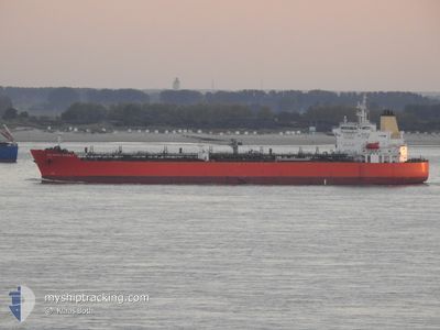
ATLANTIC MARBLE
Tanker
Current Trip
| Trip Time | 13 days |
|---|---|
| Trip Distance | 2394.46 морская миля |
| AVG Speed | 12.2 Узлы |
| MAX Speed | 14.2 Узлы |
| Осадка | 8 м |
| AVG Wind | 13.2 knots |
| MAX Wind | 21 knots |
| MIN Temp | 21.3°C / 70.34°F |
| MAX Temp | 29.3°C / 84.74°F |
| Позиция Получена | 4 d тому назад |
Current Position
| Долгота | -63.93906° |
|---|---|
| Широта | 18.34413° |
| Статус | Under way using engine |
| Скорость | 13 Узлы |
| Курс | 189° |
| Район | Caribbean Sea |
| Станция | T-AIS |
| Позиция Получена | 4 d тому назад |
Info
Information
The current position of ATLANTIC MARBLE is in Caribbean Sea with coordinates 18.34413° / -63.93906° as reported on 2025-02-05 02:47 by AIS to our vessel tracker app. The vessel's current speed is 13 Узлы and is currently inside the port of POINT LISAS.
The vessel ATLANTIC MARBLE (IMO: 9798959, MMSI: 538007896) is a Tanker It's sailing under the flag of [MH] Marshall Is.
In this page you can find informations about the vessels current position, last detected port calls, and current voyage information. If the vessels is not in coverage by AIS you will find the latest position.
The current position of ATLANTIC MARBLE is detected by our AIS receivers and we are not responsible for the reliability of the data. The last position was recorded while the vessel was in Coverage by the Ais receivers of our vessel tracking app.
The current draught of ATLANTIC MARBLE as reported by AIS is 8 meters
Weather
| Temperature | 24.5°C / 76.1°F |
|---|---|
| Wind Speed | 7 knots |
| Direction | 56° NE |
| Pressure | 1013.6 hPa |
| Humidity | 84.4 % |
| Cloud Coverage | 100 % |
Featured Company
Last Port Calls
| Port | Arrival | Departure | Time In Port |
|---|---|---|---|
| 2025-02-08 18:23 | |||
| 2025-01-24 00:42 | 2025-01-26 08:55 | 2 d | |
| 2025-01-17 19:23 | 2025-01-20 22:56 | 3 d | |
| 2024-12-23 17:57 | 2024-12-25 05:31 | 1 d | |
| 2024-12-20 04:12 | 2024-12-21 18:23 | 1 d | |
| 2024-12-05 07:52 | 2024-12-06 22:25 | 1 d | |
| 2024-12-04 08:48 | 2024-12-04 09:39 | 51 m |
Most Visited Ports (Last year)
| Port | Arrivals | |
|---|---|---|
| 2 | ||
| 2 | ||
| 2 | ||
| 1 | ||
| 1 | ||
| 1 |
Last Trips
| Origin | Departure | Destination | Arrival | Distance | |
|---|---|---|---|---|---|
| 2025-01-26 04:55 | 2025-02-08 14:23 | 2394.46 морская миля | |||
| 2025-01-20 18:56 | 2025-01-23 20:42 | 434.66 морская миля | |||
| 2024-12-24 23:31 | 2025-01-17 15:23 | 3705.51 морская миля | |||
| 2024-12-21 12:23 | 2024-12-23 11:57 | 64.74 морская миля | |||
| 2024-12-06 16:25 | 2024-12-19 22:12 | 1567.62 морская миля | |||
| 2024-12-04 03:39 | 2024-12-05 01:52 | 21.86 морская миля | |||
| 2024-11-23 14:10 | 2024-12-04 02:48 | 2636.32 морская миля |
Events
| Время | Событие | Детали | Позиция / Направление | Информация |
|---|---|---|---|---|
| 2025-02-08 18:23 | Окончание движения |
10.39990 / -61.49153
[TT] POINT LISAS
|
Скорость: 0.2 kn Курс: 252° |
|
| 2025-02-08 18:23 | Порт |
|
10.39990 / -61.49153
[TT] POINT LISAS
|
Скорость: 1 kn Курс: 243° |
| 2025-02-08 16:55 | Начало движения | 3.86 nm, West of POINT LISAS |
10.40535 / -61.55986
NASSAU CLIFFTON PIER
|
Скорость: 3.2 kn Курс: 335° |
| 2025-02-06 22:35 | Окончание движения | 3.89 nm, West of POINT LISAS |
10.40338 / -61.56070
NASSAU CLIFFTON PIER
|
Скорость: 0.2 kn Курс: 69° |
| 2025-02-05 02:57 | Статус изменился | Default Under way using engine |
18.30610 / -63.94673
NASSAU CLIFFTON PIER
|
Скорость: 13 kn Курс: 189° |
| 2025-02-05 02:47 | Вне покрытия |
18.34413 / -63.93906
Caribbean Sea
|
Скорость: 13 kn Курс: 189° |
|
| 2025-02-05 02:45 | Обнаружено в море | British Virgin Islands part of the Caribbean Sea |
18.35220 / -63.93747
Caribbean Sea
|
Скорость: 13 kn Курс: 188° |
| 2025-02-05 02:45 | Статус изменился | Under way using engine Default |
18.35220 / -63.93747
NASSAU CLIFFTON PIER
|
Скорость: 13.7 kn Курс: 191° |
| 2025-02-05 02:39 | В покрытии |
18.35220 / -63.93747
Caribbean Sea
|
Скорость: 13 kn Курс: 188° |
|
| 2025-02-02 00:44 | Начало движения | 12.81 nm, South West of NASSAU |
24.99819 / -77.54910
NASSAU CLIFFTON PIER
|
Скорость: 3.4 kn Курс: 279° |