
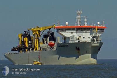
BARTOLOMEU DIAS
Trailing Suction Hopper Dredger
Current Trip
DREDGING BALBOA
| Time Travelled | 5 mins |
|---|---|
| Remaining Time | --- |
| Distance Travelled | --- |
| Remaining Distance | --- |
| AVG Speed | --- |
| MAX Speed | --- |
| AVG Wind | --- |
| MAX Wind | --- |
| MIN Temp | --- |
| MAX Temp | --- |
| Осадка | 8.9 м |
| Позиция Получена | 8 h, 48 m тому назад |
Current Position
| Долгота | -78.98762° |
|---|---|
| Широта | -8.22337° |
| Статус | Restricted manoeuverability |
| Скорость | 1.6 Узлы |
| Курс | 293° |
| Район | South Pacific Ocean |
| Станция | T-AIS |
| Позиция Получена | 8 h, 48 m тому назад |
Info
Information
The current position of BARTOLOMEU DIAS is in South Pacific Ocean with coordinates -8.22337° / -78.98762° as reported on 2025-02-07 00:44 by AIS to our vessel tracker app. The vessel's current speed is 1.6 Узлы
The vessel BARTOLOMEU DIAS (IMO: 9618991, MMSI: 253384000) is a Trailing Suction Hopper Dredger that was built in 2013 ( 12 лет ). It's sailing under the flag of [LU] Luxembourg.
In this page you can find informations about the vessels current position, last detected port calls, and current voyage information. If the vessels is not in coverage by AIS you will find the latest position.
The current position of BARTOLOMEU DIAS is detected by our AIS receivers and we are not responsible for the reliability of the data. The last position was recorded while the vessel was in Coverage by the Ais receivers of our vessel tracking app.
The current draught of BARTOLOMEU DIAS as reported by AIS is 8.9 meters
Weather
| Temperature | 20.7°C / 69.26°F |
|---|---|
| Wind Speed | 3 knots |
| Direction | 178° S |
| Pressure | 1009.5 hPa |
| Humidity | 86.1 % |
| Cloud Coverage | 100 % |
Featured Company
Last Port Calls
| Port | Arrival | Departure | Time In Port |
|---|---|---|---|
| 2025-02-07 08:41 | 2025-02-07 09:27 | 46 m | |
| 2025-02-07 06:23 | 2025-02-07 07:16 | 53 m | |
| 2025-02-07 04:21 | 2025-02-07 05:09 | 47 m | |
| 2025-02-07 02:14 | 2025-02-07 03:03 | 49 m | |
| 2025-02-07 00:14 | 2025-02-07 01:01 | 47 m | |
| 2025-02-06 22:06 | 2025-02-06 23:01 | 54 m | |
| 2025-02-06 16:45 | 2025-02-06 20:54 | 4 h | |
| 2025-02-01 10:02 | 2025-02-01 10:27 | 24 m | |
| 2025-01-31 14:20 | 2025-01-31 15:59 | 1 h | |
| 2025-01-31 11:30 | 2025-01-31 12:55 | 1 h |
Most Visited Ports (Last year)
| Port | Arrivals | |
|---|---|---|
| 76 | ||
| 50 | ||
| 48 | ||
| 34 | ||
| 5 | ||
| 1 |
Last Trips
| Origin | Departure | Destination | Arrival | Distance | |
|---|---|---|---|---|---|
| 2025-02-07 02:16 | 2025-02-07 03:41 | 10.94 морская миля | |||
| 2025-02-07 00:09 | 2025-02-07 01:23 | 10.55 морская миля | |||
| 2025-02-06 22:03 | 2025-02-06 23:21 | 10.88 морская миля | |||
| 2025-02-06 20:01 | 2025-02-06 21:14 | 10.26 морская миля | |||
| 2025-02-06 18:01 | 2025-02-06 19:14 | 11.13 морская миля | |||
| 2025-02-06 15:54 | 2025-02-06 17:06 | 10.99 морская миля | |||
| 2025-02-01 05:27 | 2025-02-06 11:45 | 1175.38 морская миля | |||
| 2025-01-31 10:59 | 2025-02-01 05:02 | 93.53 морская миля | |||
| 2025-01-31 07:55 | 2025-01-31 09:20 | 16.78 морская миля | |||
| 2025-01-31 04:51 | 2025-01-31 06:30 | 17.62 морская миля |
Events
| Время | Событие | Детали | Позиция / Направление | Информация |
|---|---|---|---|---|
| 2025-02-07 09:27 | ПОРТ ОТПРАВЛЕНИЯ |
|
-8.22136 / -79.00120
DREDGING BALBOA
|
Скорость: 5.5 kn Курс: 277° |
| 2025-02-07 08:41 | Порт |
|
-8.22293 / -78.99106
[PE] SALAVERRY
|
Скорость: 3.1 kn Курс: 61° |
| 2025-02-07 07:25 | Начало движения | 1.02 nm, West of SALAVERRY |
-8.22104 / -79.00223
DREDGING BALBOA
|
Скорость: 8.4 kn Курс: 285° |
| 2025-02-07 07:16 | Окончание движения | 0.5 nm, West of SALAVERRY |
-8.22268 / -78.99354
DREDGING BALBOA
|
Скорость: 0.3 kn Курс: 218° |
| 2025-02-07 07:16 | ПОРТ ОТПРАВЛЕНИЯ |
|
-8.22268 / -78.99354
DREDGING BALBOA
|
Скорость: 1.9 kn Курс: 289° |
| 2025-02-07 06:23 | Порт |
|
-8.22284 / -78.99100
[PE] SALAVERRY
|
Скорость: 1.4 kn Курс: 49° |
| 2025-02-07 05:49 | Начало движения | 5.19 nm, West of SALAVERRY |
-8.24741 / -79.06989
DREDGING BALBOA
|
Скорость: 10.5 kn Курс: 72° |
| 2025-02-07 05:45 | Окончание движения | 5.64 nm, West of SALAVERRY |
-8.25027 / -79.07685
DREDGING BALBOA
|
Скорость: 0.3 kn Курс: 58° |
| 2025-02-07 05:09 | ПОРТ ОТПРАВЛЕНИЯ |
|
-8.22092 / -79.00043
DREDGING BALBOA
|
Скорость: 3.1 kn Курс: 288° |
| 2025-02-07 04:21 | Порт |
|
-8.22348 / -78.98972
[PE] SALAVERRY
|
Скорость: 1.9 kn Курс: 49° |