
BBC LISBON
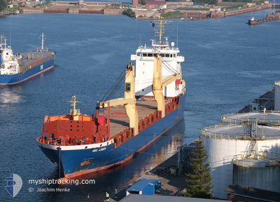
General Cargo
Current Trip
| Time Travelled | 2 days |
|---|---|
| Remaining Time | --- |
| Distance Travelled | 444.80 морская миля |
| Remaining Distance | --- |
| AVG Speed | 9 Узлы |
| MAX Speed | 10.8 Узлы |
| AVG Wind | 20.8 knots |
| MAX Wind | 31.3 knots |
| MIN Temp | 8.4°C / 47.12°F |
| MAX Temp | 13°C / 55.4°F |
| Осадка | 6.9 м |
| Позиция Получена | 1 m тому назад |
Current Position
| Долгота | -9.23763° |
|---|---|
| Широта | 41.37333° |
| Статус | Under way using engine |
| Скорость | 8.6 Узлы |
| Курс | 156.8° |
| Район | North Atlantic Ocean |
| Станция | T-AIS |
| Позиция Получена | 1 m тому назад |
Info
Information
The current position of BBC LISBON is in North Atlantic Ocean with coordinates 41.37333° / -9.23763° as reported on 2025-03-03 00:47 by AIS to our vessel tracker app. The vessel's current speed is 8.6 Узлы
The vessel BBC LISBON (IMO: 9513634, MMSI: 305688000) is a General Cargo that was built in 2011 ( 14 лет ). It's sailing under the flag of [AG] Antigua Barbuda.
In this page you can find informations about the vessels current position, last detected port calls, and current voyage information. If the vessels is not in coverage by AIS you will find the latest position.
The current position of BBC LISBON is detected by our AIS receivers and we are not responsible for the reliability of the data. The last position was recorded while the vessel was in Coverage by the Ais receivers of our vessel tracking app.
The current draught of BBC LISBON as reported by AIS is 6.9 meters
Weather
| Temperature | 9.9°C / 49.82°F |
|---|---|
| Wind Speed | 16 knots |
| Direction | 83° E |
| Pressure | 1016.9 hPa |
| Humidity | 77 % |
| Cloud Coverage | 23 % |
Featured Company
Last Port Calls
| Port | Arrival | Departure | Time In Port |
|---|---|---|---|
| 2025-02-23 13:18 | 2025-02-28 23:55 | 5 d | |
| 2025-02-12 21:19 | 2025-02-14 23:47 | 2 d | |
| 2025-01-31 06:36 | 2025-02-04 01:12 | 3 d | |
| 2025-01-03 11:27 |
Last Trips
| Origin | Departure | Destination | Arrival | Distance | |
|---|---|---|---|---|---|
| 2025-02-14 23:47 | 2025-02-23 14:18 | 2154.30 морская миля | |||
| 2025-02-04 02:12 | 2025-02-12 21:19 | 2253.21 морская миля | |||
| 2025-01-03 16:57 | 2025-01-31 07:36 | 6609.09 морская миля |
Events
| Время | Событие | Детали | Позиция / Направление | Информация |
|---|---|---|---|---|
| 2025-03-03 00:26 | Статус изменился | Under way using engine Default |
41.41951 / -9.26505
AVEIRO
|
Скорость: 8.7 kn Курс: 155° |
| 2025-03-03 00:11 | Статус изменился | Default Under way using engine |
41.45251 / -9.28456
AVEIRO
|
Скорость: 8.3 kn Курс: 157.1° |
| 2025-03-03 00:04 | Изменение морского района | Portuguese part of the North Atlantic Ocean Spanish part of the North Atlantic Ocean |
41.46794 / -9.29385
North Atlantic Ocean
AVEIRO
|
Скорость: 8.3 kn Курс: 157.1° |
| 2025-03-03 00:04 | Статус изменился | Under way using engine Default |
41.46794 / -9.29385
AVEIRO
|
Скорость: 8.8 kn Курс: 160° |
| 2025-03-02 23:46 | В покрытии |
41.46794 / -9.29385
North Atlantic Ocean
AVEIRO
|
Скорость: 8.3 kn Курс: 157.1° |
|
| 2025-03-02 03:09 | Статус изменился | Default Under way using engine |
43.71626 / -8.88469
AVEIRO
|
Скорость: 8.8 kn Курс: 253.4° |
| 2025-03-02 03:06 | Вне покрытия |
43.71829 / -8.87443
North Atlantic Ocean
AVEIRO
|
Скорость: 8.8 kn Курс: 253.4° |
|
| 2025-03-02 02:54 | Статус изменился | Under way using engine Default |
43.72482 / -8.83483
AVEIRO
|
Скорость: 8.6 kn Курс: 257° |
| 2025-03-02 02:09 | Статус изменился | Default Under way using engine |
43.74829 / -8.69383
AVEIRO
|
Скорость: 8.5 kn Курс: 254.3° |
| 2025-03-02 01:58 | Статус изменился | Under way using engine Default |
43.75434 / -8.65976
AVEIRO
|
Скорость: 8.3 kn Курс: 256° |