
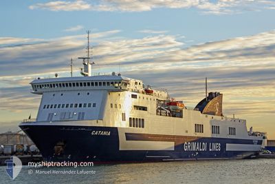
CATANIA
Ro-Ro/Passenger Ship
Current Trip
| Time Travelled | 10 h, 34 mins |
|---|---|
| Remaining Time | 4 h, 42 mins |
| Distance Travelled | 152.33 морская миля |
| Remaining Distance | 133.56 морская миля |
| AVG Speed | 17.4 Узлы |
| MAX Speed | 18.5 Узлы |
| AVG Wind | 18.3 knots |
| MAX Wind | 26.5 knots |
| MIN Temp | 9.1°C / 48.38°F |
| MAX Temp | 16.9°C / 62.42°F |
| Осадка | 6 м |
| Позиция Получена | 4 h, 42 m тому назад |
Current Position
| Долгота | 11.58962° |
|---|---|
| Широта | 37.78963° |
| Статус | Under way using engine |
| Скорость | 17.9 Узлы |
| Курс | 229° |
| Район | Mediterranean Sea - Western Basin |
| Станция | T-AIS |
| Позиция Получена | 4 h, 42 m тому назад |
Info
Information
The current position of CATANIA is in Mediterranean Sea - Western Basin with coordinates 37.78963° / 11.58962° as reported on 2026-01-06 07:08 by AIS to our vessel tracker app. The vessel's current speed is 17.9 Узлы and is heading at the port of PALERMO. The estimated time of arrival as calculated by MyShipTracking vessel tracking app is 2026-01-06 17:32 LT
The vessel CATANIA (IMO: 9261554, MMSI: 247098200) is a Ro-Ro/Passenger Ship that was built in 2003 ( 23 лет ). It's sailing under the flag of [IT] Italy.
In this page you can find informations about the vessels current position, last detected port calls, and current voyage information. If the vessels is not in coverage by AIS you will find the latest position.
The current position of CATANIA is detected by our AIS receivers and we are not responsible for the reliability of the data. The last position was recorded while the vessel was in Coverage by the Ais receivers of our vessel tracking app.
The current draught of CATANIA as reported by AIS is 6 meters
Weather
| Temperature | 15°C / 59°F |
|---|---|
| Wind Speed | 18 knots |
| Direction | 300° WNW |
| Pressure | 1005.4 hPa |
| Humidity | 71.6 % |
| Cloud Coverage | 17 % |
Featured Company
Last Port Calls
| Port | Arrival | Departure | Time In Port |
|---|---|---|---|
| 2026-01-05 23:04 | 2026-01-06 02:16 | 3 h | |
| 2026-01-05 06:56 | 2026-01-05 13:44 | 6 h | |
| 2026-01-04 17:36 | 2026-01-04 21:09 | 3 h | |
| 2026-01-03 23:47 | 2026-01-04 07:34 | 7 h | |
| 2026-01-03 10:40 | 2026-01-03 13:39 | 2 h | |
| 2026-01-02 20:21 | 2026-01-03 01:40 | 5 h | |
| 2026-01-02 07:04 | 2026-01-02 11:00 | 3 h | |
| 2026-01-01 15:21 | 2026-01-01 20:44 | 5 h | |
| 2025-12-31 11:52 | 2025-12-31 19:40 | 7 h | |
| 2025-12-30 12:52 | 2025-12-30 18:29 | 5 h |
Last Trips
| Origin | Departure | Destination | Arrival | Distance | |
|---|---|---|---|---|---|
| 2026-01-05 13:44 | 2026-01-05 23:04 | 165.15 морская миля | |||
| 2026-01-04 21:09 | 2026-01-05 06:56 | 165.79 морская миля | |||
| 2026-01-04 07:34 | 2026-01-04 17:36 | 188.19 морская миля | |||
| 2026-01-03 13:39 | 2026-01-03 23:47 | 190.67 морская миля | |||
| 2026-01-03 01:40 | 2026-01-03 10:40 | 165.43 морская миля | |||
| 2026-01-02 11:00 | 2026-01-02 20:21 | 174.15 морская миля | |||
| 2026-01-01 20:44 | 2026-01-02 07:04 | 188.63 морская миля | |||
| 2025-12-31 19:40 | 2026-01-01 15:21 | 331.17 морская миля | |||
| 2025-12-30 18:29 | 2025-12-31 11:52 | 329.52 морская миля | |||
| 2025-12-30 01:04 | 2025-12-30 12:52 | 190.21 морская миля |
Events
| Время | Событие | Детали | Позиция / Направление | Информация |
|---|---|---|---|---|
| 2026-01-06 07:20 | Статус изменился | Default Under way using engine |
37.75067 / 11.53148
ITPMO-TNLGN
|
Скорость: 17.9 kn Курс: 229° |
| 2026-01-06 07:08 | Вне покрытия |
37.78963 / 11.58962
Mediterranean Sea - Western Basin
ITPMO-TNLGN
|
Скорость: 17.9 kn Курс: 229° |
|
| 2026-01-06 07:04 | Статус изменился | Under way using engine Default |
37.80263 / 11.60862
ITPMO-TNLGN
|
Скорость: 18.2 kn Курс: 229° |
| 2026-01-06 06:55 | Статус изменился | Default Under way using engine |
37.82939 / 11.64823
ITPMO-TNLGN
|
Скорость: 17.9 kn Курс: 228° |
| 2026-01-06 06:38 | Статус изменился | Under way using engine Default |
37.89053 / 11.72697
ITPMO-TNLGN
|
Скорость: 17.6 kn Курс: 225° |
| 2026-01-06 06:37 | Статус изменился | Default Under way using engine |
37.89417 / 11.73147
ITPMO-TNLGN
|
Скорость: 17.6 kn Курс: 225° |
| 2026-01-06 06:31 | Изменение морского района | Italian part of the Mediterranean Sea - Western Basin Italian part of the Tyrrhenian Sea |
37.91405 / 11.75728
Mediterranean Sea - Western Basin
ITPMO-TNLGN
|
Скорость: 17.3 kn Курс: 226° |
| 2026-01-06 06:28 | Статус изменился | Under way using engine Default |
37.92215 / 11.76780
ITPMO-TNLGN
|
Скорость: 17.2 kn Курс: 226° |
| 2026-01-06 06:24 | Статус изменился | Default Under way using engine |
37.93568 / 11.78580
ITPMO-TNLGN
|
Скорость: 17.2 kn Курс: 228° |
| 2026-01-06 03:54 | Осадка изменилась | 6 6.4 |
38.22379 / 12.60275
ITPMO-TNLGN
|
Скорость: 17.7 kn Курс: 259° |