
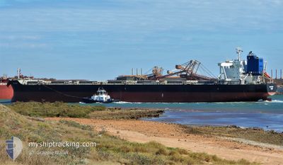
CEDRIC OLDENDORFF
Bulk Carrier
Current Trip
| Time Travelled | 7 h, 51 mins |
|---|---|
| Remaining Time | --- |
| Distance Travelled | 81.21 морская миля |
| Remaining Distance | 50.88 морская миля |
| AVG Speed | 11 Узлы |
| MAX Speed | 13.3 Узлы |
| AVG Wind | 17 knots |
| MAX Wind | 32.8 knots |
| MIN Temp | 5.6°C / 42.08°F |
| MAX Temp | 8.3°C / 46.94°F |
| Осадка | 7.8 м |
| Позиция Получена | 3 m тому назад |
Current Position
| Долгота | -123.66060° |
|---|---|
| Широта | 49.04482° |
| Статус | At anchor |
| Скорость | 0.5 Узлы |
| Курс | 310° |
| Район | The Coastal Waters of Southeast Alaska and British Columbia |
| Станция | T-AIS |
| Позиция Получена | 3 m тому назад |
Info
Information
The current position of CEDRIC OLDENDORFF is in The Coastal Waters of Southeast Alaska and British Columbia with coordinates 49.04482° / -123.66060° as reported on 2025-02-25 15:57 by AIS to our vessel tracker app. The vessel's current speed is 0.5 Узлы and is heading at the port of TSAWWASSEN. The estimated time of arrival as calculated by MyShipTracking vessel tracking app is 2025-02-16 00:00 LT
The vessel CEDRIC OLDENDORFF (IMO: 9591571, MMSI: 636092975) is a Bulk Carrier that was built in 2011 ( 14 лет ). It's sailing under the flag of [LR] Liberia.
In this page you can find informations about the vessels current position, last detected port calls, and current voyage information. If the vessels is not in coverage by AIS you will find the latest position.
The current position of CEDRIC OLDENDORFF is detected by our AIS receivers and we are not responsible for the reliability of the data. The last position was recorded while the vessel was in Coverage by the Ais receivers of our vessel tracking app.
The current draught of CEDRIC OLDENDORFF as reported by AIS is 7.8 meters
Weather
| Temperature | 5.8°C / 42.44°F |
|---|---|
| Wind Speed | 3 knots |
| Direction | 14° NNE |
| Pressure | 1003.9 hPa |
| Humidity | 98.1 % |
| Cloud Coverage | 100 % |
Featured Company
Events
| Время | Событие | Детали | Позиция / Направление | Информация |
|---|---|---|---|---|
| 2025-02-25 15:51 | Окончание движения | 3.97 nm, North of THETIS ISLAND |
49.04478 / -123.66131
CARTB
|
Скорость: 0.3 kn Курс: 313° |
| 2025-02-25 12:22 | Изменение морского района | Canadian part of the The Coastal Waters of Southeast Alaska and British Columbia United States part of the The Coastal Waters of Southeast Alaska and British Columbia |
48.80119 / -123.00952
The Coastal Waters of Southeast Alaska and British Columbia
|
Скорость: 10.7 kn Курс: 205.3° |
| 2025-02-25 12:16 | Изменение морского района | United States part of the The Coastal Waters of Southeast Alaska and British Columbia Canadian part of the The Coastal Waters of Southeast Alaska and British Columbia |
48.81870 / -123.00516
The Coastal Waters of Southeast Alaska and British Columbia
|
Скорость: 10.2 kn Курс: 168.3° |
| 2025-02-25 11:52 | Изменение морского района | Canadian part of the The Coastal Waters of Southeast Alaska and British Columbia United States part of the The Coastal Waters of Southeast Alaska and British Columbia |
48.86763 / -123.07921
The Coastal Waters of Southeast Alaska and British Columbia
|
Скорость: 10.3 kn Курс: 141.1° |
| 2025-02-25 10:43 | Изменение морского района | United States part of the The Coastal Waters of Southeast Alaska and British Columbia Canadian part of the The Coastal Waters of Southeast Alaska and British Columbia |
48.99673 / -123.28789
The Coastal Waters of Southeast Alaska and British Columbia
|
Скорость: 9.7 kn Курс: 131.4° |
| 2025-02-25 08:09 | ПОРТ ОТПРАВЛЕНИЯ |
|
49.31766 / -123.14875
CARTB
|
Скорость: 8.4 kn Курс: 283° |
| 2025-02-25 07:47 | Начало движения |
49.30184 / -123.09596
[CA] VANCOUVER
|
Скорость: 3.1 kn Курс: 246° |
|
| 2025-02-23 03:44 | Статус изменился | At anchor Default |
49.30384 / -123.09432
[CA] VANCOUVER
|
Скорость: Курс: 101° |
| 2025-02-23 03:41 | В покрытии |
49.30384 / -123.09432
The Coastal Waters of Southeast Alaska and British Columbia
[CA] VANCOUVER
|
Скорость: Курс: 237.2° |
|
| 2025-02-23 02:32 | Вне покрытия |
49.30387 / -123.09429
The Coastal Waters of Southeast Alaska and British Columbia
[CA] VANCOUVER
|
Скорость: Курс: 34.9° |