

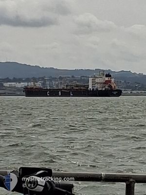
CSL FRONTIER
Self Discharging Bulk Carrier

Current Trip
| Time Travelled | 19 days |
|---|---|
| Remaining Time | --- |
| Distance Travelled | 3755.50 морская миля |
| Remaining Distance | --- |
| AVG Speed | 10.4 Узлы |
| MAX Speed | 14.7 Узлы |
| AVG Wind | 10.6 knots |
| MAX Wind | 26.5 knots |
| MIN Temp | 11.4°C / 52.52°F |
| MAX Temp | 30.9°C / 87.62°F |
| Осадка | 8.1 м |
| Позиция Получена | 1 d тому назад |
Current Position
| Долгота | -109.79067° |
|---|---|
| Широта | 24.32192° |
| Статус | Under way using engine |
| Скорость | 10.4 Узлы |
| Курс | 151.9° |
| Район | Gulf of California |
| Станция | T-AIS |
| Позиция Получена | 1 d тому назад |
Information
The current position of CSL FRONTIER is in Gulf of California with coordinates 24.32192° / -109.79067° as reported on 2025-06-07 23:10 by AIS to our vessel tracker app. The vessel's current speed is 10.4 Узлы and is heading at the port of SANTA ROSALIA. The estimated time of arrival as calculated by MyShipTracking vessel tracking app is 2025-06-04 14:00 LT
The vessel CSL FRONTIER (IMO: 9228734, MMSI: 311000421) is a Self Discharging Bulk Carrier that was built in 2001 ( 24 лет ). It's sailing under the flag of [BS] Bahamas.
In this page you can find informations about the vessels current position, last detected port calls, and current voyage information. If the vessels is not in coverage by AIS you will find the latest position.
The current position of CSL FRONTIER is detected by our AIS receivers and we are not responsible for the reliability of the data. The last position was recorded while the vessel was in Coverage by the Ais receivers of our vessel tracking app.
The current draught of CSL FRONTIER as reported by AIS is 8.1 meters
Weather
| Temperature | 17.5°C / 63.5°F |
|---|---|
| Wind Speed | 17 knots |
| Direction | 327° NNW |
| Pressure | 1010.9 hPa |
| Humidity | 91.8 % |
| Cloud Coverage | 7 % |


Featured Company
Last Port Calls
| Port | Arrival | Departure | Time In Port |
|---|---|---|---|
| 2025-05-19 08:58 | 2025-05-20 19:44 | 1 d | |
| 2025-04-25 10:37 | 2025-04-28 10:40 | 3 d | |
| 2025-04-14 09:54 | 2025-04-15 18:51 | 1 d |
Most Visited Ports (Last year)
| Port | Arrivals | |
|---|---|---|
| 8 | ||
| 4 | ||
| 4 | ||
| 4 | ||
| 1 | ||
| 1 |
Last Trips
| Origin | Departure | Destination | Arrival | Distance | |
|---|---|---|---|---|---|
| 2025-04-28 10:40 | 2025-05-19 08:58 | 4643.63 морская миля | |||
| 2025-04-15 18:51 | 2025-04-25 10:37 | 1569.30 морская миля | |||
| 2025-03-30 09:30 | 2025-04-14 09:54 | 3131.28 морская миля |
Events
| Время | Событие | Детали | Позиция / Направление | Информация |
|---|---|---|---|---|
| 2025-06-07 23:13 | Статус изменился | Default Under way using engine |
24.31381 / -109.78597
MX SRL
|
Скорость: 10.4 kn Курс: 151.9° |
| 2025-06-07 23:10 | Статус изменился | Under way using engine Default |
24.32192 / -109.79067
MX SRL
|
Скорость: 10.4 kn Курс: 151° |
| 2025-06-07 23:10 | Вне покрытия |
24.32192 / -109.79067
Gulf of California
|
Скорость: 10.4 kn Курс: 151.9° |
|
| 2025-06-07 22:32 | Статус изменился | Default Under way using engine |
24.41660 / -109.84756
MX SRL
|
Скорость: 10.4 kn Курс: 150.2° |
| 2025-06-07 22:10 | Статус изменился | Under way using engine Default |
24.47447 / -109.88303
MX SRL
|
Скорость: 10.3 kn Курс: 151° |
| 2025-06-07 22:09 | Статус изменился | Default Under way using engine |
24.47700 / -109.88458
MX SRL
|
Скорость: 10.3 kn Курс: 150.7° |
| 2025-06-07 21:55 | Статус изменился | Under way using engine Default |
24.51155 / -109.90544
MX SRL
|
Скорость: 10.5 kn Курс: 151° |
| 2025-06-07 21:44 | Статус изменился | Default Under way using engine |
24.53891 / -109.92168
MX SRL
|
Скорость: 10.5 kn Курс: 151.5° |
| 2025-06-07 21:43 | Статус изменился | Under way using engine Default |
24.54098 / -109.92296
MX SRL
|
Скорость: 10.5 kn Курс: 152° |
| 2025-06-07 21:39 | Статус изменился | Default Under way using engine |
24.55128 / -109.92904
MX SRL
|
Скорость: 10.6 kn Курс: 150.7° |