
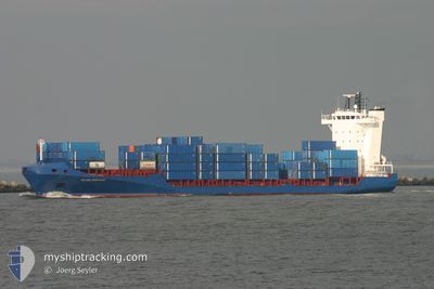
DENEB
Container Ship
Current Trip
| Time Travelled | 3 days |
|---|---|
| Remaining Time | --- |
| Distance Travelled | 842.90 морская миля |
| Remaining Distance | --- |
| AVG Speed | 12.4 Узлы |
| MAX Speed | 14.2 Узлы |
| AVG Wind | 12.1 knots |
| MAX Wind | 17 knots |
| MIN Temp | 24.4°C / 75.92°F |
| MAX Temp | 27.8°C / 82.04°F |
| Осадка | 5 м |
| Позиция Получена | 1 d тому назад |
Current Position
| Долгота | -69.65793° |
|---|---|
| Широта | 19.71500° |
| Статус | Under way using engine |
| Скорость | 14 Узлы |
| Курс | 288.7° |
| Район | North Atlantic Ocean |
| Станция | T-AIS |
| Позиция Получена | 1 d тому назад |
Info
Information
The current position of DENEB is in North Atlantic Ocean with coordinates 19.71500° / -69.65793° as reported on 2026-01-07 05:11 by AIS to our vessel tracker app. The vessel's current speed is 14 Узлы and is heading at the port of CHRISTIANSTED. The estimated time of arrival as calculated by MyShipTracking vessel tracking app is 2026-01-05 06:00 LT
The vessel DENEB (IMO: 9344241, MMSI: 304941000) is a Container Ship that was built in 2006 ( 20 лет ). It's sailing under the flag of [AG] Antigua Barbuda.
In this page you can find informations about the vessels current position, last detected port calls, and current voyage information. If the vessels is not in coverage by AIS you will find the latest position.
The current position of DENEB is detected by our AIS receivers and we are not responsible for the reliability of the data. The last position was recorded while the vessel was in Coverage by the Ais receivers of our vessel tracking app.
The current draught of DENEB as reported by AIS is 5 meters
Weather
| Temperature | 24.4°C / 75.92°F |
|---|---|
| Wind Speed | 16 knots |
| Direction | 95° E |
| Pressure | 1017.3 hPa |
| Humidity | 75.6 % |
| Cloud Coverage | --- |
Featured Company
Last Port Calls
| Port | Arrival | Departure | Time In Port |
|---|---|---|---|
| 2026-01-05 06:35 | 2026-01-05 13:10 | 6 h | |
| 2025-12-28 22:27 | 2026-01-01 00:12 | 3 d | |
| 2025-12-27 09:39 | 2025-12-28 22:20 | 1 d | |
| 2025-12-24 20:37 | 2025-12-25 01:29 | 4 h | |
| 2025-12-22 06:24 | 2025-12-22 19:30 | 13 h | |
| 2025-12-17 06:43 | 2025-12-18 00:34 | 17 h | |
| 2025-12-17 06:20 | 2025-12-17 06:28 | 7 m | |
| 2025-12-14 16:27 | |||
| 2025-12-13 07:23 | 2025-12-13 17:50 | 10 h | |
| 2025-12-13 06:58 | 2025-12-13 07:06 | 8 m |
Most Visited Ports (Last year)
| Port | Arrivals | |
|---|---|---|
| 46 | ||
| 44 | ||
| 17 | ||
| 16 | ||
| 11 | ||
| 10 |
Last Trips
| Origin | Departure | Destination | Arrival | Distance | |
|---|---|---|---|---|---|
| 2026-01-01 00:12 | 2026-01-05 06:35 | 1052.59 морская миля | |||
| 2025-12-28 22:20 | 2025-12-28 22:27 | 0.79 морская миля | |||
| 2025-12-25 01:29 | 2025-12-27 09:39 | 712.80 морская миля | |||
| 2025-12-22 19:30 | 2025-12-24 20:37 | 478.03 морская миля | |||
| 2025-12-18 00:34 | 2025-12-22 06:24 | 1119.76 морская миля | |||
| 2025-12-17 06:28 | 2025-12-17 06:43 | 1.04 морская миля | |||
| 2025-12-17 06:28 | 2025-12-17 06:20 | 1.04 морская миля | |||
| 2025-12-13 17:50 | 2025-12-14 16:27 | 302.56 морская миля | |||
| 2025-12-13 07:06 | 2025-12-13 07:23 | 1.12 морская миля | |||
| 2025-12-10 18:30 | 2025-12-13 06:58 | 707.08 морская миля |
Events
| Время | Событие | Детали | Позиция / Направление | Информация |
|---|---|---|---|---|
| 2026-01-07 05:15 | Статус изменился | Default Under way using engine |
19.72167 / -69.67333
VICTD
|
Скорость: 14 kn Курс: 288.7° |
| 2026-01-07 05:11 | Вне покрытия |
19.71500 / -69.65793
North Atlantic Ocean
|
Скорость: 14 kn Курс: 288.7° |
|
| 2026-01-07 03:36 | Статус изменился | Under way using engine Default |
19.58294 / -69.30481
VICTD
|
Скорость: 13 kn Курс: 290° |
| 2026-01-07 02:51 | Статус изменился | Default Under way using engine |
19.50833 / -69.16167
VICTD
|
Скорость: 12.9 kn Курс: 309.5° |
| 2026-01-06 23:01 | Изменение морского района | Dominican Republic part of the North Atlantic Ocean Puerto Rican part of the Caribbean Sea |
19.05100 / -68.47174
North Atlantic Ocean
|
Скорость: 11.6 kn Курс: 305.4° |
| 2026-01-06 23:00 | Статус изменился | Under way using engine Default |
19.04862 / -68.46799
VICTD
|
Скорость: 12 kn Курс: 304° |
| 2026-01-06 22:50 | В покрытии |
19.05100 / -68.47174
North Atlantic Ocean
|
Скорость: 11.6 kn Курс: 305.4° |
|
| 2026-01-06 03:50 | Начало движения |
17.66091 / -65.32333
VICTD
|
Скорость: 4 kn Курс: 252° |
|
| 2026-01-05 22:02 | Статус изменился | Default Under way using engine |
17.65365 / -65.33912
VICTD
|
Скорость: Курс: 251° |
| 2026-01-05 21:58 | Вне покрытия |
17.65298 / -65.33896
Caribbean Sea
|
Скорость: Курс: 344° |