
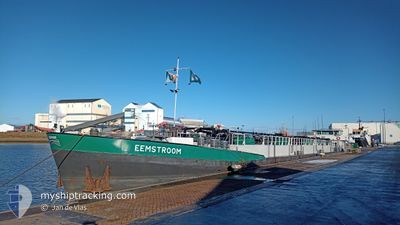
EEMSTROOM
Tanker
Current Trip
| Time Travelled | 3 h, 44 mins |
|---|---|
| Remaining Time | 5 h, 22 mins |
| Distance Travelled | 20.78 морская миля |
| Remaining Distance | 43.32 морская миля |
| AVG Speed | 9 Узлы |
| MAX Speed | 10.6 Узлы |
| AVG Wind | 9.6 knots |
| MAX Wind | 11 knots |
| MIN Temp | 2.1°C / 35.78°F |
| MAX Temp | 3.5°C / 38.3°F |
| Осадка | 2.2 м |
| Позиция Получена | Сейчас |
Current Position
| Долгота | 5.38401° |
|---|---|
| Широта | 52.50496° |
| Статус | Under way using engine |
| Скорость | 10.4 Узлы |
| Курс | 253.2° |
| Район | North Sea |
| Станция | T-AIS |
| Позиция Получена | Сейчас |
Info
Information
The current position of EEMSTROOM is in North Sea with coordinates 52.50496° / 5.38401° as reported on 2025-02-04 08:53 by AIS to our vessel tracker app. The vessel's current speed is 10.4 Узлы and is heading at the port of NIEUWEGEIN. The estimated time of arrival as calculated by MyShipTracking vessel tracking app is 2025-02-04 14:15 LT
The vessel EEMSTROOM (MMSI: 244630019) is a Tanker It's sailing under the flag of [NL] Netherlands.
In this page you can find informations about the vessels current position, last detected port calls, and current voyage information. If the vessels is not in coverage by AIS you will find the latest position.
The current position of EEMSTROOM is detected by our AIS receivers and we are not responsible for the reliability of the data. The last position was recorded while the vessel was in Coverage by the Ais receivers of our vessel tracking app.
The current draught of EEMSTROOM as reported by AIS is 2.2 meters
Weather
| Temperature | 3.4°C / 38.12°F |
|---|---|
| Wind Speed | 11 knots |
| Direction | 185° S |
| Pressure | 1025.4 hPa |
| Humidity | 88 % |
| Cloud Coverage | 100 % |
Featured Company
Last Port Calls
| Port | Arrival | Departure | Time In Port |
|---|---|---|---|
| 2025-02-03 22:28 | 2025-02-04 05:09 | 6 h | |
| 2025-02-03 13:42 | 2025-02-03 14:33 | 50 m | |
| 2025-02-02 11:23 | 2025-02-02 12:04 | 40 m | |
| 2025-01-31 12:18 | 2025-02-01 05:33 | 17 h | |
| 2025-01-30 10:48 | 2025-01-31 11:34 | 1 d | |
| 2025-01-29 21:23 | 2025-01-30 10:37 | 13 h | |
| 2025-01-29 16:48 | 2025-01-29 17:57 | 1 h | |
| 2025-01-29 02:43 | 2025-01-29 11:50 | 9 h | |
| 2025-01-28 16:22 | 2025-01-29 02:33 | 10 h | |
| 2025-01-28 11:52 | 2025-01-28 12:17 | 24 m |
Most Visited Ports (Last year)
| Port | Arrivals | |
|---|---|---|
| 98 | ||
| 97 | ||
| 28 | ||
| 24 | ||
| 21 | ||
| 18 |
Last Trips
| Origin | Departure | Destination | Arrival | Distance | |
|---|---|---|---|---|---|
| 2025-02-03 15:33 | 2025-02-03 23:28 | 37.21 морская миля | |||
| 2025-02-02 13:04 | 2025-02-03 14:42 | 1.74 морская миля | |||
| 2025-02-01 06:33 | 2025-02-02 12:23 | 82.63 морская миля | |||
| 2025-01-31 12:34 | 2025-01-31 13:18 | 4.41 морская миля | |||
| 2025-01-30 11:37 | 2025-01-30 11:48 | 0.64 морская миля | |||
| 2025-01-29 18:57 | 2025-01-29 22:23 | 26.82 морская миля | |||
| 2025-01-29 12:50 | 2025-01-29 17:48 | 40.77 морская миля | |||
| 2025-01-29 03:33 | 2025-01-29 03:43 | 0.91 морская миля | |||
| 2025-01-28 13:17 | 2025-01-28 17:22 | 35.90 морская миля | |||
| 2025-01-27 15:17 | 2025-01-28 12:52 | 90.47 морская миля |
Events
| Время | Событие | Детали | Позиция / Направление | Информация |
|---|---|---|---|---|
| 2025-02-04 08:39 | Начало движения | 0.3 nm, South West of LELYSTAD |
52.52192 / 5.43450
ROTTERDAM NECKARHAV
|
Скорость: 7.9 kn Курс: 191.5° |
| 2025-02-04 08:38 | Статус изменился | Under way using engine Moored |
52.52343 / 5.43485
ROTTERDAM NECKARHAV
|
Скорость: Курс: 511° |
| 2025-02-04 07:37 | Статус изменился | Moored Under way using engine |
52.52390 / 5.43490
ROTTERDAM NECKARHAV
|
Скорость: Курс: 511° |
| 2025-02-04 07:18 | Окончание движения | 0.2 nm, South West of LELYSTAD |
52.52397 / 5.43478
ROTTERDAM NECKARHAV
|
Скорость: 0.3 kn Курс: 511° |
| 2025-02-04 07:14 | Начало движения | 0.15 nm, West of LELYSTAD |
52.52629 / 5.43463
ROTTERDAM NECKARHAV
|
Скорость: 3.8 kn Курс: 183.3° |
| 2025-02-04 07:07 | Окончание движения | 0.19 nm, North West of LELYSTAD |
52.52827 / 5.43480
ROTTERDAM NECKARHAV
|
Скорость: Курс: 511° |
| 2025-02-04 05:09 | ПОРТ ОТПРАВЛЕНИЯ |
|
52.57837 / 5.87946
ROTTERDAM NECKARHAV
|
Скорость: 10.8 kn Курс: 309.2° |
| 2025-02-04 05:00 | В покрытии |
52.56696 / 5.90630
North Sea
[NL] KAMPEN
|
Скорость: 5.1 kn Курс: 309.6° |
|
| 2025-02-04 01:37 | Вне покрытия |
52.56584 / 5.90807
North Sea
[NL] KAMPEN
|
Скорость: Курс: 511° |
|
| 2025-02-04 01:25 | В покрытии |
52.56586 / 5.90807
North Sea
[NL] KAMPEN
|
Скорость: Курс: 511° |