

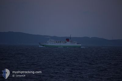
FERRY NAMIZI
Ro-Ro/Passenger Ship

Current Trip
| Trip Time | 17 h, 40 mins |
|---|---|
| Trip Distance | 95.07 морская миля |
| AVG Speed | 14.4 Узлы |
| MAX Speed | 18.9 Узлы |
| Осадка | 3.4 м |
| AVG Wind | 14.8 knots |
| MAX Wind | 20.3 knots |
| MIN Temp | 16.1°C / 60.98°F |
| MAX Temp | 21°C / 69.8°F |
| Позиция Получена | 9 d тому назад |
Current Position
| Долгота | 129.10748° |
|---|---|
| Широта | 33.20390° |
| Статус | Under way using engine |
| Скорость | 14.9 Узлы |
| Курс | 185° |
| Район | Japan Sea |
| Станция | T-AIS |
| Позиция Получена | 9 d тому назад |
Information
The current position of FERRY NAMIZI is in Japan Sea with coordinates 33.20390° / 129.10748° as reported on 2025-05-30 04:39 by AIS to our vessel tracker app. The vessel's current speed is 14.9 Узлы and is currently inside the port of NAGASAKI.
The vessel FERRY NAMIZI (IMO: 8713988, MMSI: 431601676) is a Ro-Ro/Passenger Ship that was built in 1987 ( 38 лет ). It's sailing under the flag of [JP] Japan.
In this page you can find informations about the vessels current position, last detected port calls, and current voyage information. If the vessels is not in coverage by AIS you will find the latest position.
The current position of FERRY NAMIZI is detected by our AIS receivers and we are not responsible for the reliability of the data. The last position was recorded while the vessel was in Coverage by the Ais receivers of our vessel tracking app.
The current draught of FERRY NAMIZI as reported by AIS is 3.4 meters
Weather
| Temperature | 19.8°C / 67.64°F |
|---|---|
| Wind Speed | 6 knots |
| Direction | 17° NNE |
| Pressure | 1007.5 hPa |
| Humidity | 96.6 % |
| Cloud Coverage | 100 % |


Featured Company
Last Port Calls
| Port | Arrival | Departure | Time In Port |
|---|---|---|---|
| 2025-05-31 10:58 | |||
| 2025-05-30 16:34 | 2025-05-30 17:18 | 43 m | |
| 2025-05-30 10:14 | 2025-05-30 10:54 | 40 m | |
| 2025-05-29 15:50 | 2025-05-29 16:50 | 1 h | |
| 2025-05-29 10:14 | 2025-05-29 10:54 | 39 m | |
| 2025-05-28 15:50 | 2025-05-28 16:50 | 1 h | |
| 2025-05-28 10:18 | 2025-05-28 10:58 | 39 m | |
| 2025-05-27 15:50 | 2025-05-27 16:50 | 59 m | |
| 2025-05-27 10:18 | 2025-05-27 10:54 | 36 m | |
| 2025-05-26 15:50 | 2025-05-26 16:50 | 59 m |
Last Trips
| Origin | Departure | Destination | Arrival | Distance | |
|---|---|---|---|---|---|
| 2025-05-30 17:18 | 2025-05-31 10:58 | 95.07 морская миля | |||
| 2025-05-30 10:54 | 2025-05-30 16:34 | 76.54 морская миля | |||
| 2025-05-29 16:50 | 2025-05-30 10:14 | 86.08 морская миля | |||
| 2025-05-29 10:54 | 2025-05-29 15:50 | 68.19 морская миля | |||
| 2025-05-28 16:50 | 2025-05-29 10:14 | 86.77 морская миля | |||
| 2025-05-28 10:58 | 2025-05-28 15:50 | 68.38 морская миля | |||
| 2025-05-27 16:50 | 2025-05-28 10:18 | 85.75 морская миля | |||
| 2025-05-27 10:54 | 2025-05-27 15:50 | 69.60 морская миля | |||
| 2025-05-26 16:50 | 2025-05-27 10:18 | 85.62 морская миля | |||
| 2025-05-26 10:55 | 2025-05-26 15:50 | 69.11 морская миля |
Events
| Время | Событие | Детали | Позиция / Направление | Информация |
|---|---|---|---|---|
| 2025-05-31 01:58 | Окончание движения |
32.70571 / 129.84328
[JP] NAGASAKI
|
Скорость: 0.3 kn Курс: 282° |
|
| 2025-05-31 01:58 | Порт |
|
32.70571 / 129.84328
[JP] NAGASAKI
|
Скорость: 0.9 kn Курс: 274° |
| 2025-05-31 01:30 | Начало движения | 2.08 nm, North West of NAGASAKI |
32.73103 / 129.80499
>JP SSB
|
Скорость: 9.4 kn Курс: 245° |
| 2025-05-30 15:18 | Окончание движения | 1.96 nm, North West of NAGASAKI |
32.73123 / 129.80786
>JP SSB
|
Скорость: 0.1 kn Курс: 13° |
| 2025-05-30 11:54 | Начало движения | 17.17 nm, South West of IKITSUKI |
33.24980 / 129.13646
>JP SSB
|
Скорость: 10.6 kn Курс: 174° |
| 2025-05-30 11:41 | Окончание движения | 17.14 nm, South West of IKITSUKI |
33.26015 / 129.13042
>JP SSB
|
Скорость: Курс: 144° |
| 2025-05-30 10:51 | Начало движения |
33.18700 / 129.06557
>JP SSB
|
Скорость: 7.7 kn Курс: 74° |
|
| 2025-05-30 10:47 | Окончание движения |
33.18662 / 129.06316
>JP SSB
|
Скорость: 0.1 kn Курс: 71° |
|
| 2025-05-30 08:18 | ПОРТ ОТПРАВЛЕНИЯ |
|
33.13248 / 129.71281
>JP SSB
|
Скорость: 15.6 kn Курс: 213° |
| 2025-05-30 08:14 | Начало движения |
33.14937 / 129.71330
[JP] SASEBO
|
Скорость: 15.6 kn Курс: 213° |