

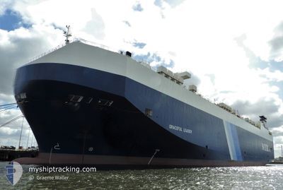
GRACEFUL LEADER
Vehicles Carrier
Current Trip
| Time Travelled | 15 days |
|---|---|
| Remaining Time | 1 day |
| Distance Travelled | 5070.73 морская миля |
| Remaining Distance | 395.27 морская миля |
| AVG Speed | 14.1 Узлы |
| MAX Speed | 19 Узлы |
| AVG Wind | 12.3 knots |
| MAX Wind | 27.3 knots |
| MIN Temp | 9.9°C / 49.82°F |
| MAX Temp | 30.7°C / 87.26°F |
| Осадка | 9.7 м |
| Позиция Получена | 22 h, 35 m тому назад |
Current Position
| Долгота | -79.45959° |
|---|---|
| Широта | 8.32267° |
| Статус | Under way using engine |
| Скорость | 14.5 Узлы |
| Курс | 181° |
| Район | North Pacific Ocean |
| Станция | T-AIS |
| Позиция Получена | 22 h, 35 m тому назад |
Information
The current position of GRACEFUL LEADER is in North Pacific Ocean with coordinates 8.32267° / -79.45959° as reported on 2025-04-26 04:37 by AIS to our vessel tracker app. The vessel's current speed is 14.5 Узлы and is heading at the port of CRISTOBAL. The estimated time of arrival as calculated by MyShipTracking vessel tracking app is 2025-04-28 03:18 LT
The vessel GRACEFUL LEADER (IMO: 9357303, MMSI: 309253000) is a Vehicles Carrier that was built in 2007 ( 18 лет ). It's sailing under the flag of [BS] Bahamas.
In this page you can find informations about the vessels current position, last detected port calls, and current voyage information. If the vessels is not in coverage by AIS you will find the latest position.
The current position of GRACEFUL LEADER is detected by our AIS receivers and we are not responsible for the reliability of the data. The last position was recorded while the vessel was in Coverage by the Ais receivers of our vessel tracking app.
The current draught of GRACEFUL LEADER as reported by AIS is 9.7 meters
Weather
| Temperature | 27.3°C / 81.14°F |
|---|---|
| Wind Speed | 9 knots |
| Direction | 141° SE |
| Pressure | 1011.3 hPa |
| Humidity | 77.6 % |
| Cloud Coverage | 89 % |
Featured Company
Last Port Calls
| Port | Arrival | Departure | Time In Port |
|---|---|---|---|
| 2025-04-11 08:08 | 2025-04-11 20:20 | 12 h | |
| 2025-04-09 00:53 | 2025-04-10 00:45 | 23 h | |
| 2025-04-04 16:23 | 2025-04-07 23:26 | 3 d | |
| 2025-03-31 21:16 | 2025-04-01 20:27 | 23 h | |
| 2025-03-27 05:20 | 2025-03-27 14:34 | 9 h | |
| 2025-02-18 19:17 | 2025-02-19 18:13 | 22 h | |
| 2025-02-13 14:21 | 2025-02-18 16:05 | 5 d | |
| 2025-02-07 06:16 | 2025-02-07 14:02 | 7 h | |
| 2025-02-03 06:37 | 2025-02-03 19:13 | 12 h |
Most Visited Ports (Last year)
| Port | Arrivals | |
|---|---|---|
| 5 | ||
| 4 | ||
| 4 | ||
| 4 | ||
| 4 | ||
| 3 |
Last Trips
| Origin | Departure | Destination | Arrival | Distance | |
|---|---|---|---|---|---|
| 2025-04-10 00:45 | 2025-04-11 08:08 | 464.89 морская миля | |||
| 2025-04-07 23:26 | 2025-04-09 00:53 | 312.47 морская миля | |||
| 2025-04-01 20:27 | 2025-04-04 16:23 | 609.69 морская миля | |||
| 2025-03-27 14:34 | 2025-03-31 21:16 | 1594.77 морская миля | |||
| 2025-02-19 18:13 | 2025-03-27 05:20 | 13989.41 морская миля | |||
| 2025-02-18 16:05 | 2025-02-18 19:17 | 42.08 морская миля | |||
| 2025-02-07 14:02 | 2025-02-13 14:21 | 1049.95 морская миля | |||
| 2025-02-03 19:13 | 2025-02-07 06:16 | 995.77 морская миля | |||
| 2025-01-17 14:28 | 2025-02-03 06:37 | 5567.27 морская миля |
Events
| Время | Событие | Детали | Позиция / Направление | Информация |
|---|---|---|---|---|
| 2025-04-26 04:45 | Статус изменился | Default Under way using engine |
8.28932 / -79.46040
PA CTB
|
Скорость: 14.5 kn Курс: 181° |
| 2025-04-26 04:37 | Статус изменился | Under way using engine Default |
8.32267 / -79.45959
PA CTB
|
Скорость: 14.4 kn Курс: 181° |
| 2025-04-26 04:37 | Вне покрытия |
8.32267 / -79.45959
North Pacific Ocean
|
Скорость: 14.5 kn Курс: 181° |
|
| 2025-04-26 04:11 | Статус изменился | Default Under way using engine |
8.42652 / -79.45826
PA CTB
|
Скорость: 14.1 kn Курс: 180.3° |
| 2025-04-26 03:58 | Статус изменился | Under way using engine Default |
8.47838 / -79.45794
PA CTB
|
Скорость: 14.1 kn Курс: 181° |
| 2025-04-26 03:55 | Статус изменился | Default Under way using engine |
8.48867 / -79.45787
PA CTB
|
Скорость: 14.1 kn Курс: 180° |
| 2025-04-26 03:42 | Статус изменился | Under way using engine Default |
8.54174 / -79.45798
PA CTB
|
Скорость: 14 kn Курс: 180° |
| 2025-04-26 03:38 | Статус изменился | Default Under way using engine |
8.55716 / -79.45822
PA CTB
|
Скорость: 14 kn Курс: 180° |
| 2025-04-26 03:18 | Статус изменился | Under way using engine Default |
8.63545 / -79.45807
PA CTB
|
Скорость: 14.7 kn Курс: 180° |
| 2025-04-26 03:15 | Статус изменился | Default Under way using engine |
8.65014 / -79.45803
PA CTB
|
Скорость: 14.7 kn Курс: 179.3° |