
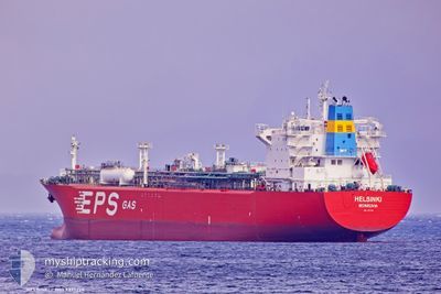
HELSINKI
Lpg Tanker
Current Trip
| Time Travelled | 13 days |
|---|---|
| Remaining Time | --- |
| Distance Travelled | 3855.35 морская миля |
| Remaining Distance | --- |
| AVG Speed | 12.4 Узлы |
| MAX Speed | 17.9 Узлы |
| AVG Wind | 9.9 knots |
| MAX Wind | 26.9 knots |
| MIN Temp | 11.5°C / 52.7°F |
| MAX Temp | 19°C / 66.2°F |
| Осадка | 8 м |
| Позиция Получена | 12 h, 16 m тому назад |
Current Position
| Долгота | -30.66986° |
|---|---|
| Широта | 35.91002° |
| Статус | Under way using engine |
| Скорость | 13.2 Узлы |
| Курс | 267.9° |
| Район | North Atlantic Ocean |
| Станция | T-AIS |
| Позиция Получена | 12 h, 16 m тому назад |
Info
Information
The current position of HELSINKI is in North Atlantic Ocean with coordinates 35.91002° / -30.66986° as reported on 2025-02-07 02:11 by AIS to our vessel tracker app. The vessel's current speed is 13.2 Узлы and is heading at the port of HOUSTON. The estimated time of arrival as calculated by MyShipTracking vessel tracking app is 2025-02-19 04:00 LT
The vessel HELSINKI (IMO: 9377224, MMSI: 636013814) is a Lpg Tanker that was built in 2008 ( 17 лет ). It's sailing under the flag of [LR] Liberia.
In this page you can find informations about the vessels current position, last detected port calls, and current voyage information. If the vessels is not in coverage by AIS you will find the latest position.
The current position of HELSINKI is detected by our AIS receivers and we are not responsible for the reliability of the data. The last position was recorded while the vessel was in Coverage by the Ais receivers of our vessel tracking app.
The current draught of HELSINKI as reported by AIS is 8 meters
Weather
| Temperature | 15.4°C / 59.72°F |
|---|---|
| Wind Speed | 27 knots |
| Direction | 322° NW |
| Pressure | 1023.1 hPa |
| Humidity | 65.2 % |
| Cloud Coverage | 67 % |
Featured Company
Last Port Calls
| Port | Arrival | Departure | Time In Port |
|---|---|---|---|
| 2025-01-23 15:31 | 2025-01-24 16:44 | 1 d | |
| 2024-12-28 03:22 | 2024-12-29 18:10 | 1 d | |
| 2024-12-22 11:58 | 2024-12-23 13:22 | 1 d |
Most Visited Ports (Last year)
| Port | Arrivals | |
|---|---|---|
| 5 | ||
| 2 | ||
| 2 | ||
| 1 | ||
| 1 | ||
| 1 |
Last Trips
| Origin | Departure | Destination | Arrival | Distance | |
|---|---|---|---|---|---|
| 2024-12-29 15:10 | 2025-01-23 16:31 | 6430.47 морская миля | |||
| 2024-12-23 10:22 | 2024-12-28 00:22 | 52.36 морская миля | |||
| 2024-11-15 14:52 | 2024-12-22 08:58 | 7141.74 морская миля |
Events
| Время | Событие | Детали | Позиция / Направление | Информация |
|---|---|---|---|---|
| 2025-02-07 02:18 | Статус изменился | Default Under way using engine |
35.90924 / -30.69882
USHOU
|
Скорость: 13.2 kn Курс: 267.9° |
| 2025-02-07 02:11 | Статус изменился | Under way using engine Default |
35.91002 / -30.66986
USHOU
|
Скорость: 13.2 kn Курс: 267° |
| 2025-02-07 02:11 | В покрытии |
35.91002 / -30.66986
North Atlantic Ocean
USHOU
|
Скорость: 13.2 kn Курс: 267.9° |
|
| 2025-02-07 02:11 | Вне покрытия |
35.91002 / -30.66986
North Atlantic Ocean
USHOU
|
Скорость: 13.2 kn Курс: 267.9° |
|
| 2025-02-07 00:38 | Статус изменился | Default Under way using engine |
35.92773 / -30.24861
USHOU
|
Скорость: 13.1 kn Курс: 269.9° |
| 2025-02-07 00:28 | Статус изменился | Under way using engine Default |
35.92818 / -30.20436
USHOU
|
Скорость: 13.1 kn Курс: 270° |
| 2025-02-07 00:28 | Вне покрытия |
35.92818 / -30.20436
North Atlantic Ocean
USHOU
|
Скорость: 13.1 kn Курс: 269.9° |
|
| 2025-02-07 00:03 | Статус изменился | Default Under way using engine |
35.92805 / -30.09193
USHOU
|
Скорость: 13 kn Курс: 269.7° |
| 2025-02-06 23:52 | Статус изменился | Under way using engine Default |
35.92808 / -30.04641
USHOU
|
Скорость: 13.1 kn Курс: 270° |
| 2025-02-06 23:49 | Статус изменился | Default Under way using engine |
35.92810 / -30.03303
USHOU
|
Скорость: 13.2 kn Курс: 270.6° |