
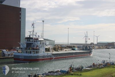
HYDRA
General Cargo
Current Trip
| Time Travelled | 6 days |
|---|---|
| Remaining Time | 1 day |
| Distance Travelled | 1023.14 морская миля |
| Remaining Distance | 415.88 морская миля |
| AVG Speed | 8.8 Узлы |
| MAX Speed | 12.4 Узлы |
| AVG Wind | 11.1 knots |
| MAX Wind | 24 knots |
| MIN Temp | 1°C / 33.8°F |
| MAX Temp | 10.7°C / 51.26°F |
| Осадка | 3.2 м |
| Позиция Получена | 1 m тому назад |
Current Position
| Долгота | -4.92318° |
|---|---|
| Широта | 49.94386° |
| Статус | Under way using engine |
| Скорость | 9.6 Узлы |
| Курс | 79.2° |
| Район | English Channel |
| Станция | T-AIS |
| Позиция Получена | 1 m тому назад |
Info
Information
The current position of HYDRA is in English Channel with coordinates 49.94386° / -4.92318° as reported on 2025-02-08 14:04 by AIS to our vessel tracker app. The vessel's current speed is 9.6 Узлы and is heading at the port of IJMUIDEN. The estimated time of arrival as calculated by MyShipTracking vessel tracking app is 2025-02-10 10:13 LT
The vessel HYDRA (IMO: 9356488, MMSI: 244765000) is a General Cargo that was built in 2007 ( 18 лет ). It's sailing under the flag of [NL] Netherlands.
In this page you can find informations about the vessels current position, last detected port calls, and current voyage information. If the vessels is not in coverage by AIS you will find the latest position.
The current position of HYDRA is detected by our AIS receivers and we are not responsible for the reliability of the data. The last position was recorded while the vessel was in Coverage by the Ais receivers of our vessel tracking app.
The current draught of HYDRA as reported by AIS is 3.2 meters
Weather
| Temperature | 6.3°C / 43.34°F |
|---|---|
| Wind Speed | 9 knots |
| Direction | 20° NNE |
| Pressure | 1018.2 hPa |
| Humidity | 71.1 % |
| Cloud Coverage | 100 % |
Featured Company
Last Port Calls
| Port | Arrival | Departure | Time In Port |
|---|---|---|---|
| 2025-01-31 02:04 | 2025-02-02 08:55 | 2 d | |
| 2025-01-28 20:32 | 2025-01-29 14:13 | 17 h | |
| 2025-01-26 10:23 | 2025-01-27 15:15 | 1 d | |
| 2025-01-14 17:19 | 2025-01-25 07:22 | 10 d | |
| 2025-01-11 13:11 | 2025-01-12 23:02 | 1 d | |
| 2025-01-09 18:25 | 2025-01-11 00:52 | 1 d | |
| 2025-01-07 02:15 | 2025-01-08 17:25 | 1 d | |
| 2024-12-28 11:23 | 2024-12-31 15:27 | 3 d | |
| 2024-12-20 17:56 | 2024-12-23 21:08 | 3 d | |
| 2024-12-16 11:06 | 2024-12-18 16:33 | 2 d |
Last Trips
| Origin | Departure | Destination | Arrival | Distance | |
|---|---|---|---|---|---|
| 2025-01-29 15:13 | 2025-01-31 03:04 | 306.96 морская миля | |||
| 2025-01-27 16:15 | 2025-01-28 21:32 | 163.45 морская миля | |||
| 2025-01-25 08:22 | 2025-01-26 11:23 | 152.20 морская миля | |||
| 2025-01-13 00:02 | 2025-01-14 18:19 | 361.52 морская миля | |||
| 2025-01-11 01:52 | 2025-01-11 14:11 | 129.53 морская миля | |||
| 2025-01-08 17:25 | 2025-01-09 19:25 | 222.52 морская миля | |||
| 2024-12-31 15:27 | 2025-01-07 02:15 | 667.88 морская миля | |||
| 2024-12-23 22:08 | 2024-12-28 11:23 | 1066.94 морская миля | |||
| 2024-12-18 16:33 | 2024-12-20 18:56 | 507.86 морская миля | |||
| 2024-12-12 20:56 | 2024-12-16 11:06 | 610.91 морская миля |
Events
| Время | Событие | Детали | Позиция / Направление | Информация |
|---|---|---|---|---|
| 2025-02-08 13:02 | Осадка изменилась | 3.2 5.4 |
49.91771 / -5.17699
NLIJM
|
Скорость: 9.3 kn Курс: 80.2° |
| 2025-02-08 13:02 | Пункт назначения изменился | NLIJM IEWAT |
49.91771 / -5.17699
NLIJM
|
Скорость: 9.3 kn Курс: 80.2° |
| 2025-02-08 13:02 | ETA изменился | 2025/02/10 09:00 2025/02/06 03:00 |
49.91771 / -5.17699
NLIJM
|
Скорость: 9.3 kn Курс: 80.2° |
| 2025-02-08 12:50 | Обнаружено в море | United Kingdom part of the English Channel |
49.91383 / -5.22509
English Channel
|
Скорость: 9.5 kn Курс: 86.7° |
| 2025-02-08 12:49 | Статус изменился | Under way using engine Default |
49.91368 / -5.22978
IEWAT
|
Скорость: 9.3 kn Курс: 87° |
| 2025-02-08 12:49 | В покрытии |
49.91383 / -5.22509
English Channel
|
Скорость: 9.5 kn Курс: 86.7° |
|
| 2025-02-08 11:19 | Статус изменился | Default Under way using engine |
49.89069 / -5.59091
IEWAT
|
Скорость: 9.2 kn Курс: 84.5° |
| 2025-02-08 11:19 | Статус изменился | Under way using engine Default |
49.89063 / -5.59183
IEWAT
|
Скорость: 9.1 kn Курс: 84° |
| 2025-02-08 11:19 | Вне покрытия |
49.89063 / -5.59183
Celtic Sea
|
Скорость: 9.2 kn Курс: 84.5° |
|
| 2025-02-08 11:19 | Обнаружено в море | United Kingdom part of the Celtic Sea |
49.89063 / -5.59183
Celtic Sea
|
Скорость: 9.2 kn Курс: 84.5° |