
IRIS
Fishing
Current Trip
| Time Travelled | 4 days |
|---|---|
| Remaining Time | 4 days |
| Distance Travelled | 422.84 морская миля |
| Remaining Distance | 321.56 морская миля |
| AVG Speed | 5.1 Узлы |
| MAX Speed | 10.7 Узлы |
| AVG Wind | 19.4 knots |
| MAX Wind | 37 knots |
| MIN Temp | 0.4°C / 32.72°F |
| MAX Temp | 5°C / 41°F |
| Осадка | 5.2 м |
| Позиция Получена | 2 m тому назад |
Current Position
| Долгота | 5.32696° |
|---|---|
| Широта | 57.95092° |
| Статус | Engaged in Fishing |
| Скорость | 3.1 Узлы |
| Курс | 128.7° |
| Район | North Sea |
| Станция | T-AIS |
| Позиция Получена | 2 m тому назад |
Info
Information
The current position of IRIS is in North Sea with coordinates 57.95092° / 5.32696° as reported on 2026-01-09 14:40 by AIS to our vessel tracker app. The vessel's current speed is 3.1 Узлы and is heading at the port of DEN HELDER. The estimated time of arrival as calculated by MyShipTracking vessel tracking app is 2026-01-13 20:02 LT
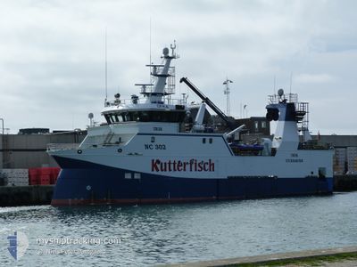
The vessel IRIS (IMO: 9826055, MMSI: 211789180) is a Fishing It's sailing under the flag of [DE] Germany.
In this page you can find informations about the vessels current position, last detected port calls, and current voyage information. If the vessels is not in coverage by AIS you will find the latest position.
The current position of IRIS is detected by our AIS receivers and we are not responsible for the reliability of the data. The last position was recorded while the vessel was in Coverage by the Ais receivers of our vessel tracking app.
The current draught of IRIS as reported by AIS is 5.2 meters
Weather
| Temperature | 3.2°C / 37.76°F |
|---|---|
| Wind Speed | 35 knots |
| Direction | 105° ESE |
| Pressure | 1009.5 hPa |
| Humidity | 61.5 % |
| Cloud Coverage | 100 % |
Featured Company
Last Port Calls
| Port | Arrival | Departure | Time In Port |
|---|---|---|---|
| 2026-01-04 16:04 | 2026-01-05 15:16 | 23 h | |
| 2025-12-17 06:05 | 2025-12-27 16:37 | 10 d | |
| 2025-12-14 22:22 | 2025-12-15 19:38 | 21 h | |
| 2025-12-04 21:14 | 2025-12-05 17:49 | 20 h | |
| 2025-11-28 14:13 | |||
| 2025-11-12 21:34 | 2025-11-14 17:54 | 1 d | |
| 2025-11-06 21:25 | 2025-11-07 16:58 | 19 h |
Last Trips
| Origin | Departure | Destination | Arrival | Distance | |
|---|---|---|---|---|---|
| 2025-12-27 16:37 | 2026-01-04 16:04 | 1016.51 морская миля | |||
| 2025-12-15 19:38 | 2025-12-17 06:05 | 306.60 морская миля | |||
| 2025-12-05 17:49 | 2025-12-14 22:22 | 1073.03 морская миля | |||
| 2025-11-28 14:13 | 2025-12-04 21:14 | 638.03 морская миля | |||
| 2025-11-07 16:58 | 2025-11-12 21:34 | 737.75 морская миля | |||
| 2025-10-30 16:52 | 2025-11-06 21:25 | 785.92 морская миля |
Events
| Время | Событие | Детали | Позиция / Направление | Информация |
|---|---|---|---|---|
| 2026-01-09 05:53 | Статус изменился | Engaged in Fishing Under way using engine |
58.13584 / 4.59054
FISHING GROUNDS
|
Скорость: 2.8 kn Курс: 106° |
| 2026-01-08 21:52 | В покрытии |
58.31679 / 4.01461
North Sea
|
Скорость: 1.9 kn Курс: 114.4° |
|
| 2026-01-08 16:16 | Вне покрытия |
58.31007 / 4.12835
North Sea
|
Скорость: 4.1 kn Курс: 301.6° |
|
| 2026-01-08 00:05 | В покрытии |
58.36821 / 3.93870
North Sea
|
Скорость: 4 kn Курс: 128.1° |
|
| 2026-01-07 11:28 | Вне покрытия |
59.03609 / 3.22716
North Sea
|
Скорость: 4.1 kn Курс: 208.6° |
|
| 2026-01-07 07:05 | В покрытии |
59.05113 / 3.41410
North Sea
|
Скорость: 4.3 kn Курс: 12.5° |
|
| 2026-01-06 18:03 | Вне покрытия |
58.31486 / 4.15450
North Sea
|
Скорость: 4.3 kn Курс: 310.1° |
|
| 2026-01-05 18:04 | Обнаружено в море | Norwegian part of the North Sea |
57.38605 / 7.60603
North Sea
|
Скорость: 9.5 kn Курс: 297.5° |
| 2026-01-05 17:32 | Пункт назначения изменился | FISHING GROUNDS HANSTHOLM |
57.34956 / 7.74615
FISHING GROUNDS
|
Скорость: 9.3 kn Курс: 295.6° |
| 2026-01-05 14:16 | ПОРТ ОТПРАВЛЕНИЯ |
|
57.12905 / 8.59303
HANSTHOLM
|
Скорость: 6.5 kn Курс: 11.2° |