

BALDER
Other Type

Current Trip
PETROLEUMHAVEN TE HE
| Time Travelled | 3 days |
|---|---|
| Remaining Time | --- |
| Distance Travelled | 67.21 морская миля |
| Remaining Distance | --- |
| AVG Speed | 6.1 Узлы |
| MAX Speed | 7.4 Узлы |
| AVG Wind | 11.6 knots |
| MAX Wind | 15.9 knots |
| MIN Temp | 9.4°C / 48.92°F |
| MAX Temp | 16.8°C / 62.24°F |
| Осадка | 0.1 м |
| Позиция Получена | 2 d тому назад |
Current Position
| Долгота | 6.12979° |
|---|---|
| Широта | 52.42342° |
| Статус | Under way using engine |
| Скорость | 5 Узлы |
| Курс | 160° |
| Район | North Sea |
| Станция | T-AIS |
| Позиция Получена | 2 d тому назад |
Information
The current position of BALDER is in North Sea with coordinates 52.42342° / 6.12979° as reported on 2025-05-16 18:28 by AIS to our vessel tracker app. The vessel's current speed is 5 Узлы
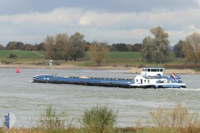
The vessel BALDER (MMSI: 244660032) is a Other Type It's sailing under the flag of [NL] Netherlands.
In this page you can find informations about the vessels current position, last detected port calls, and current voyage information. If the vessels is not in coverage by AIS you will find the latest position.
The current position of BALDER is detected by our AIS receivers and we are not responsible for the reliability of the data. The last position was recorded while the vessel was in Coverage by the Ais receivers of our vessel tracking app.
The current draught of BALDER as reported by AIS is 0.1 meters
Weather
| Temperature | 12.9°C / 55.22°F |
|---|---|
| Wind Speed | 10 knots |
| Direction | 344° NNW |
| Pressure | 1018.3 hPa |
| Humidity | 71.6 % |
| Cloud Coverage | 6 % |


Featured Company
Last Port Calls
| Port | Arrival | Departure | Time In Port |
|---|---|---|---|
| 2025-05-15 16:00 | 2025-05-15 17:26 | 1 h | |
| 2025-05-14 20:38 | 2025-05-15 15:36 | 18 h | |
| 2025-05-14 02:41 | |||
| 2025-05-06 17:50 | 2025-05-07 08:40 | 14 h | |
| 2025-05-05 22:38 | 2025-05-06 17:47 | 19 h | |
| 2025-05-05 16:39 | 2025-05-05 17:02 | 23 m | |
| 2025-05-05 01:16 | 2025-05-05 12:39 | 11 h | |
| 2025-04-29 21:57 | 2025-04-30 08:46 | 10 h | |
| 2025-04-29 14:33 | 2025-04-29 15:14 | 40 m | |
| 2025-04-27 21:11 | 2025-04-28 18:16 | 21 h |
Most Visited Ports (Last year)
| Port | Arrivals | |
|---|---|---|
| 44 | ||
| 20 | ||
| 11 | ||
| 8 | ||
| 8 | ||
| 8 |
Last Trips
| Origin | Departure | Destination | Arrival | Distance | |
|---|---|---|---|---|---|
| 2025-05-15 15:36 | 2025-05-15 16:00 | 3.15 морская миля | |||
| 2025-05-14 02:41 | 2025-05-14 20:38 | 106.56 морская миля | |||
| 2025-05-06 17:47 | 2025-05-06 17:50 | 0.19 морская миля | |||
| 2025-05-05 17:02 | 2025-05-05 22:38 | 34.73 морская миля | |||
| 2025-05-05 12:39 | 2025-05-05 16:39 | 23.69 морская миля | |||
| 2025-04-30 08:46 | 2025-05-05 01:16 | 63.18 морская миля | |||
| 2025-04-29 15:14 | 2025-04-29 21:57 | 41.08 морская миля | |||
| 2025-04-28 18:16 | 2025-04-29 14:33 | 10.47 морская миля | |||
| 2025-04-27 16:28 | 2025-04-27 21:11 | 33.05 морская миля | |||
| 2025-04-24 15:49 | 2025-04-27 15:44 | 192.15 морская миля |
Events
| Время | Событие | Детали | Позиция / Направление | Информация |
|---|---|---|---|---|
| 2025-05-16 18:28 | Вне покрытия |
52.42342 / 6.12979
North Sea
PETROLEUMHAVEN TE HE
|
Скорость: 5 kn Курс: 160° |
|
| 2025-05-16 12:47 | Начало движения | 0.26 nm, North West of LELYSTAD |
52.52970 / 5.43428
PETROLEUMHAVEN TE HE
|
Скорость: 3.3 kn Курс: 3.4° |
| 2025-05-16 12:28 | Окончание движения | 0.19 nm, North West of LELYSTAD |
52.52768 / 5.43403
PETROLEUMHAVEN TE HE
|
Скорость: 0.3 kn Курс: 511° |
| 2025-05-16 10:44 | Пункт назначения изменился | PETROLEUMHAVEN TE HE BOSPORUSHAVEN |
52.42779 / 5.17237
PETROLEUMHAVEN TE HE
|
Скорость: 7.1 kn Курс: 58.8° |
| 2025-05-16 10:44 | ETA изменился | 2025/05/17 10:47 2025/05/14 16:22 |
52.42779 / 5.17237
PETROLEUMHAVEN TE HE
|
Скорость: 7.1 kn Курс: 58.8° |
| 2025-05-16 09:29 | Начало движения | 0.13 nm, South West of SCHELLINGWOUDE |
52.37923 / 4.96258
BOSPORUSHAVEN
|
Скорость: 3.4 kn Курс: 117.7° |
| 2025-05-16 09:08 | Окончание движения | 0.19 nm, West of SCHELLINGWOUDE |
52.38002 / 4.95990
BOSPORUSHAVEN
|
Скорость: 0.2 kn Курс: 511° |
| 2025-05-16 07:37 | Начало движения | 0.71 nm, East of IJMOND |
52.43308 / 4.73174
BOSPORUSHAVEN
|
Скорость: 4.8 kn Курс: 126.5° |
| 2025-05-16 07:35 | Статус изменился | Under way using engine Moored |
52.43400 / 4.72910
BOSPORUSHAVEN
|
Скорость: 0.1 kn Курс: 511° |
| 2025-05-16 06:44 | Статус изменился | Moored Default |
52.43410 / 4.72846
BOSPORUSHAVEN
|
Скорость: Курс: -1° |