

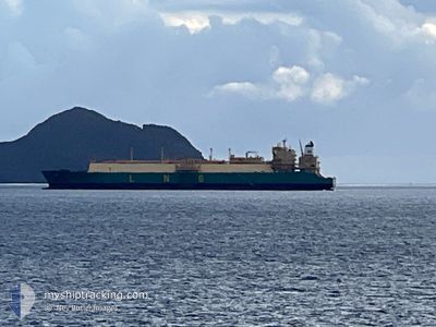
LNG ABUJA II
Tanker

Current Trip
| Time Travelled | 15 days |
|---|---|
| Remaining Time | 3 days |
| Distance Travelled | 3973.17 морская миля |
| Remaining Distance | 970.60 морская миля |
| AVG Speed | 11.6 Узлы |
| MAX Speed | 15 Узлы |
| AVG Wind | 12.3 knots |
| MAX Wind | 19 knots |
| MIN Temp | 17.1°C / 62.78°F |
| MAX Temp | 28°C / 82.4°F |
| Осадка | 9.2 м |
| Позиция Получена | 3 d тому назад |
Current Position
| Долгота | -19.16262° |
|---|---|
| Широта | 9.52961° |
| Статус | Under way using engine |
| Скорость | 11.1 Узлы |
| Курс | 141.2° |
| Район | North Atlantic Ocean |
| Станция | T-AIS |
| Позиция Получена | 3 d тому назад |
Information
The current position of LNG ABUJA II is in North Atlantic Ocean with coordinates 9.52961° / -19.16262° as reported on 2025-06-09 02:03 by AIS to our vessel tracker app. The vessel's current speed is 11.1 Узлы and is heading at the port of BONNY. The estimated time of arrival as calculated by MyShipTracking vessel tracking app is 2025-06-16 15:33 LT
The vessel LNG ABUJA II (IMO: 9690169, MMSI: 310730000) is a Tanker It's sailing under the flag of [BM] Bermuda.
In this page you can find informations about the vessels current position, last detected port calls, and current voyage information. If the vessels is not in coverage by AIS you will find the latest position.
The current position of LNG ABUJA II is detected by our AIS receivers and we are not responsible for the reliability of the data. The last position was recorded while the vessel was in Coverage by the Ais receivers of our vessel tracking app.
The current draught of LNG ABUJA II as reported by AIS is 9.2 meters
Weather
| Temperature | 24.9°C / 76.82°F |
|---|---|
| Wind Speed | 11 knots |
| Direction | 156° SSE |
| Pressure | 1012.5 hPa |
| Humidity | 75.4 % |
| Cloud Coverage | 50 % |


Featured Company
Events
| Время | Событие | Детали | Позиция / Направление | Информация |
|---|---|---|---|---|
| 2025-06-09 02:05 | Статус изменился | Default Under way using engine |
9.52481 / -19.15859
NGBON
|
Скорость: 11.1 kn Курс: 141.2° |
| 2025-06-09 02:03 | Статус изменился | Under way using engine Default |
9.52961 / -19.16262
NGBON
|
Скорость: 11.2 kn Курс: 141° |
| 2025-06-09 02:03 | Вне покрытия |
9.52961 / -19.16262
North Atlantic Ocean
NGBON
|
Скорость: 11.1 kn Курс: 141.2° |
|
| 2025-06-09 01:47 | Статус изменился | Default Under way using engine |
9.56910 / -19.19560
NGBON
|
Скорость: 11.3 kn Курс: 139° |
| 2025-06-09 01:44 | Статус изменился | Under way using engine Default |
9.57748 / -19.20290
NGBON
|
Скорость: 11.3 kn Курс: 139° |
| 2025-06-09 01:44 | Обнаружено в море | Guinea Bissau part of the North Atlantic Ocean |
9.57748 / -19.20290
North Atlantic Ocean
NGBON
|
Скорость: 11.3 kn Курс: 139° |
| 2025-06-09 01:24 | В покрытии |
9.57748 / -19.20290
North Atlantic Ocean
NGBON
|
Скорость: 11.3 kn Курс: 139° |
|
| 2025-06-08 21:54 | Статус изменился | Default Under way using engine |
10.12880 / -19.66887
NGBON
|
Скорость: 11.1 kn Курс: 138.5° |
| 2025-06-08 21:48 | Вне покрытия |
10.14160 / -19.67962
North Atlantic Ocean
NGBON
|
Скорость: 11.1 kn Курс: 138.5° |
|
| 2025-06-08 21:17 | Статус изменился | Under way using engine Default |
10.21510 / -19.74102
NGBON
|
Скорость: 10.9 kn Курс: 143° |