
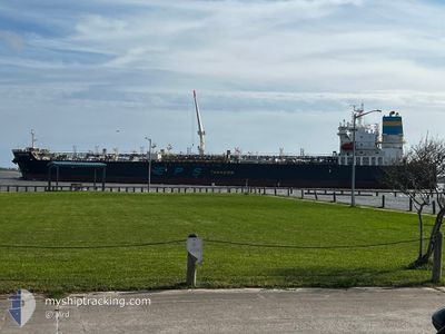
PACIFIC RUBY
Tanker
Current Trip
BR SUP
| Time Travelled | 8 days |
|---|---|
| Remaining Time | --- |
| Distance Travelled | 2621.40 морская миля |
| Remaining Distance | --- |
| AVG Speed | 12.6 Узлы |
| MAX Speed | 16.9 Узлы |
| AVG Wind | 9.1 knots |
| MAX Wind | 16 knots |
| MIN Temp | 15.8°C / 60.44°F |
| MAX Temp | 26.5°C / 79.7°F |
| Осадка | 11.9 м |
| Позиция Получена | 3 d тому назад |
Current Position
| Долгота | -71.68310° |
|---|---|
| Широта | 20.31549° |
| Статус | Under way using engine |
| Скорость | 12.8 Узлы |
| Курс | 97.3° |
| Район | North Atlantic Ocean |
| Станция | T-AIS |
| Позиция Получена | 3 d тому назад |
Info
Information
The current position of PACIFIC RUBY is in North Atlantic Ocean with coordinates 20.31549° / -71.68310° as reported on 2026-01-05 18:27 by AIS to our vessel tracker app. The vessel's current speed is 12.8 Узлы
The vessel PACIFIC RUBY (IMO: 9906881, MMSI: 636020916) is a Tanker It's sailing under the flag of [LR] Liberia.
In this page you can find informations about the vessels current position, last detected port calls, and current voyage information. If the vessels is not in coverage by AIS you will find the latest position.
The current position of PACIFIC RUBY is detected by our AIS receivers and we are not responsible for the reliability of the data. The last position was recorded while the vessel was in Coverage by the Ais receivers of our vessel tracking app.
The current draught of PACIFIC RUBY as reported by AIS is 11.9 meters
Weather
| Temperature | 25.9°C / 78.62°F |
|---|---|
| Wind Speed | 16 knots |
| Direction | 72° ENE |
| Pressure | 1014 hPa |
| Humidity | 78.3 % |
| Cloud Coverage | 4 % |
Featured Company
Last Port Calls
| Port | Arrival | Departure | Time In Port |
|---|---|---|---|
| 2025-12-29 17:53 | 2025-12-31 19:18 | 2 d | |
| 2025-12-26 15:26 | 2025-12-27 18:42 | 1 d | |
| 2025-12-13 17:38 | 2025-12-14 16:34 | 22 h | |
| 2025-12-09 01:22 | 2025-12-10 13:50 | 1 d | |
| 2025-11-28 17:34 | 2025-11-30 16:22 | 1 d | |
| 2025-11-09 08:38 | 2025-11-09 09:07 | 29 m |
Most Visited Ports (Last year)
| Port | Arrivals | |
|---|---|---|
| 5 | ||
| 3 | ||
| 3 | ||
| 3 | ||
| 2 | ||
| 2 |
Last Trips
| Origin | Departure | Destination | Arrival | Distance | |
|---|---|---|---|---|---|
| 2025-12-27 18:42 | 2025-12-29 17:53 | 61.34 морская миля | |||
| 2025-12-14 16:34 | 2025-12-26 15:26 | 3551.10 морская миля | |||
| 2025-12-10 13:50 | 2025-12-13 17:38 | 31.88 морская миля | |||
| 2025-11-30 16:22 | 2025-12-09 01:22 | 1275.81 морская миля | |||
| 2025-11-09 09:07 | 2025-11-28 17:34 | 4449.10 морская миля | |||
| 2025-10-08 20:22 | 2025-11-09 08:38 | 3849.30 морская миля |
Events
| Время | Событие | Детали | Позиция / Направление | Информация |
|---|---|---|---|---|
| 2026-01-05 18:40 | Статус изменился | Default Under way using engine |
20.30833 / -71.62833
BR SUP
|
Скорость: 12.8 kn Курс: 97.3° |
| 2026-01-05 18:27 | Вне покрытия |
20.31549 / -71.68310
North Atlantic Ocean
|
Скорость: 12.8 kn Курс: 97.3° |
|
| 2026-01-05 17:10 | Изменение морского района | Dominican Republic part of the North Atlantic Ocean Grenadian part of the Caribbean Sea |
20.34790 / -71.96345
North Atlantic Ocean
|
Скорость: 12.3 kn Курс: 96.8° |
| 2026-01-05 17:10 | Статус изменился | Under way using engine Default |
20.34790 / -71.96345
BR SUP
|
Скорость: 12 kn Курс: 95° |
| 2026-01-05 17:10 | В покрытии |
20.34790 / -71.96345
North Atlantic Ocean
|
Скорость: 12.3 kn Курс: 96.8° |
|
| 2026-01-01 01:18 | ПОРТ ОТПРАВЛЕНИЯ |
|
27.81027 / -97.36799
BR SUP
|
Скорость: 9.3 kn Курс: 91° |
| 2026-01-01 00:55 | Начало движения |
27.81572 / -97.42023
[US] CORPUS CHRISTI
|
Скорость: 4.5 kn Курс: 110° |