
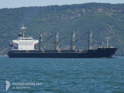
PNOI
General Cargo
Current Trip
| Time Travelled | 3 days |
|---|---|
| Remaining Time | 2 days |
| Distance Travelled | 683.19 морская миля |
| Remaining Distance | 845.71 морская миля |
| AVG Speed | 9.4 Узлы |
| MAX Speed | 13.7 Узлы |
| AVG Wind | 10.8 knots |
| MAX Wind | 18 knots |
| MIN Temp | 11°C / 51.8°F |
| MAX Temp | 16.5°C / 61.7°F |
| Осадка | 6 м |
| Позиция Получена | 1 m тому назад |
Current Position
| Долгота | -8.42160° |
|---|---|
| Широта | 36.54592° |
| Статус | Under way using engine |
| Скорость | 11.1 Узлы |
| Курс | 288.9° |
| Район | Strait of Gibraltar |
| Станция | T-AIS |
| Позиция Получена | 1 m тому назад |
Info
Information
The current position of PNOI is in Strait of Gibraltar with coordinates 36.54592° / -8.42160° as reported on 2025-02-03 23:55 by AIS to our vessel tracker app. The vessel's current speed is 11.1 Узлы and is heading at the port of LA PALLICE. The estimated time of arrival as calculated by MyShipTracking vessel tracking app is 2025-02-06 22:54 LT
The vessel PNOI (IMO: 9400887, MMSI: 372605000) is a General Cargo that was built in 2009 ( 16 лет ). It's sailing under the flag of [PA] Panama.
In this page you can find informations about the vessels current position, last detected port calls, and current voyage information. If the vessels is not in coverage by AIS you will find the latest position.
The current position of PNOI is detected by our AIS receivers and we are not responsible for the reliability of the data. The last position was recorded while the vessel was in Coverage by the Ais receivers of our vessel tracking app.
The current draught of PNOI as reported by AIS is 6 meters
Weather
| Temperature | 15.1°C / 59.18°F |
|---|---|
| Wind Speed | 8 knots |
| Direction | 67° ENE |
| Pressure | 1024.4 hPa |
| Humidity | 68.3 % |
| Cloud Coverage | 4 % |
Featured Company
Events
| Время | Событие | Детали | Позиция / Направление | Информация |
|---|---|---|---|---|
| 2025-02-03 23:53 | Статус изменился | Under way using engine Default |
36.54436 / -8.41609
LA PALLICE
|
Скорость: 11.3 kn Курс: 288° |
| 2025-02-03 13:03 | Статус изменился | Default Under way using engine |
35.96504 / -5.84233
LA PALLICE
|
Скорость: 12.9 kn Курс: 272° |
| 2025-02-03 12:55 | Вне покрытия |
35.96384 / -5.80991
Strait of Gibraltar
LA PALLICE
|
Скорость: 12.9 kn Курс: 272° |
|
| 2025-02-03 12:48 | Статус изменился | Under way using engine Default |
35.96337 / -5.77645
LA PALLICE
|
Скорость: 13.1 kn Курс: 270° |
| 2025-02-03 12:35 | Статус изменился | Default Under way using engine |
35.96348 / -5.72097
LA PALLICE
|
Скорость: 11.9 kn Курс: 266.9° |
| 2025-02-03 10:31 | Изменение морского района | Spanish part of the Strait of Gibraltar Gibraltarian part of the Strait of Gibraltar |
36.08609 / -5.38804
Strait of Gibraltar
LA PALLICE
|
Скорость: 12.2 kn Курс: 204.9° |
| 2025-02-03 10:28 | ETA изменился | 2025/02/07 00:00 2025/02/07 17:00 |
36.09662 / -5.38190
LA PALLICE
|
Скорость: 11.4 kn Курс: 205.6° |
| 2025-02-03 10:19 | Статус изменился | Under way using engine At anchor |
36.11625 / -5.36947
GIBRALTAR
|
Скорость: 6.3 kn Курс: 218° |
| 2025-02-03 10:14 | Начало движения | 1.61 nm, South of GIBRALTAR |
36.12063 / -5.36254
GIBRALTAR
|
Скорость: 3.1 kn Курс: 242° |
| 2025-02-03 05:33 | Статус изменился | At anchor Under way using engine |
36.11935 / -5.35935
GIBRALTAR
|
Скорость: Курс: 344° |