
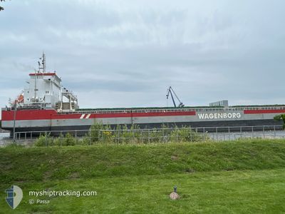
ROERBORG
General Cargo
Current Trip
| Time Travelled | --- |
|---|---|
| Remaining Time | --- |
| Distance Travelled | --- |
| Remaining Distance | --- |
| AVG Speed | --- |
| MAX Speed | --- |
| AVG Wind | --- |
| MAX Wind | --- |
| MIN Temp | --- |
| MAX Temp | --- |
| Осадка | 7.8 м |
| Позиция Получена | 11 h, 15 m тому назад |
Current Position
| Долгота | 13.13582° |
|---|---|
| Широта | 65.89611° |
| Статус | Under way using engine |
| Скорость | 10.9 Узлы |
| Курс | 161.8° |
| Район | Norwegian Sea |
| Станция | T-AIS |
| Позиция Получена | 11 h, 15 m тому назад |
Info
Information
The current position of ROERBORG is in Norwegian Sea with coordinates 65.89611° / 13.13582° as reported on 2025-02-12 20:42 by AIS to our vessel tracker app. The vessel's current speed is 10.9 Узлы
The vessel ROERBORG (IMO: 9592599, MMSI: 244820055) is a General Cargo that was built in 2014 ( 11 лет ). It's sailing under the flag of [NL] Netherlands.
In this page you can find informations about the vessels current position, last detected port calls, and current voyage information. If the vessels is not in coverage by AIS you will find the latest position.
The current position of ROERBORG is detected by our AIS receivers and we are not responsible for the reliability of the data. The last position was recorded while the vessel was in Coverage by the Ais receivers of our vessel tracking app.
The current draught of ROERBORG as reported by AIS is 7.8 meters
Weather
| Temperature | -15.4°C / 4.28°F |
|---|---|
| Wind Speed | 5 knots |
| Direction | 91° E |
| Pressure | 1036.6 hPa |
| Humidity | 96.1 % |
| Cloud Coverage | 13 % |
Featured Company
Last Port Calls
| Port | Arrival | Departure | Time In Port |
|---|---|---|---|
| 2025-02-03 07:30 | |||
| 2025-01-07 19:51 | 2025-01-12 23:11 | 5 d | |
| 2025-01-02 22:03 | 2025-01-04 01:43 | 1 d | |
| 2024-12-26 22:21 | 2024-12-31 04:19 | 4 d | |
| 2024-12-01 11:23 | 2024-12-06 01:48 | 4 d |
Most Visited Ports (Last year)
| Port | Arrivals | |
|---|---|---|
| 2 | ||
| 2 | ||
| 2 | ||
| 1 | ||
| 1 | ||
| 1 |
Last Trips
| Origin | Departure | Destination | Arrival | Distance | |
|---|---|---|---|---|---|
| 2025-01-12 17:11 | 2025-02-03 08:30 | 5121.70 морская миля | |||
| 2025-01-03 20:43 | 2025-01-07 13:51 | 1012.44 морская миля | |||
| 2024-12-30 23:19 | 2025-01-02 17:03 | 711.89 морская миля | |||
| 2024-12-06 03:48 | 2024-12-26 17:21 | 4811.41 морская миля | |||
| 2024-11-30 08:24 | 2024-12-01 13:23 | 325.06 морская миля |
Events
| Время | Событие | Детали | Позиция / Направление | Информация |
|---|---|---|---|---|
| 2025-02-12 20:42 | Вне покрытия |
65.89611 / 13.13582
Norwegian Sea
|
Скорость: 10.9 kn Курс: 161.8° |
|
| 2025-02-12 17:24 | Начало движения | 1.94 nm, North East of NESNA |
66.22947 / 13.04793
NOMJF
|
Скорость: 4.4 kn Курс: 268° |
| 2025-02-12 17:20 | Статус изменился | Under way using engine At anchor |
66.22716 / 13.05237
NOMJF
|
Скорость: 0.5 kn Курс: 7° |
| 2025-02-12 11:34 | Статус изменился | At anchor Default |
66.22498 / 13.05268
NOMJF
|
Скорость: 0.1 kn Курс: 29° |
| 2025-02-12 11:31 | Статус изменился | Default At anchor |
66.22496 / 13.05275
NOMJF
|
Скорость: 0.2 kn Курс: 27° |
| 2025-02-12 07:55 | Статус изменился | At anchor Default |
66.22493 / 13.05570
NOMJF
|
Скорость: 0.1 kn Курс: 351° |
| 2025-02-12 07:48 | Статус изменился | Default At anchor |
66.22478 / 13.05540
NOMJF
|
Скорость: 0.1 kn Курс: 354° |
| 2025-02-11 22:19 | Окончание движения | 1.89 nm, North East of NESNA |
66.22571 / 13.05792
NOMJF
|
Скорость: 0.2 kn Курс: 315° |
| 2025-02-11 22:03 | Статус изменился | At anchor Under way using engine |
66.22601 / 13.05352
NOMJF
|
Скорость: 0.8 kn Курс: 2° |
| 2025-02-11 15:05 | Начало движения | 20.71 nm, South West of TRAENA |
66.30918 / 11.39185
NOMJF
|
Скорость: 3.2 kn Курс: 221° |