
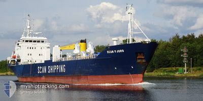
SCAN FJORD
General Cargo
Current Trip
NORDHAMMARVIKA
| Time Travelled | 13 h, 12 mins |
|---|---|
| Remaining Time | --- |
| Distance Travelled | 145.56 морская миля |
| Remaining Distance | --- |
| AVG Speed | 11.1 Узлы |
| MAX Speed | 12 Узлы |
| AVG Wind | 13.8 knots |
| MAX Wind | 22.8 knots |
| MIN Temp | -4°C / 24.8°F |
| MAX Temp | 5.7°C / 42.26°F |
| Осадка | 4.5 м |
| Позиция Получена | Сейчас |
Current Position
| Долгота | 11.31770° |
|---|---|
| Широта | 64.88960° |
| Статус | Under way using engine |
| Скорость | 11.7 Узлы |
| Курс | 224.7° |
| Район | Norwegian Sea |
| Станция | T-AIS |
| Позиция Получена | Сейчас |
Info
Information
The current position of SCAN FJORD is in Norwegian Sea with coordinates 64.88960° / 11.31770° as reported on 2025-02-11 01:33 by AIS to our vessel tracker app. The vessel's current speed is 11.7 Узлы
The vessel SCAN FJORD (IMO: 8015879, MMSI: 314318000) is a General Cargo that was built in 1981 ( 44 лет ). It's sailing under the flag of [BB] Barbados.
In this page you can find informations about the vessels current position, last detected port calls, and current voyage information. If the vessels is not in coverage by AIS you will find the latest position.
The current position of SCAN FJORD is detected by our AIS receivers and we are not responsible for the reliability of the data. The last position was recorded while the vessel was in Coverage by the Ais receivers of our vessel tracking app.
The current draught of SCAN FJORD as reported by AIS is 4.5 meters
Weather
| Temperature | 5.3°C / 41.54°F |
|---|---|
| Wind Speed | 15 knots |
| Direction | 213° SSW |
| Pressure | 1041.3 hPa |
| Humidity | 88.7 % |
| Cloud Coverage | 71 % |
Featured Company
Last Port Calls
| Port | Arrival | Departure | Time In Port |
|---|---|---|---|
| 2025-02-09 14:47 | 2025-02-10 12:21 | 21 h | |
| 2025-02-07 11:49 | 2025-02-07 13:18 | 1 h | |
| 2025-02-06 07:23 | 2025-02-06 09:27 | 2 h | |
| 2025-02-03 22:13 | 2025-02-04 22:48 | 1 d | |
| 2025-01-29 20:32 | 2025-01-30 01:32 | 4 h | |
| 2025-01-29 04:41 | 2025-01-29 07:00 | 2 h | |
| 2025-01-28 17:27 | 2025-01-28 18:44 | 1 h | |
| 2025-01-27 20:27 | 2025-01-27 23:00 | 2 h | |
| 2025-01-24 10:34 | 2025-01-26 12:47 | 2 d | |
| 2025-01-21 18:58 | 2025-01-22 11:49 | 16 h |
Last Trips
| Origin | Departure | Destination | Arrival | Distance | |
|---|---|---|---|---|---|
| 2025-02-07 14:18 | 2025-02-09 15:47 | 619.12 морская миля | |||
| 2025-02-06 09:27 | 2025-02-07 12:49 | 325.63 морская миля | |||
| 2025-02-04 22:48 | 2025-02-06 07:23 | 394.56 морская миля | |||
| 2025-01-30 02:32 | 2025-02-03 22:13 | 1035.68 морская миля | |||
| 2025-01-29 08:00 | 2025-01-29 21:32 | 162.76 морская миля | |||
| 2025-01-28 19:44 | 2025-01-29 05:41 | 121.98 морская миля | |||
| 2025-01-28 00:00 | 2025-01-28 18:27 | 111.95 морская миля | |||
| 2025-01-26 13:47 | 2025-01-27 21:27 | 360.31 морская миля | |||
| 2025-01-22 12:49 | 2025-01-24 11:34 | 540.11 морская миля | |||
| 2025-01-21 19:31 | 2025-01-21 19:58 | 2.07 морская миля |
Events
| Время | Событие | Детали | Позиция / Направление | Информация |
|---|---|---|---|---|
| 2025-02-10 13:00 | Осадка изменилась | 4.5 3.3 |
66.82172 / 13.63276
NORDHAMMARVIKA
|
Скорость: 11.1 kn Курс: 265.3° |
| 2025-02-10 13:00 | Пункт назначения изменился | NORDHAMMARVIKA NOGLO |
66.82172 / 13.63276
NORDHAMMARVIKA
|
Скорость: 11.1 kn Курс: 265.3° |
| 2025-02-10 13:00 | ETA изменился | 2025/02/11 11:00 2025/02/09 21:00 |
66.82172 / 13.63276
NORDHAMMARVIKA
|
Скорость: 11.1 kn Курс: 265.3° |
| 2025-02-10 12:34 | Статус изменился | Under way using engine Default |
66.80504 / 13.83088
NOGLO
|
Скорость: 9 kn Курс: 263° |
| 2025-02-10 12:34 | В покрытии |
66.80504 / 13.83088
Norwegian Sea
|
Скорость: 10.9 kn Курс: 282.2° |
|
| 2025-02-10 12:24 | Начало движения | 0.46 nm, West of GLOMFJORD |
66.80428 / 13.90900
NOGLO
|
Скорость: 9 kn Курс: 263° |
| 2025-02-10 12:21 | ПОРТ ОТПРАВЛЕНИЯ |
|
66.80428 / 13.90900
NOGLO
|
Скорость: Курс: 261° |
| 2025-02-09 15:18 | Окончание движения |
66.81051 / 13.94069
[NO] GLOMFJORD
|
Скорость: Курс: 226° |
|
| 2025-02-09 14:47 | Порт |
|
66.81051 / 13.94069
[NO] GLOMFJORD
|
Скорость: 11 kn Курс: 84° |
| 2025-02-09 14:33 | Вне покрытия |
66.80443 / 13.83217
Norwegian Sea
[NO] GLOMFJORD
|
Скорость: 11.7 kn Курс: 100.5° |