
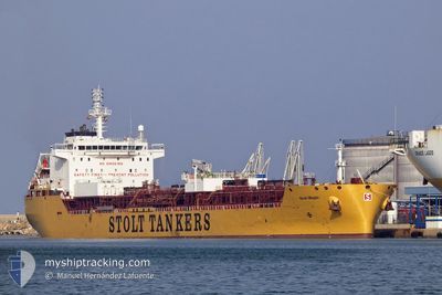
STOLT MAPLE
Tanker
Current Trip
| Time Travelled | 5 days |
|---|---|
| Remaining Time | 7 h, 11 mins |
| Distance Travelled | 1651.51 морская миля |
| Remaining Distance | 65.11 морская миля |
| AVG Speed | 11.4 Узлы |
| MAX Speed | 14 Узлы |
| AVG Wind | 10.7 knots |
| MAX Wind | 30.5 knots |
| MIN Temp | 5.7°C / 42.26°F |
| MAX Temp | 15.3°C / 59.54°F |
| Осадка | 9.8 м |
| Позиция Получена | 4 h, 54 m тому назад |
Current Position
| Долгота | -2.43539° |
|---|---|
| Широта | 49.85531° |
| Статус | Under way using engine |
| Скорость | 9.8 Узлы |
| Курс | 73.2° |
| Район | English Channel |
| Станция | T-AIS |
| Позиция Получена | 4 h, 54 m тому назад |
Info
Information
The current position of STOLT MAPLE is in English Channel with coordinates 49.85531° / -2.43539° as reported on 2025-02-07 05:23 by AIS to our vessel tracker app. The vessel's current speed is 9.8 Узлы and is heading at the port of LE HAVRE. The estimated time of arrival as calculated by MyShipTracking vessel tracking app is 2025-02-07 17:28 LT
The vessel STOLT MAPLE (IMO: 9764491, MMSI: 255806424) is a Tanker It's sailing under the flag of [PT] Portugal.
In this page you can find informations about the vessels current position, last detected port calls, and current voyage information. If the vessels is not in coverage by AIS you will find the latest position.
The current position of STOLT MAPLE is detected by our AIS receivers and we are not responsible for the reliability of the data. The last position was recorded while the vessel was in Coverage by the Ais receivers of our vessel tracking app.
The current draught of STOLT MAPLE as reported by AIS is 9.8 meters
Weather
| Temperature | 5.7°C / 42.26°F |
|---|---|
| Wind Speed | 24 knots |
| Direction | 83° E |
| Pressure | 1021.3 hPa |
| Humidity | 76.1 % |
| Cloud Coverage | 100 % |
Featured Company
Last Trips
| Origin | Departure | Destination | Arrival | Distance | |
|---|---|---|---|---|---|
| 2024-12-27 11:36 | 2025-01-31 17:57 | 10942.25 морская миля | |||
| 2024-12-21 06:56 | 2024-12-26 08:25 | 306.56 морская миля | |||
| 2024-12-16 11:18 | 2024-12-20 19:16 | 185.42 морская миля | |||
| 2024-12-05 00:15 | 2024-12-14 07:06 | 1206.03 морская миля | |||
| 2024-10-19 20:45 | 2024-12-03 00:54 | 8426.96 морская миля |
Events
| Время | Событие | Детали | Позиция / Направление | Информация |
|---|---|---|---|---|
| 2025-02-07 05:31 | Статус изменился | Default Under way using engine |
49.86185 / -2.40247
FRLEH
|
Скорость: 9.8 kn Курс: 73.2° |
| 2025-02-07 05:23 | Вне покрытия |
49.85531 / -2.43539
English Channel
FRLEH
|
Скорость: 9.8 kn Курс: 73.2° |
|
| 2025-02-07 05:17 | Изменение морского района | Guernsey part of the English Channel Portuguese part of the North Atlantic Ocean |
49.85045 / -2.46015
English Channel
FRLEH
|
Скорость: 9.6 kn Курс: 72.5° |
| 2025-02-07 05:16 | Статус изменился | Under way using engine Default |
49.85016 / -2.46145
FRLEH
|
Скорость: 9.5 kn Курс: 77° |
| 2025-02-07 05:16 | В покрытии |
49.85045 / -2.46015
English Channel
FRLEH
|
Скорость: 9.6 kn Курс: 72.5° |
|
| 2025-02-04 22:46 | Статус изменился | Default Under way using engine |
40.97945 / -9.95799
FRLEH
|
Скорость: 12.6 kn Курс: 357.2° |
| 2025-02-04 22:45 | Вне покрытия |
40.97706 / -9.95805
North Atlantic Ocean
FRLEH
|
Скорость: 12.6 kn Курс: 357.2° |
|
| 2025-02-04 22:17 | Статус изменился | Under way using engine Default |
40.88003 / -9.95965
FRLEH
|
Скорость: 12.4 kn Курс: 359° |
| 2025-02-04 21:58 | В покрытии |
40.88003 / -9.95965
North Atlantic Ocean
FRLEH
|
Скорость: 12.3 kn Курс: 359.6° |
|
| 2025-02-04 18:40 | Вне покрытия |
40.10860 / -9.95445
North Atlantic Ocean
FRLEH
|
Скорость: 12.4 kn Курс: 358.8° |