
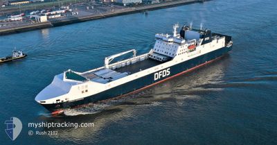
SUECIA SEAWAYS
Ro-Ro Cargo
Current Trip
| Time Travelled | 7 h, 24 mins |
|---|---|
| Remaining Time | 1 h, 4 mins |
| Distance Travelled | 103.71 морская миля |
| Remaining Distance | 18.25 морская миля |
| AVG Speed | 13.7 Узлы |
| MAX Speed | 15.8 Узлы |
| AVG Wind | 9.8 knots |
| MAX Wind | 12.5 knots |
| MIN Temp | 3.4°C / 38.12°F |
| MAX Temp | 4.5°C / 40.1°F |
| Осадка | 6.4 м |
| Позиция Получена | 1 m тому назад |
Current Position
| Долгота | 3.95246° |
|---|---|
| Широта | 51.99126° |
| Статус | Under way using engine |
| Скорость | 13.8 Узлы |
| Курс | 76.6° |
| Район | North Sea |
| Станция | T-AIS |
| Позиция Получена | 1 m тому назад |
Info
Information
The current position of SUECIA SEAWAYS is in North Sea with coordinates 51.99126° / 3.95246° as reported on 2025-02-11 08:52 by AIS to our vessel tracker app. The vessel's current speed is 13.8 Узлы and is heading at the port of VLAARDINGEN - ROTTERDAM. The estimated time of arrival as calculated by MyShipTracking vessel tracking app is 2025-02-11 09:57 LT
The vessel SUECIA SEAWAYS (IMO: 9153020, MMSI: 220284000) is a Ro-Ro Cargo that was built in 1999 ( 26 лет ). It's sailing under the flag of [DK] Denmark.
In this page you can find informations about the vessels current position, last detected port calls, and current voyage information. If the vessels is not in coverage by AIS you will find the latest position.
The current position of SUECIA SEAWAYS is detected by our AIS receivers and we are not responsible for the reliability of the data. The last position was recorded while the vessel was in Coverage by the Ais receivers of our vessel tracking app.
The current draught of SUECIA SEAWAYS as reported by AIS is 6.4 meters
Weather
| Temperature | 3.8°C / 38.84°F |
|---|---|
| Wind Speed | 11 knots |
| Direction | 93° E |
| Pressure | 1014.3 hPa |
| Humidity | 97.2 % |
| Cloud Coverage | 100 % |
Featured Company
Last Port Calls
| Port | Arrival | Departure | Time In Port |
|---|---|---|---|
| 2025-02-10 21:46 | 2025-02-11 01:29 | 3 h | |
| 2025-02-08 10:09 | 2025-02-10 14:28 | 2 d | |
| 2025-02-07 21:39 | 2025-02-08 00:51 | 3 h | |
| 2025-02-07 10:18 | 2025-02-07 14:18 | 4 h | |
| 2025-02-06 21:44 | 2025-02-07 01:21 | 3 h | |
| 2025-02-06 10:20 | 2025-02-06 14:11 | 3 h | |
| 2025-02-05 22:02 | 2025-02-06 01:33 | 3 h | |
| 2025-02-05 10:18 | 2025-02-05 14:17 | 3 h | |
| 2025-02-04 22:08 | 2025-02-05 01:24 | 3 h | |
| 2025-02-04 10:19 | 2025-02-04 14:22 | 4 h |
Most Visited Ports (Last year)
| Port | Arrivals | |
|---|---|---|
| 220 | ||
| 218 | ||
| 11 | ||
| 10 | ||
| 2 | ||
| 1 |
Last Trips
| Origin | Departure | Destination | Arrival | Distance | |
|---|---|---|---|---|---|
| 2025-02-10 15:28 | 2025-02-10 21:46 | 119.44 морская миля | |||
| 2025-02-08 00:51 | 2025-02-08 11:09 | 121.12 морская миля | |||
| 2025-02-07 15:18 | 2025-02-07 21:39 | 118.58 морская миля | |||
| 2025-02-07 01:21 | 2025-02-07 11:18 | 121.43 морская миля | |||
| 2025-02-06 15:11 | 2025-02-06 21:44 | 120.02 морская миля | |||
| 2025-02-06 01:33 | 2025-02-06 11:20 | 120.82 морская миля | |||
| 2025-02-05 15:17 | 2025-02-05 22:02 | 119.58 морская миля | |||
| 2025-02-05 01:24 | 2025-02-05 11:18 | 120.98 морская миля | |||
| 2025-02-04 15:22 | 2025-02-04 22:08 | 119.30 морская миля | |||
| 2025-02-04 01:39 | 2025-02-04 11:19 | 121.06 морская миля |
Events
| Время | Событие | Детали | Позиция / Направление | Информация |
|---|---|---|---|---|
| 2025-02-11 05:14 | Изменение морского района | Dutch part of the North Sea United Kingdom part of the North Sea |
51.88892 / 2.57245
North Sea
RTM <=> FXT
|
Скорость: 14.4 kn Курс: 113.4° |
| 2025-02-11 01:30 | Начало движения | 0.55 nm, South East of FELIXSTOWE |
51.95142 / 1.30832
RTM <=> FXT
|
Скорость: 3.3 kn Курс: 195° |
| 2025-02-11 01:29 | ПОРТ ОТПРАВЛЕНИЯ |
|
51.95170 / 1.30850
RTM <=> FXT
|
Скорость: 2.7 kn Курс: 206° |
| 2025-02-11 01:17 | Статус изменился | Under way using engine Moored |
51.95296 / 1.31182
[GB] FELIXSTOWE
|
Скорость: Курс: 306° |
| 2025-02-11 01:08 | Осадка изменилась | 6.4 6.7 |
51.95296 / 1.31181
[GB] FELIXSTOWE
|
Скорость: Курс: 306° |
| 2025-02-11 01:08 | ETA изменился | 2025/02/11 10:40 2025/02/10 22:00 |
51.95296 / 1.31181
[GB] FELIXSTOWE
|
Скорость: Курс: 306° |
| 2025-02-10 21:59 | Статус изменился | Moored Under way using engine |
51.95297 / 1.31182
[GB] FELIXSTOWE
|
Скорость: Курс: 306° |
| 2025-02-10 21:51 | Окончание движения |
51.95298 / 1.31167
[GB] FELIXSTOWE
|
Скорость: 0.3 kn Курс: 304° |
|
| 2025-02-10 21:46 | Порт |
|
51.95247 / 1.31084
[GB] FELIXSTOWE
|
Скорость: 0.6 kn Курс: 307° |
| 2025-02-10 19:19 | Статус изменился | Under way using engine Default |
52.04948 / 2.26500
RTM <=> FXT
|
Скорость: 18.6 kn Курс: 270° |