

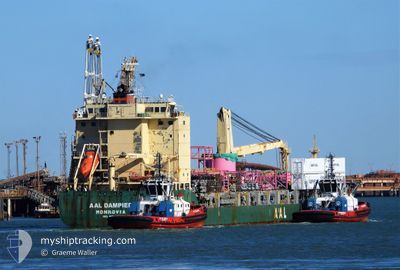
AAL DAMPIER
General Cargo

Current Trip
| Time Travelled | 22 days |
|---|---|
| Remaining Time | --- |
| Distance Travelled | 6757.97 nm |
| Remaining Distance | --- |
| AVG Speed | 12.7 Knop |
| MAX Speed | 16.5 Knop |
| AVG Wind | 12.6 knots |
| MAX Wind | 25.6 knots |
| MIN Temp | 12°C / 53.6°F |
| MAX Temp | 28.2°C / 82.76°F |
| Djupgående | 6.8 m |
| Position mottagen | 2 d sen |
Current Position
| Longitud | 19.11203° |
|---|---|
| Latitude | -34.71674° |
| Status | Under way using engine |
| Fart | 14.1 Knop |
| Kurs | 112.4° |
| Område | South Atlantic Ocean |
| Station | T-AIS |
| Position mottagen | 2 d sen |
Information
The current position of AAL DAMPIER is in South Atlantic Ocean with coordinates -34.71674° / 19.11203° as reported on 2025-06-05 21:32 by AIS to our vessel tracker app. The vessel's current speed is 14.1 Knop and is heading at the port of SINGAPORE. The estimated time of arrival as calculated by MyShipTracking vessel tracking app is 2025-06-24 01:00 LT
The vessel AAL DAMPIER (IMO: 9521540, MMSI: 210418000) is a General Cargo that was built in 2011 ( 14 År gammal ). It's sailing under the flag of [CY] Cyprus.
In this page you can find informations about the vessels current position, last detected port calls, and current voyage information. If the vessels is not in coverage by AIS you will find the latest position.
The current position of AAL DAMPIER is detected by our AIS receivers and we are not responsible for the reliability of the data. The last position was recorded while the vessel was in Coverage by the Ais receivers of our vessel tracking app.
The current draught of AAL DAMPIER as reported by AIS is 6.8 meters
Weather
| Temperature | 23.9°C / 75.02°F |
|---|---|
| Wind Speed | 9 knots |
| Direction | 203° SSW |
| Pressure | 1010.3 hPa |
| Humidity | 63.4 % |
| Cloud Coverage | 100 % |


Featured Company
Last Port Calls
| Port | Arrival | Departure | Time In Port |
|---|---|---|---|
| 2025-05-16 06:51 | 2025-05-16 16:19 | 9 h | |
| 2025-05-12 21:37 | 2025-05-14 16:21 | 1 d | |
| 2025-04-30 15:28 | 2025-05-01 00:52 | 9 h | |
| 2025-04-28 23:52 | 2025-04-29 14:41 | 14 h | |
| 2025-04-26 21:35 | 2025-04-27 12:25 | 14 h | |
| 2025-04-24 11:31 | 2025-04-25 14:31 | 1 d | |
| 2025-04-23 04:46 | 2025-04-23 04:48 | 2 m | |
| 2025-04-18 15:48 | 2025-04-19 19:36 | 1 d | |
| 2025-04-11 17:36 | 2025-04-16 08:17 | 4 d |
Last Trips
| Origin | Departure | Destination | Arrival | Distance | |
|---|---|---|---|---|---|
| 2025-05-14 16:21 | 2025-05-16 06:51 | 304.51 nm | |||
| 2025-05-01 00:52 | 2025-05-12 21:37 | 504.99 nm | |||
| 2025-04-29 14:41 | 2025-04-30 15:28 | 278.90 nm | |||
| 2025-04-27 12:25 | 2025-04-28 23:52 | 244.15 nm | |||
| 2025-04-25 14:31 | 2025-04-26 21:35 | 455.50 nm | |||
| 2025-04-23 04:48 | 2025-04-24 11:31 | 411.36 nm | |||
| 2025-04-19 19:36 | 2025-04-23 04:46 | 927.93 nm | |||
| 2025-04-16 08:17 | 2025-04-18 15:48 | 697.39 nm | |||
| 2025-03-03 19:18 | 2025-04-11 17:36 | 13141.93 nm |
Events
| Tid | Event | Detaljer | Position / Dest | Information |
|---|---|---|---|---|
| 2025-06-05 21:33 | Status ändrad | Default Under way using engine |
-34.71913 / 19.11902
SGSIN
|
Fart: 14.1 kn Kurs: 112.4° |
| 2025-06-05 21:32 | UTANFÖR täckningsområde |
-34.71674 / 19.11203
South Atlantic Ocean
SGSIN
|
Fart: 14.1 kn Kurs: 112.4° |
|
| 2025-06-05 21:21 | Status ändrad | Under way using engine Default |
-34.70054 / 19.06408
SGSIN
|
Fart: 14.2 kn Kurs: 113° |
| 2025-06-05 20:53 | Status ändrad | Default Under way using engine |
-34.65588 / 18.93848
SGSIN
|
Fart: 14.1 kn Kurs: 114.4° |
| 2025-06-05 20:24 | Status ändrad | Under way using engine Default |
-34.61311 / 18.81252
SGSIN
|
Fart: 13.9 kn Kurs: 108° |
| 2025-06-05 20:13 | Status ändrad | Default Under way using engine |
-34.60040 / 18.76224
SGSIN
|
Fart: 13.7 kn Kurs: 110.1° |
| 2025-06-05 19:25 | Status ändrad | Under way using engine Default |
-34.52087 / 18.55791
SGSIN
|
Fart: 14.2 kn Kurs: 129° |
| 2025-06-05 19:25 | I täckningsområde |
-34.52087 / 18.55791
South Atlantic Ocean
SGSIN
|
Fart: 14.3 kn Kurs: 128.7° |
|
| 2025-06-05 17:42 | Status ändrad | Default Under way using engine |
-34.25783 / 18.21811
SGSIN
|
Fart: 13.4 kn Kurs: 142.8° |
| 2025-06-05 17:35 | UTANFÖR täckningsområde |
-34.23742 / 18.19943
South Atlantic Ocean
SGSIN
|
Fart: 13.4 kn Kurs: 142.8° |