
AASTUN
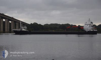
General Cargo
Current Trip
| Time Travelled | 1 day |
|---|---|
| Remaining Time | 1 day |
| Distance Travelled | 328.26 nm |
| Remaining Distance | 438.96 nm |
| AVG Speed | 11.2 Knop |
| MAX Speed | 14.8 Knop |
| AVG Wind | 14.5 knots |
| MAX Wind | 20 knots |
| MIN Temp | 3.2°C / 37.76°F |
| MAX Temp | 6.6°C / 43.88°F |
| Djupgående | 6.3 m |
| Position mottagen | 5 h, 20 m sen |
Current Position
| Longitud | -3.53197° |
|---|---|
| Latitude | 50.10490° |
| Status | Under way using engine |
| Fart | 10.8 Knop |
| Kurs | 81.3° |
| Område | English Channel |
| Station | T-AIS |
| Position mottagen | 5 h, 20 m sen |
Info
Information
The current position of AASTUN is in English Channel with coordinates 50.10490° / -3.53197° as reported on 2025-02-11 14:35 by AIS to our vessel tracker app. The vessel's current speed is 10.8 Knop and is heading at the port of MIDDLESBROUGH. The estimated time of arrival as calculated by MyShipTracking vessel tracking app is 2025-02-13 04:39 LT
The vessel AASTUN (IMO: 9321407, MMSI: 255768000) is a General Cargo that was built in 2006 ( 19 År gammal ). It's sailing under the flag of [PT] Portugal.
In this page you can find informations about the vessels current position, last detected port calls, and current voyage information. If the vessels is not in coverage by AIS you will find the latest position.
The current position of AASTUN is detected by our AIS receivers and we are not responsible for the reliability of the data. The last position was recorded while the vessel was in Coverage by the Ais receivers of our vessel tracking app.
The current draught of AASTUN as reported by AIS is 6.3 meters
Weather
| Temperature | 6°C / 42.8°F |
|---|---|
| Wind Speed | 6 knots |
| Direction | 69° ENE |
| Pressure | 1018.1 hPa |
| Humidity | 68.9 % |
| Cloud Coverage | 100 % |
Featured Company
Last Port Calls
| Port | Arrival | Departure | Time In Port |
|---|---|---|---|
| 2025-02-08 00:44 | 2025-02-10 15:46 | 2 d | |
| 2025-02-03 11:58 | 2025-02-05 19:20 | 2 d | |
| 2025-01-27 14:28 | 2025-01-28 14:10 | 23 h | |
| 2025-01-24 05:49 | 2025-01-26 15:09 | 2 d | |
| 2025-01-21 02:12 | 2025-01-22 04:21 | 1 d | |
| 2025-01-17 23:05 | 2025-01-18 12:44 | 13 h | |
| 2025-01-13 11:27 | 2025-01-14 21:14 | 1 d | |
| 2024-12-29 07:45 | 2025-01-10 13:05 | 12 d | |
| 2024-12-16 21:17 | 2024-12-19 19:01 | 2 d | |
| 2024-12-14 06:03 | 2024-12-15 07:15 | 1 d |
Last Trips
| Origin | Departure | Destination | Arrival | Distance | |
|---|---|---|---|---|---|
| 2025-02-05 20:20 | 2025-02-08 00:44 | 606.82 nm | |||
| 2025-01-28 15:10 | 2025-02-03 12:58 | 563.44 nm | |||
| 2025-01-26 16:09 | 2025-01-27 15:28 | 159.21 nm | |||
| 2025-01-22 06:21 | 2025-01-24 06:49 | 433.10 nm | |||
| 2025-01-18 13:44 | 2025-01-21 04:12 | 565.70 nm | |||
| 2025-01-14 22:14 | 2025-01-18 00:05 | 574.26 nm | |||
| 2025-01-10 14:05 | 2025-01-13 12:27 | 105.81 nm | |||
| 2024-12-19 19:01 | 2024-12-29 08:45 | 1442.22 nm | |||
| 2024-12-15 07:15 | 2024-12-16 21:17 | 89.87 nm | |||
| 2024-12-12 08:16 | 2024-12-14 06:03 | 534.21 nm |
Events
| Tid | Event | Detaljer | Position / Dest | Information |
|---|---|---|---|---|
| 2025-02-11 14:43 | Status ändrad | Default Under way using engine |
50.10854 / -3.49552
GBMID
|
Fart: 10.8 kn Kurs: 81.3° |
| 2025-02-11 14:35 | UTANFÖR täckningsområde |
50.10490 / -3.53197
English Channel
GBMID
|
Fart: 10.8 kn Kurs: 81.3° |
|
| 2025-02-11 10:01 | Status ändrad | Under way using engine Default |
49.94885 / -4.74651
GBMID
|
Fart: 10.3 kn Kurs: 80° |
| 2025-02-11 09:11 | Status ändrad | Default Under way using engine |
49.92762 / -4.96365
GBMID
|
Fart: 10.2 kn Kurs: 83.5° |
| 2025-02-11 09:11 | Status ändrad | Under way using engine Default |
49.92756 / -4.96447
GBMID
|
Fart: 10.3 kn Kurs: 83° |
| 2025-02-11 09:03 | Status ändrad | Default Under way using engine |
49.92490 / -4.99884
GBMID
|
Fart: 10.2 kn Kurs: 82.3° |
| 2025-02-11 08:37 | Byter havsområde | United Kingdom part of the English Channel United Kingdom part of the Celtic Sea |
49.91580 / -5.11246
English Channel
GBMID
|
Fart: 10.1 kn Kurs: 83.3° |
| 2025-02-11 08:37 | Status ändrad | Under way using engine Default |
49.91568 / -5.11397
GBMID
|
Fart: 10.2 kn Kurs: 83° |
| 2025-02-11 08:27 | I täckningsområde |
49.91580 / -5.11246
English Channel
GBMID
|
Fart: 10.1 kn Kurs: 83.3° |
|
| 2025-02-11 02:40 | UTANFÖR täckningsområde |
50.41820 / -5.83555
Celtic Sea
GBMID
|
Fart: 10.4 kn Kurs: 231.8° |