
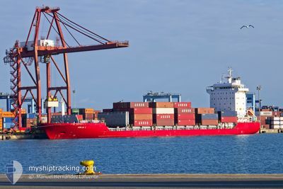
ADILIA I
Container Ship
Current Trip
| Time Travelled | 21 h, 31 mins |
|---|---|
| Remaining Time | 1 day |
| Distance Travelled | 296.48 nm |
| Remaining Distance | 595.88 nm |
| AVG Speed | 13.5 Knop |
| MAX Speed | 15.2 Knop |
| AVG Wind | 9.7 knots |
| MAX Wind | 22.7 knots |
| MIN Temp | 13°C / 55.4°F |
| MAX Temp | 15.1°C / 59.18°F |
| Djupgående | 8.5 m |
| Position mottagen | Nu |
Current Position
| Longitud | -9.74992° |
|---|---|
| Latitude | 38.35043° |
| Status | Under way using engine |
| Fart | 13.6 Knop |
| Kurs | 347.7° |
| Område | North Atlantic Ocean |
| Station | T-AIS |
| Position mottagen | Nu |
Info
Information
The current position of ADILIA I is in North Atlantic Ocean with coordinates 38.35043° / -9.74992° as reported on 2025-02-07 02:47 by AIS to our vessel tracker app. The vessel's current speed is 13.6 Knop and is heading at the port of BILBAO. The estimated time of arrival as calculated by MyShipTracking vessel tracking app is 2025-02-08 23:26 LT
The vessel ADILIA I (IMO: 9318761, MMSI: 255806330) is a Container Ship that was built in 2004 ( 21 År gammal ). It's sailing under the flag of [PT] Portugal.
In this page you can find informations about the vessels current position, last detected port calls, and current voyage information. If the vessels is not in coverage by AIS you will find the latest position.
The current position of ADILIA I is detected by our AIS receivers and we are not responsible for the reliability of the data. The last position was recorded while the vessel was in Coverage by the Ais receivers of our vessel tracking app.
The current draught of ADILIA I as reported by AIS is 8.5 meters
Weather
| Temperature | 15°C / 59°F |
|---|---|
| Wind Speed | 9 knots |
| Direction | 245° WSW |
| Pressure | 1024.5 hPa |
| Humidity | 66.7 % |
| Cloud Coverage | 100 % |
Featured Company
Last Port Calls
| Port | Arrival | Departure | Time In Port |
|---|---|---|---|
| 2025-02-05 23:20 | 2025-02-06 06:17 | 6 h | |
| 2025-02-05 08:21 | 2025-02-05 15:25 | 7 h | |
| 2025-02-03 06:16 | 2025-02-04 06:50 | 1 d | |
| 2025-01-31 10:10 | 2025-02-01 15:25 | 1 d | |
| 2025-01-29 07:50 | 2025-01-29 14:17 | 6 h | |
| 2025-01-28 07:29 | 2025-01-28 13:00 | 5 h | |
| 2025-01-24 17:05 | 2025-01-25 08:52 | 15 h | |
| 2025-01-19 00:58 | 2025-01-20 06:23 | 1 d | |
| 2025-01-18 07:53 | 2025-01-18 13:23 | 5 h | |
| 2025-01-15 09:01 | 2025-01-15 17:27 | 8 h |
Last Trips
| Origin | Departure | Destination | Arrival | Distance | |
|---|---|---|---|---|---|
| 2025-02-05 15:25 | 2025-02-05 23:20 | 47.07 nm | |||
| 2025-02-04 06:50 | 2025-02-05 08:21 | 19.73 nm | |||
| 2025-02-01 15:25 | 2025-02-03 06:16 | 454.59 nm | |||
| 2025-01-29 14:17 | 2025-01-31 10:10 | 403.09 nm | |||
| 2025-01-28 13:00 | 2025-01-29 07:50 | 100.51 nm | |||
| 2025-01-25 08:52 | 2025-01-28 07:29 | 735.45 nm | |||
| 2025-01-20 06:23 | 2025-01-24 17:05 | 991.83 nm | |||
| 2025-01-18 13:23 | 2025-01-19 00:58 | 117.80 nm | |||
| 2025-01-15 17:27 | 2025-01-18 07:53 | 793.07 nm | |||
| 2025-01-14 05:24 | 2025-01-15 09:01 | 5.20 nm |
Events
| Tid | Event | Detaljer | Position / Dest | Information |
|---|---|---|---|---|
| 2025-02-06 16:51 | Status ändrad | Under way using engine Default |
36.57181 / -8.51808
ESBIO
|
Fart: 13.5 kn Kurs: 287° |
| 2025-02-06 16:47 | Status ändrad | Default Under way using engine |
36.56686 / -8.50008
ESBIO
|
Fart: 13.9 kn Kurs: 289° |
| 2025-02-06 16:33 | Status ändrad | Under way using engine Default |
36.54952 / -8.43573
ESBIO
|
Fart: 13.6 kn Kurs: 288° |
| 2025-02-06 16:31 | Status ändrad | Default Under way using engine |
36.54738 / -8.42714
ESBIO
|
Fart: 13.9 kn Kurs: 286.2° |
| 2025-02-06 16:07 | Destination ändrad | ESBIO ESGIJ |
36.52078 / -8.31547
ESBIO
|
Fart: 13.9 kn Kurs: 284.9° |
| 2025-02-06 16:07 | ETA ändrat | 2025/02/09 00:01 2025/02/08 16:00 |
36.52078 / -8.31547
ESBIO
|
Fart: 13.9 kn Kurs: 284.9° |
| 2025-02-06 15:57 | Status ändrad | Under way using engine Default |
36.50845 / -8.26833
ESGIJ
|
Fart: 13.7 kn Kurs: 287° |
| 2025-02-06 15:11 | Status ändrad | Default Under way using engine |
36.45303 / -8.06513
ESGIJ
|
Fart: 13.8 kn Kurs: 288.1° |
| 2025-02-06 14:49 | Byter havsområde | Portuguese part of the North Atlantic Ocean Spanish part of the North Atlantic Ocean |
36.42576 / -7.96504
North Atlantic Ocean
ESGIJ
|
Fart: 14.1 kn Kurs: 287.3° |
| 2025-02-06 14:48 | Status ändrad | Under way using engine Default |
36.42361 / -7.95724
ESGIJ
|
Fart: 14.2 kn Kurs: 288° |