

ADNOC MP01
Other Type

Current Trip
| Time Travelled | 15 days |
|---|---|
| Remaining Time | --- |
| Distance Travelled | 333.86 nm |
| Remaining Distance | --- |
| AVG Speed | 5.7 Knop |
| MAX Speed | 8.4 Knop |
| AVG Wind | 11 knots |
| MAX Wind | 19.9 knots |
| MIN Temp | 28.8°C / 83.84°F |
| MAX Temp | 33.2°C / 91.76°F |
| Djupgående | 5 m |
| Position mottagen | Nu |
Current Position
| Longitud | 53.33225° |
|---|---|
| Latitude | 24.71268° |
| Status | Under way using engine |
| Fart | 5.8 Knop |
| Kurs | 297.2° |
| Område | Persian Gulf |
| Station | T-AIS |
| Position mottagen | Nu |
Information
The current position of ADNOC MP01 is in Persian Gulf with coordinates 24.71268° / 53.33225° as reported on 2025-06-09 20:19 by AIS to our vessel tracker app. The vessel's current speed is 5.8 Knop and is heading at the port of MUBARRAZ. The estimated time of arrival as calculated by MyShipTracking vessel tracking app is 2025-06-09 10:00 LT
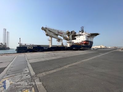
The vessel ADNOC MP01 (IMO: 9689263, MMSI: 470085000) is a Other Type It's sailing under the flag of [AE] UAE.
In this page you can find informations about the vessels current position, last detected port calls, and current voyage information. If the vessels is not in coverage by AIS you will find the latest position.
The current position of ADNOC MP01 is detected by our AIS receivers and we are not responsible for the reliability of the data. The last position was recorded while the vessel was in Coverage by the Ais receivers of our vessel tracking app.
The current draught of ADNOC MP01 as reported by AIS is 5 meters
Weather
| Temperature | 29.6°C / 85.28°F |
|---|---|
| Wind Speed | 7 knots |
| Direction | 58° ENE |
| Pressure | 1005.4 hPa |
| Humidity | 77.1 % |
| Cloud Coverage | --- |


Featured Company
Most Visited Ports (Last year)
| Port | Arrivals | |
|---|---|---|
| 9 | ||
| 7 | ||
| 4 |
Events
| Tid | Event | Detaljer | Position / Dest | Information |
|---|---|---|---|---|
| 2025-06-09 15:10 | STARTAR förflyttning |
24.61606 / 53.89035
MUBARRAZ OF
|
Fart: 3.1 kn Kurs: 308° |
|
| 2025-06-09 09:28 | I täckningsområde |
24.61760 / 53.89149
Persian Gulf
MUBARRAZ OF
|
Fart: Kurs: 136.1° |
|
| 2025-06-09 05:51 | UTANFÖR täckningsområde |
24.63945 / 53.84053
Persian Gulf
MUBARRAZ OF
|
Fart: Kurs: 290.9° |
|
| 2025-06-09 03:18 | ETA ändrat | 2025/06/09 06:00 2025/06/09 05:00 |
24.63938 / 53.84072
MUBARRAZ OF
|
Fart: Kurs: 25° |
| 2025-06-09 02:10 | STOPPAR förflyttning |
24.63961 / 53.84003
MUBARRAZ OF
|
Fart: 0.3 kn Kurs: 60° |
|
| 2025-06-09 02:07 | Status ändrad | Restricted manoeuverability Under way using engine |
24.64119 / 53.83942
MUBARRAZ OF
|
Fart: 3.4 kn Kurs: 176° |
| 2025-06-08 19:15 | STARTAR förflyttning | 7.32 nm, South of ZIRKU |
24.75170 / 53.04784
MUBARRAZ OF
|
Fart: 6.2 kn Kurs: 102.4° |
| 2025-06-08 18:58 | STOPPAR förflyttning | 7.31 nm, South of ZIRKU |
24.75264 / 53.04511
MUBARRAZ OF
|
Fart: 0.3 kn Kurs: 168° |
| 2025-06-08 18:20 | Destination ändrad | MUBARRAZ OF ZIRKU WEST BORDER |
24.79733 / 53.02245
MUBARRAZ OF
|
Fart: 3.4 kn Kurs: 168° |
| 2025-06-08 18:20 | ETA ändrat | 2025/06/09 05:00 2025/06/03 09:30 |
24.79733 / 53.02245
MUBARRAZ OF
|
Fart: 3.4 kn Kurs: 168° |