

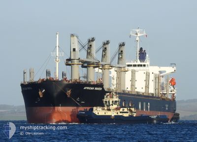
AFRICAN RAVEN
Cargo

Current Trip
| Time Travelled | 11 days |
|---|---|
| Remaining Time | 4 days |
| Distance Travelled | 3183.13 nm |
| Remaining Distance | 1198.56 nm |
| AVG Speed | 11.9 Knop |
| MAX Speed | 13.4 Knop |
| AVG Wind | 11.4 knots |
| MAX Wind | 21.3 knots |
| MIN Temp | 15.4°C / 59.72°F |
| MAX Temp | 27.9°C / 82.22°F |
| Djupgående | 10.1 m |
| Position mottagen | 4 d sen |
Current Position
| Longitud | -25.27834° |
|---|---|
| Latitude | 8.82291° |
| Status | Under way using engine |
| Fart | 12.6 Knop |
| Kurs | 204.4° |
| Område | North Atlantic Ocean |
| Station | T-AIS |
| Position mottagen | 4 d sen |
Information
The current position of AFRICAN RAVEN is in North Atlantic Ocean with coordinates 8.82291° / -25.27834° as reported on 2025-06-04 22:11 by AIS to our vessel tracker app. The vessel's current speed is 12.6 Knop and is heading at the port of PARANAGUA. The estimated time of arrival as calculated by MyShipTracking vessel tracking app is 2025-06-13 17:04 LT
The vessel AFRICAN RAVEN (IMO: 9700287, MMSI: 311000243) is a Cargo It's sailing under the flag of [BS] Bahamas.
In this page you can find informations about the vessels current position, last detected port calls, and current voyage information. If the vessels is not in coverage by AIS you will find the latest position.
The current position of AFRICAN RAVEN is detected by our AIS receivers and we are not responsible for the reliability of the data. The last position was recorded while the vessel was in Coverage by the Ais receivers of our vessel tracking app.
The current draught of AFRICAN RAVEN as reported by AIS is 10.1 meters
Weather
| Temperature | 25.9°C / 78.62°F |
|---|---|
| Wind Speed | 11 knots |
| Direction | 102° ESE |
| Pressure | 1014.5 hPa |
| Humidity | 80.8 % |
| Cloud Coverage | 5 % |


Featured Company
Last Port Calls
| Port | Arrival | Departure | Time In Port |
|---|---|---|---|
| 2025-05-22 21:31 | 2025-05-29 13:11 | 6 d | |
| 2025-05-16 10:28 | 2025-05-16 11:17 | 49 m | |
| 2025-04-18 05:58 | 2025-04-19 20:20 | 1 d | |
| 2025-04-12 14:25 | 2025-04-15 17:13 | 3 d |
Most Visited Ports (Last year)
| Port | Arrivals | |
|---|---|---|
| 1 | ||
| 1 | ||
| 1 | ||
| 1 | ||
| 1 | ||
| 1 |
Last Trips
| Origin | Departure | Destination | Arrival | Distance | |
|---|---|---|---|---|---|
| 2025-05-16 11:17 | 2025-05-22 21:31 | 534.45 nm | |||
| 2025-04-19 20:20 | 2025-05-16 10:28 | 6752.78 nm | |||
| 2025-04-15 17:13 | 2025-04-18 05:58 | 612.13 nm | |||
| 2025-03-15 02:07 | 2025-04-12 14:25 | 5236.11 nm |
Events
| Tid | Event | Detaljer | Position / Dest | Information |
|---|---|---|---|---|
| 2025-06-04 22:15 | Status ändrad | Default Under way using engine |
8.80983 / -25.28462
BR PNG
|
Fart: 12.6 kn Kurs: 204.4° |
| 2025-06-04 22:11 | UTANFÖR täckningsområde |
8.82291 / -25.27834
North Atlantic Ocean
BR PNG
|
Fart: 12.6 kn Kurs: 204.4° |
|
| 2025-06-04 22:02 | Status ändrad | Under way using engine Default |
8.84944 / -25.26599
BR PNG
|
Fart: 12.7 kn Kurs: 205° |
| 2025-06-04 21:55 | Status ändrad | Default Under way using engine |
8.87223 / -25.25547
BR PNG
|
Fart: 12.6 kn Kurs: 204.1° |
| 2025-06-04 20:03 | Status ändrad | Under way using engine Default |
9.21971 / -25.09133
BR PNG
|
Fart: 12.5 kn Kurs: 205° |
| 2025-06-04 19:22 | Status ändrad | Default Under way using engine |
9.35140 / -25.03222
BR PNG
|
Fart: 12.8 kn Kurs: 201.8° |
| 2025-06-04 19:18 | Status ändrad | Under way using engine Default |
9.36288 / -25.02720
BR PNG
|
Fart: 12.8 kn Kurs: 203° |
| 2025-06-04 18:55 | Status ändrad | Default Under way using engine |
9.43904 / -24.99408
BR PNG
|
Fart: 12.3 kn Kurs: 204.6° |
| 2025-06-04 18:48 | Status ändrad | Under way using engine Default |
9.45946 / -24.98479
BR PNG
|
Fart: 12.3 kn Kurs: 203° |
| 2025-06-04 18:34 | Status ändrad | Default Under way using engine |
9.50469 / -24.96448
BR PNG
|
Fart: 12.3 kn Kurs: 202.8° |