
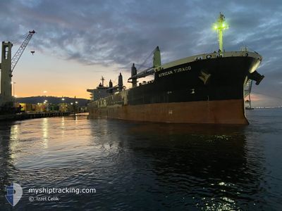
AFRICAN TURACO
Cargo
Current Trip
| Trip Time | 37 days |
|---|---|
| Trip Distance | 6972.56 nm |
| AVG Speed | 11.6 Knop |
| MAX Speed | 15.3 Knop |
| Djupgående | 11 m |
| AVG Wind | 12.5 knots |
| MAX Wind | 25 knots |
| MIN Temp | 18.1°C / 64.58°F |
| MAX Temp | 27.7°C / 81.86°F |
| Position mottagen | 3 d sen |
Current Position
| Longitud | -97.03188° |
|---|---|
| Latitude | 26.08498° |
| Status | At anchor |
| Fart | 0.1 Knop |
| Kurs | 51° |
| Område | Gulf of Mexico |
| Station | T-AIS |
| Position mottagen | 3 d sen |
Info
Information
The current position of AFRICAN TURACO is in Gulf of Mexico with coordinates 26.08498° / -97.03188° as reported on 2025-02-01 15:12 by AIS to our vessel tracker app. The vessel's current speed is 0.1 Knop and is currently inside the port of BROWNSVILLE.
The vessel AFRICAN TURACO (MMSI: 374270000) is a Cargo It's sailing under the flag of [PA] Panama.
In this page you can find informations about the vessels current position, last detected port calls, and current voyage information. If the vessels is not in coverage by AIS you will find the latest position.
The current position of AFRICAN TURACO is detected by our AIS receivers and we are not responsible for the reliability of the data. The last position was recorded while the vessel was in Coverage by the Ais receivers of our vessel tracking app.
The current draught of AFRICAN TURACO as reported by AIS is 11 meters
Weather
| Temperature | 25.6°C / 78.08°F |
|---|---|
| Wind Speed | 14 knots |
| Direction | 138° SE |
| Pressure | 1016.7 hPa |
| Humidity | 59.3 % |
| Cloud Coverage | 95 % |
Featured Company
Last Port Calls
| Port | Arrival | Departure | Time In Port |
|---|---|---|---|
| 2025-02-02 02:27 | |||
| 2024-12-22 02:17 | 2024-12-26 12:49 | 4 d | |
| 2024-12-19 04:33 | 2024-12-19 18:33 | 13 h |
Events
| Tid | Event | Detaljer | Position / Dest | Information |
|---|---|---|---|---|
| 2025-02-04 22:27 | STARTAR förflyttning |
25.95507 / -97.39052
[US] BROWNSVILLE
|
Fart: 3.1 kn Kurs: 249° |
|
| 2025-02-02 03:19 | STOPPAR förflyttning |
25.95632 / -97.38555
[US] BROWNSVILLE
|
Fart: Kurs: 249° |
|
| 2025-02-02 02:27 | ANLÄNDER HAMN |
|
25.97397 / -97.33641
[US] BROWNSVILLE
|
Fart: 5.6 kn Kurs: 248° |
| 2025-02-01 23:45 | STARTAR förflyttning | 19.29 nm, East of BROWNSVILLE |
26.08406 / -97.03925
GH TEM
|
Fart: 4.2 kn Kurs: 240° |
| 2025-02-01 15:21 | Status ändrad | Default At anchor |
26.08496 / -97.03187
GH TEM
|
Fart: 0.1 kn Kurs: 51° |
| 2025-02-01 15:12 | Status ändrad | At anchor Default |
26.08498 / -97.03188
GH TEM
|
Fart: 0.1 kn Kurs: 52° |
| 2025-02-01 15:12 | UTANFÖR täckningsområde |
26.08498 / -97.03188
Gulf of Mexico
|
Fart: 0.1 kn Kurs: 100.6° |
|
| 2025-02-01 14:45 | Status ändrad | Default At anchor |
26.08476 / -97.03168
GH TEM
|
Fart: 0.2 kn Kurs: 43° |
| 2025-02-01 14:39 | Status ändrad | At anchor Default |
26.08477 / -97.03168
GH TEM
|
Fart: 0.2 kn Kurs: 44° |
| 2025-02-01 14:21 | I täckningsområde |
26.08477 / -97.03168
Gulf of Mexico
|
Fart: 0.2 kn Kurs: 152.4° |