
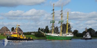
ALEX VON HUMBOLDT 2
Sailing Vessel
Current Trip
DO PUD
| Time Travelled | 6 days |
|---|---|
| Remaining Time | --- |
| Distance Travelled | 13.51 nm |
| Remaining Distance | --- |
| AVG Speed | 5.2 Knop |
| MAX Speed | 7.6 Knop |
| AVG Wind | 9.9 knots |
| MAX Wind | 10 knots |
| MIN Temp | 27.4°C / 81.32°F |
| MAX Temp | 28.8°C / 83.84°F |
| Djupgående | 4.7 m |
| Position mottagen | 6 d sen |
Current Position
| Longitud | -69.67557° |
|---|---|
| Latitude | 18.38705° |
| Status | Under way using engine |
| Fart | 4.1 Knop |
| Kurs | 106° |
| Område | Caribbean Sea |
| Station | T-AIS |
| Position mottagen | 6 d sen |
Info
Information
The current position of ALEX VON HUMBOLDT 2 is in Caribbean Sea with coordinates 18.38705° / -69.67557° as reported on 2025-01-31 19:11 by AIS to our vessel tracker app. The vessel's current speed is 4.1 Knop
The vessel ALEX VON HUMBOLDT 2 (IMO: 9618446, MMSI: 218768000) is a Sailing Vessel that was built in 2011 ( 14 År gammal ). It's sailing under the flag of [DE] Germany.
In this page you can find informations about the vessels current position, last detected port calls, and current voyage information. If the vessels is not in coverage by AIS you will find the latest position.
The current position of ALEX VON HUMBOLDT 2 is detected by our AIS receivers and we are not responsible for the reliability of the data. The last position was recorded while the vessel was in Coverage by the Ais receivers of our vessel tracking app.
The current draught of ALEX VON HUMBOLDT 2 as reported by AIS is 4.7 meters
Weather
| Temperature | 27.5°C / 81.5°F |
|---|---|
| Wind Speed | 10 knots |
| Direction | 82° E |
| Pressure | 1016 hPa |
| Humidity | 73 % |
| Cloud Coverage | 23 % |
Featured Company
Last Port Calls
| Port | Arrival | Departure | Time In Port |
|---|---|---|---|
| 2025-01-28 10:20 | 2025-01-31 12:34 | 3 d | |
| 2025-01-17 10:59 | 2025-01-17 16:45 | 5 h |
Most Visited Ports (Last year)
| Port | Arrivals | |
|---|---|---|
| 17 | ||
| 4 | ||
| 4 | ||
| 4 | ||
| 2 | ||
| 1 |
Last Trips
| Origin | Departure | Destination | Arrival | Distance | |
|---|---|---|---|---|---|
| 2025-01-17 16:45 | 2025-01-28 10:20 | 717.97 nm | |||
| 2024-11-27 11:13 | 2025-01-17 10:59 | 3355.25 nm |
Events
| Tid | Event | Detaljer | Position / Dest | Information |
|---|---|---|---|---|
| 2025-01-31 19:11 | UTANFÖR täckningsområde |
18.38705 / -69.67557
Caribbean Sea
DO PUD
|
Fart: 4.1 kn Kurs: 106.7° |
|
| 2025-01-31 16:34 | AVGÅTT HAMN |
|
18.46018 / -69.89053
DO PUD
|
Fart: 4.9 kn Kurs: 221° |
| 2025-01-31 16:23 | Status ändrad | Under way using engine Moored |
18.47173 / -69.88019
[DO] SANTO DOMINGO
|
Fart: 4.4 kn Kurs: 169° |
| 2025-01-31 16:19 | STARTAR förflyttning |
18.47663 / -69.88123
[DO] SANTO DOMINGO
|
Fart: 4.6 kn Kurs: 176° |
|
| 2025-01-31 14:05 | ETA ändrat | 2025/02/02 14:00 2025/01/28 12:00 |
18.47827 / -69.88206
[DO] SANTO DOMINGO
|
Fart: Kurs: 343° |
| 2025-01-31 14:05 | Destination ändrad | DO PUD DOSDQ |
18.47827 / -69.88206
[DO] SANTO DOMINGO
|
Fart: Kurs: 343° |
| 2025-01-31 05:10 | I täckningsområde |
18.47828 / -69.88208
Caribbean Sea
[DO] SANTO DOMINGO
|
Fart: Kurs: 181.5° |
|
| 2025-01-31 03:31 | UTANFÖR täckningsområde |
18.47826 / -69.88211
Caribbean Sea
[DO] SANTO DOMINGO
|
Fart: Kurs: 86.8° |
|
| 2025-01-30 21:25 | I täckningsområde |
18.47829 / -69.88206
Caribbean Sea
[DO] SANTO DOMINGO
|
Fart: Kurs: 177.9° |
|
| 2025-01-30 15:52 | UTANFÖR täckningsområde |
18.47831 / -69.88207
Caribbean Sea
[DO] SANTO DOMINGO
|
Fart: 0.1 kn Kurs: 7.8° |