

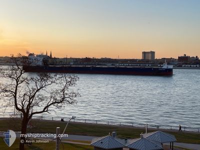
ALGOMA BEAR
Cargo

Current Trip
| Time Travelled | 1 day |
|---|---|
| Remaining Time | --- |
| Distance Travelled | 140.77 nm |
| Remaining Distance | --- |
| AVG Speed | 13.3 Knop |
| MAX Speed | 13.5 Knop |
| AVG Wind | 6.8 knots |
| MAX Wind | 11 knots |
| MIN Temp | 5°C / 41°F |
| MAX Temp | 9.3°C / 48.74°F |
| Djupgående | 8.1 m |
| Position mottagen | 1 d sen |
Current Position
| Longitud | -86.19419° |
|---|---|
| Latitude | 47.19299° |
| Status | Under way using engine |
| Fart | 13.3 Knop |
| Kurs | 122° |
| Område | Gulf of St-Lawrence |
| Station | T-AIS |
| Position mottagen | 1 d sen |
Information
The current position of ALGOMA BEAR is in Gulf of St-Lawrence with coordinates 47.19299° / -86.19419° as reported on 2025-06-07 12:19 by AIS to our vessel tracker app. The vessel's current speed is 13.3 Knop and is heading at the port of HAMILTON. The estimated time of arrival as calculated by MyShipTracking vessel tracking app is 2025-06-10 03:00 LT
The vessel ALGOMA BEAR (IMO: 9619309, MMSI: 316053597) is a Cargo It's sailing under the flag of [CA] Canada.
In this page you can find informations about the vessels current position, last detected port calls, and current voyage information. If the vessels is not in coverage by AIS you will find the latest position.
The current position of ALGOMA BEAR is detected by our AIS receivers and we are not responsible for the reliability of the data. The last position was recorded while the vessel was in Coverage by the Ais receivers of our vessel tracking app.
The current draught of ALGOMA BEAR as reported by AIS is 8.1 meters
Weather
| Temperature | 5.4°C / 41.72°F |
|---|---|
| Wind Speed | 1 knots |
| Direction | 242° WSW |
| Pressure | 1017.1 hPa |
| Humidity | 85.5 % |
| Cloud Coverage | 3 % |


Featured Company
Last Port Calls
| Port | Arrival | Departure | Time In Port |
|---|---|---|---|
| 2025-06-05 16:05 | 2025-06-06 21:37 | 1 d | |
| 2025-06-03 00:32 | 2025-06-03 08:18 | 7 h | |
| 2025-05-29 15:38 | 2025-05-30 09:59 | 18 h | |
| 2025-05-25 00:37 | 2025-05-25 13:50 | 13 h | |
| 2025-05-21 11:04 | 2025-05-22 01:52 | 14 h | |
| 2025-05-15 06:46 | 2025-05-15 19:39 | 12 h | |
| 2025-05-12 01:53 | 2025-05-12 02:34 | 41 m | |
| 2025-05-10 19:22 | 2025-05-11 23:04 | 1 d | |
| 2025-05-10 16:01 | 2025-05-10 16:57 | 55 m | |
| 2025-05-05 23:56 | 2025-05-07 14:57 | 1 d |
Most Visited Ports (Last year)
| Port | Arrivals | |
|---|---|---|
| 34 | ||
| 14 | ||
| 11 | ||
| 10 | ||
| 8 | ||
| 7 |
Last Trips
| Origin | Departure | Destination | Arrival | Distance | |
|---|---|---|---|---|---|
| 2025-06-03 08:18 | 2025-06-05 16:05 | 395.04 nm | |||
| 2025-05-30 09:59 | 2025-06-03 00:32 | 409.19 nm | |||
| 2025-05-25 13:50 | 2025-05-29 15:38 | 404.78 nm | |||
| 2025-05-22 01:52 | 2025-05-25 00:37 | 387.63 nm | |||
| 2025-05-15 19:39 | 2025-05-21 11:04 | 472.24 nm | |||
| 2025-05-12 02:34 | 2025-05-15 06:46 | 827.96 nm | |||
| 2025-05-11 23:04 | 2025-05-12 01:53 | 28.03 nm | |||
| 2025-05-10 16:57 | 2025-05-10 19:22 | 28.05 nm | |||
| 2025-05-07 14:57 | 2025-05-10 16:01 | 732.65 nm | |||
| 2025-05-03 09:29 | 2025-05-05 23:56 | 720.03 nm |
Events
| Tid | Event | Detaljer | Position / Dest | Information |
|---|---|---|---|---|
| 2025-06-07 12:19 | UTANFÖR täckningsområde |
47.19299 / -86.19419
Gulf of St-Lawrence
HAMILTON
|
Fart: 13.3 kn Kurs: 122° |
|
| 2025-06-07 01:38 | STARTAR förflyttning | 3.16 nm, South of THUNDER BAY |
48.34993 / -89.19546
HAMILTON
|
Fart: 8.4 kn Kurs: 109° |
| 2025-06-07 01:37 | AVGÅTT HAMN |
|
48.34993 / -89.19546
HAMILTON
|
Fart: 0.6 kn Kurs: 26° |
| 2025-06-07 00:13 | Status ändrad | Under way using engine Moored |
48.35383 / -89.22869
[CA] THUNDER BAY
|
Fart: Kurs: 290° |
| 2025-06-06 05:37 | Djupgående ändrat | 8.1 6.8 |
48.35386 / -89.22881
[CA] THUNDER BAY
|
Fart: Kurs: 290° |
| 2025-06-06 05:37 | Destination ändrad | HAMILTON THUNDER BAY |
48.35386 / -89.22881
[CA] THUNDER BAY
|
Fart: Kurs: 290° |
| 2025-06-06 05:37 | ETA ändrat | 2025/06/10 07:00 2025/06/05 23:00 |
48.35386 / -89.22881
[CA] THUNDER BAY
|
Fart: Kurs: 290° |
| 2025-06-05 20:49 | Status ändrad | Moored Under way using engine |
48.35385 / -89.22885
[CA] THUNDER BAY
|
Fart: 0.2 kn Kurs: 291° |
| 2025-06-05 20:43 | STOPPAR förflyttning |
48.35387 / -89.22898
[CA] THUNDER BAY
|
Fart: 0.3 kn Kurs: 291° |
|
| 2025-06-05 20:05 | ANLÄNDER HAMN |
|
48.35089 / -89.20055
[CA] THUNDER BAY
|
Fart: 4.4 kn Kurs: 289° |