
ALPA
Cargo
Current Trip
063700
| Time Travelled | 8 h, 0 mins |
|---|---|
| Remaining Time | --- |
| Distance Travelled | 46.97 nm |
| Remaining Distance | --- |
| AVG Speed | 6.7 Knop |
| MAX Speed | 7.7 Knop |
| AVG Wind | 12.6 knots |
| MAX Wind | 18 knots |
| MIN Temp | 1.3°C / 34.34°F |
| MAX Temp | 4.3°C / 39.74°F |
| Djupgående | 0.3 m |
| Position mottagen | 1 m sen |
Current Position
| Longitud | 4.24497° |
|---|---|
| Latitude | 51.63730° |
| Status | Under way using engine |
| Fart | 7.2 Knop |
| Kurs | 239.5° |
| Område | North Sea |
| Station | T-AIS |
| Position mottagen | 1 m sen |
Info
Information
The current position of ALPA is in North Sea with coordinates 51.63730° / 4.24497° as reported on 2026-01-03 15:25 by AIS to our vessel tracker app. The vessel's current speed is 7.2 Knop
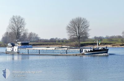
The vessel ALPA (MMSI: 244830385) is a Cargo It's sailing under the flag of [NL] Netherlands.
In this page you can find informations about the vessels current position, last detected port calls, and current voyage information. If the vessels is not in coverage by AIS you will find the latest position.
The current position of ALPA is detected by our AIS receivers and we are not responsible for the reliability of the data. The last position was recorded while the vessel was in Coverage by the Ais receivers of our vessel tracking app.
The current draught of ALPA as reported by AIS is 0.3 meters
Weather
| Temperature | 3.7°C / 38.66°F |
|---|---|
| Wind Speed | 12 knots |
| Direction | 320° NW |
| Pressure | 1003.4 hPa |
| Humidity | 66.9 % |
| Cloud Coverage | 94 % |
Featured Company
Last Port Calls
| Port | Arrival | Departure | Time In Port |
|---|---|---|---|
| 2026-01-02 19:04 | 2026-01-03 08:27 | 13 h | |
| 2026-01-02 12:18 | 2026-01-02 18:36 | 6 h | |
| 2025-12-27 20:20 | 2025-12-31 10:23 | 3 d | |
| 2025-12-27 13:08 | 2025-12-27 13:17 | 9 m | |
| 2025-12-27 10:19 | |||
| 2025-12-19 18:18 | 2025-12-20 10:01 | 15 h | |
| 2025-12-17 13:11 | 2025-12-19 13:21 | 2 d | |
| 2025-12-10 15:33 | 2025-12-16 17:20 | 6 d | |
| 2025-12-10 04:53 | 2025-12-10 08:17 | 3 h | |
| 2025-12-08 15:30 | 2025-12-10 04:33 | 1 d |
Most Visited Ports (Last year)
| Port | Arrivals | |
|---|---|---|
| 40 | ||
| 25 | ||
| 21 | ||
| 20 | ||
| 16 | ||
| 10 |
Last Trips
| Origin | Departure | Destination | Arrival | Distance | |
|---|---|---|---|---|---|
| 2026-01-02 18:36 | 2026-01-02 19:04 | 2.67 nm | |||
| 2025-12-31 10:23 | 2026-01-02 12:18 | 36.63 nm | |||
| 2025-12-27 13:17 | 2025-12-27 20:20 | 54.55 nm | |||
| 2025-12-27 10:19 | 2025-12-27 13:08 | 25.23 nm | |||
| 2025-12-19 13:21 | 2025-12-19 18:18 | 35.64 nm | |||
| 2025-12-16 17:20 | 2025-12-17 13:11 | 41.36 nm | |||
| 2025-12-10 08:17 | 2025-12-10 15:33 | 46.35 nm | |||
| 2025-12-10 04:33 | 2025-12-10 04:53 | 0.34 nm | |||
| 2025-12-08 15:28 | 2025-12-08 15:30 | 0.47 nm | |||
| 2025-12-06 12:26 | 2025-12-06 12:42 | 1.47 nm |
Events
| Tid | Event | Detaljer | Position / Dest | Information |
|---|---|---|---|---|
| 2026-01-03 15:15 | Status ändrad | Under way using engine Default |
51.64713 / 4.27310
063700
|
Fart: 7.2 kn Kurs: 244° |
| 2026-01-03 15:13 | Status ändrad | Default Under way using engine |
51.64901 / 4.27869
063700
|
Fart: 7.2 kn Kurs: 248.7° |
| 2026-01-03 14:42 | Status ändrad | Under way using engine Default |
51.66795 / 4.37025
063700
|
Fart: 7.1 kn Kurs: 239° |
| 2026-01-03 14:41 | I täckningsområde |
51.66576 / 4.36376
North Sea
|
Fart: 7.1 kn Kurs: 242.4° |
|
| 2026-01-03 14:29 | STARTAR förflyttning | 1.53 nm, West of WILLEMSTAD |
51.68700 / 4.40055
063700
|
Fart: 6.7 kn Kurs: 232° |
| 2026-01-03 14:21 | STOPPAR förflyttning | 1.12 nm, West of WILLEMSTAD |
51.69188 / 4.41005
063700
|
Fart: Kurs: -1° |
| 2026-01-03 12:48 | Status ändrad | Default Under way using engine |
51.70519 / 4.57203
063700
|
Fart: 7 kn Kurs: 252° |
| 2026-01-03 12:43 | UTANFÖR täckningsområde |
51.70855 / 4.58746
North Sea
|
Fart: 7 kn Kurs: 252° |
|
| 2026-01-03 12:42 | Status ändrad | Under way using engine Default |
51.70903 / 4.58984
063700
|
Fart: 6.9 kn Kurs: 251° |
| 2026-01-03 12:09 | Status ändrad | Default Under way using engine |
51.75346 / 4.62885
063700
|
Fart: 5.3 kn Kurs: 172.7° |