
ANVIL POINT
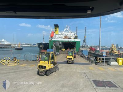
Ro-Ro Cargo
Current Trip
| Time Travelled | 4 days |
|---|---|
| Remaining Time | --- |
| Distance Travelled | 1833.62 nm |
| Remaining Distance | --- |
| AVG Speed | 16.7 Knop |
| MAX Speed | 18.6 Knop |
| AVG Wind | 15.1 knots |
| MAX Wind | 22.8 knots |
| MIN Temp | 17.9°C / 64.22°F |
| MAX Temp | 26°C / 78.8°F |
| Djupgående | 5.3 m |
| Position mottagen | 4 d sen |
Current Position
| Longitud | 18.25146° |
|---|---|
| Latitude | -33.75284° |
| Status | Under way using engine |
| Fart | 17.5 Knop |
| Kurs | 320.8° |
| Område | South Atlantic Ocean |
| Station | T-AIS |
| Position mottagen | 4 d sen |
Info
Information
The current position of ANVIL POINT is in South Atlantic Ocean with coordinates -33.75284° / 18.25146° as reported on 2025-03-10 13:27 by AIS to our vessel tracker app. The vessel's current speed is 17.5 Knop and is heading at the port of ALEXANDROUPOLI. The estimated time of arrival as calculated by MyShipTracking vessel tracking app is 2025-03-29 07:00 LT
The vessel ANVIL POINT (IMO: 9248540, MMSI: 235572000) is a Ro-Ro Cargo that was built in 2003 ( 22 År gammal ). It's sailing under the flag of [GB] United Kingdom.
In this page you can find informations about the vessels current position, last detected port calls, and current voyage information. If the vessels is not in coverage by AIS you will find the latest position.
The current position of ANVIL POINT is detected by our AIS receivers and we are not responsible for the reliability of the data. The last position was recorded while the vessel was in Coverage by the Ais receivers of our vessel tracking app.
The current draught of ANVIL POINT as reported by AIS is 5.3 meters
Weather
| Temperature | 26.1°C / 78.98°F |
|---|---|
| Wind Speed | 11 knots |
| Direction | 137° SE |
| Pressure | 1011.1 hPa |
| Humidity | 79.1 % |
| Cloud Coverage | 100 % |
Featured Company
Last Port Calls
Most Visited Ports (Last year)
| Port | Arrivals | |
|---|---|---|
| 10 | ||
| 4 | ||
| 3 | ||
| 3 | ||
| 2 | ||
| 2 |
Last Trips
| Origin | Departure | Destination | Arrival | Distance | |
|---|---|---|---|---|---|
| 2025-02-20 09:28 | 2025-03-08 10:55 | 4597.33 nm | |||
| 2025-01-28 14:31 | 2025-02-09 10:15 | 685.68 nm | |||
| 2025-01-15 19:20 | 2025-01-23 06:29 | 1929.37 nm | |||
| 2025-01-07 20:14 | 2025-01-15 10:48 | 2670.10 nm | |||
| 2024-12-23 11:14 | 2025-01-07 08:21 | 5249.82 nm |
Events
| Tid | Event | Detaljer | Position / Dest | Information |
|---|---|---|---|---|
| 2025-03-10 13:33 | Status ändrad | Default Under way using engine |
-33.73320 / 18.23183
GRAXD
|
Fart: 17.5 kn Kurs: 320.8° |
| 2025-03-10 13:27 | UTANFÖR täckningsområde |
-33.75284 / 18.25146
South Atlantic Ocean
GRAXD
|
Fart: 17.5 kn Kurs: 320.8° |
|
| 2025-03-10 13:26 | Status ändrad | Under way using engine Default |
-33.75762 / 18.25620
GRAXD
|
Fart: 17.4 kn Kurs: 321° |
| 2025-03-10 13:25 | Status ändrad | Default Under way using engine |
-33.76282 / 18.26141
GRAXD
|
Fart: 17.4 kn Kurs: 321.1° |
| 2025-03-10 13:22 | Status ändrad | Under way using engine Default |
-33.77102 / 18.26980
GRAXD
|
Fart: 17.4 kn Kurs: 323° |
| 2025-03-10 13:21 | Status ändrad | Default Under way using engine |
-33.77740 / 18.27566
GRAXD
|
Fart: 17.4 kn Kurs: 322.4° |
| 2025-03-10 12:33 | AVGÅTT HAMN |
|
-33.89702 / 18.43678
GRAXD
|
Fart: 7.9 kn Kurs: 3° |
| 2025-03-10 12:22 | STARTAR förflyttning |
-33.91398 / 18.43636
[ZA] CAPE TOWN
|
Fart: 3.7 kn Kurs: 348° |
|
| 2025-03-10 12:21 | Status ändrad | Under way using engine Moored |
-33.91436 / 18.43652
[ZA] CAPE TOWN
|
Fart: 0.9 kn Kurs: 15° |
| 2025-03-10 12:10 | Status ändrad | Moored Default |
-33.91472 / 18.44081
[ZA] CAPE TOWN
|
Fart: Kurs: 132° |