

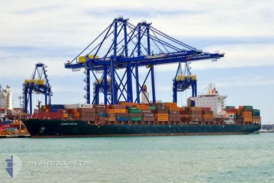
ARICA EXPRESS
Cargo B

Current Trip
| Time Travelled | 1 day |
|---|---|
| Remaining Time | 2 h, 16 mins |
| Distance Travelled | 497.81 nm |
| Remaining Distance | 30.55 nm |
| AVG Speed | 15 Knop |
| MAX Speed | 20.1 Knop |
| AVG Wind | 11.5 knots |
| MAX Wind | 22.5 knots |
| MIN Temp | 19.5°C / 67.1°F |
| MAX Temp | 26.4°C / 79.52°F |
| Djupgående | 10.6 m |
| Position mottagen | 1 m sen |
Current Position
| Longitud | -4.89637° |
|---|---|
| Latitude | 35.84846° |
| Status | Under way using engine |
| Fart | 2.5 Knop |
| Kurs | 315° |
| Område | Alboran Sea |
| Station | T-AIS |
| Position mottagen | 1 m sen |
Information
The current position of ARICA EXPRESS is in Alboran Sea with coordinates 35.84846° / -4.89637° as reported on 2025-06-10 08:21 by AIS to our vessel tracker app. The vessel's current speed is 2.5 Knop and is heading at the port of ALGECIRAS. The estimated time of arrival as calculated by MyShipTracking vessel tracking app is 2025-06-10 12:38 LT
The vessel ARICA EXPRESS (IMO: 9495765, MMSI: 636092697) is a Cargo B It's sailing under the flag of [LR] Liberia.
In this page you can find informations about the vessels current position, last detected port calls, and current voyage information. If the vessels is not in coverage by AIS you will find the latest position.
The current position of ARICA EXPRESS is detected by our AIS receivers and we are not responsible for the reliability of the data. The last position was recorded while the vessel was in Coverage by the Ais receivers of our vessel tracking app.
The current draught of ARICA EXPRESS as reported by AIS is 10.6 meters
Weather
| Temperature | 20.7°C / 69.26°F |
|---|---|
| Wind Speed | 10 knots |
| Direction | 64° ENE |
| Pressure | 1018.4 hPa |
| Humidity | 92.4 % |
| Cloud Coverage | 99 % |


Featured Company
Last Port Calls
| Port | Arrival | Departure | Time In Port |
|---|---|---|---|
| 2025-06-08 01:18 | 2025-06-08 14:06 | 12 h | |
| 2025-06-05 18:53 | 2025-06-06 20:21 | 1 d | |
| 2025-06-03 10:50 | 2025-06-04 18:08 | 1 d | |
| 2025-06-01 03:51 | 2025-06-02 14:54 | 1 d | |
| 2025-05-22 17:29 | 2025-05-27 17:26 | 4 d | |
| 2025-05-18 11:52 | 2025-05-18 23:47 | 11 h | |
| 2025-05-07 01:47 | 2025-05-09 10:36 | 2 d | |
| 2025-05-02 03:44 | 2025-05-03 16:32 | 1 d | |
| 2025-04-24 01:26 | 2025-04-24 08:08 | 6 h | |
| 2025-04-19 04:49 | 2025-04-19 13:34 | 8 h |
Most Visited Ports (Last year)
| Port | Arrivals | |
|---|---|---|
| 8 | ||
| 8 | ||
| 7 | ||
| 7 | ||
| 7 | ||
| 7 |
Last Trips
| Origin | Departure | Destination | Arrival | Distance | |
|---|---|---|---|---|---|
| 2025-06-06 20:21 | 2025-06-08 01:18 | 519.25 nm | |||
| 2025-06-04 18:08 | 2025-06-05 18:53 | 97.08 nm | |||
| 2025-06-02 14:54 | 2025-06-03 10:50 | 340.91 nm | |||
| 2025-05-27 17:26 | 2025-06-01 03:51 | 1140.98 nm | |||
| 2025-05-18 23:47 | 2025-05-22 17:29 | 130.07 nm | |||
| 2025-05-09 10:36 | 2025-05-18 11:52 | 3268.99 nm | |||
| 2025-05-03 16:32 | 2025-05-07 01:47 | 1331.59 nm | |||
| 2025-04-24 08:08 | 2025-05-02 03:44 | 2677.96 nm | |||
| 2025-04-19 13:34 | 2025-04-24 01:26 | 777.16 nm | |||
| 2025-04-18 06:51 | 2025-04-19 04:49 | 129.29 nm |
Events
| Tid | Event | Detaljer | Position / Dest | Information |
|---|---|---|---|---|
| 2025-06-10 08:14 | Status ändrad | Under way using engine Default |
35.84303 / -4.89734
MA PTM>ES ALG
|
Fart: 6 kn Kurs: 77° |
| 2025-06-10 08:04 | Status ändrad | Default Under way using engine |
35.83776 / -4.92109
MA PTM>ES ALG
|
Fart: 8.9 kn Kurs: 62.5° |
| 2025-06-10 07:54 | Status ändrad | Under way using engine Default |
35.82510 / -4.94782
MA PTM>ES ALG
|
Fart: 6.1 kn Kurs: 45° |
| 2025-06-10 07:50 | Status ändrad | Default Under way using engine |
35.81998 / -4.95372
MA PTM>ES ALG
|
Fart: 2.6 kn Kurs: 72° |
| 2025-06-10 07:50 | STARTAR förflyttning | 18.08 nm, East of CEUTA |
35.81998 / -4.95372
MA PTM>ES ALG
|
Fart: 6.1 kn Kurs: 45° |
| 2025-06-10 07:46 | Status ändrad | Under way using engine Default |
35.81737 / -4.95915
MA PTM>ES ALG
|
Fart: 0.6 kn Kurs: 86° |
| 2025-06-10 07:20 | Status ändrad | Default Under way using engine |
35.81943 / -4.95501
MA PTM>ES ALG
|
Fart: 0.6 kn Kurs: 73° |
| 2025-06-10 07:11 | Status ändrad | Under way using engine Default |
35.81990 / -4.95317
MA PTM>ES ALG
|
Fart: 0.7 kn Kurs: 58° |
| 2025-06-10 06:45 | Status ändrad | Default Under way using engine |
35.82093 / -4.94629
MA PTM>ES ALG
|
Fart: 0.8 kn Kurs: 39° |
| 2025-06-10 06:39 | Status ändrad | Under way using engine Default |
35.82124 / -4.94437
MA PTM>ES ALG
|
Fart: 0.8 kn Kurs: 41° |