

ARMADA
Tanker

Current Trip
| Time Travelled | 17 h, 10 mins |
|---|---|
| Remaining Time | --- |
| Distance Travelled | 8.80 nm |
| Remaining Distance | --- |
| AVG Speed | 7.9 Knop |
| MAX Speed | 10.9 Knop |
| AVG Wind | 9.9 knots |
| MAX Wind | 10 knots |
| MIN Temp | 16.7°C / 62.06°F |
| MAX Temp | 18.3°C / 64.94°F |
| Djupgående | 1.9 m |
| Position mottagen | 15 h, 48 m sen |
Current Position
| Longitud | 4.35720° |
|---|---|
| Latitude | 51.03020° |
| Status | Under way using engine |
| Fart | 8.7 Knop |
| Kurs | 174.4° |
| Område | North Sea |
| Station | T-AIS |
| Position mottagen | 15 h, 48 m sen |
Information
The current position of ARMADA is in North Sea with coordinates 51.03020° / 4.35720° as reported on 2025-05-18 15:44 by AIS to our vessel tracker app. The vessel's current speed is 8.7 Knop
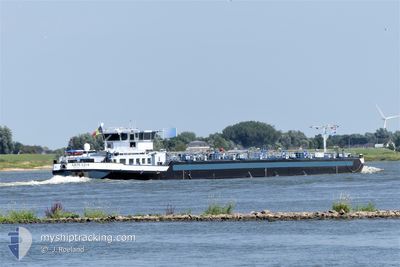
The vessel ARMADA (MMSI: 205252890) is a Tanker It's sailing under the flag of [BE] Belgium.
In this page you can find informations about the vessels current position, last detected port calls, and current voyage information. If the vessels is not in coverage by AIS you will find the latest position.
The current position of ARMADA is detected by our AIS receivers and we are not responsible for the reliability of the data. The last position was recorded while the vessel was in Coverage by the Ais receivers of our vessel tracking app.
The current draught of ARMADA as reported by AIS is 1.9 meters
Weather
| Temperature | 16°C / 60.8°F |
|---|---|
| Wind Speed | 1 knots |
| Direction | 153° SSE |
| Pressure | 1017.4 hPa |
| Humidity | 58.5 % |
| Cloud Coverage | 99 % |


Featured Company
Last Port Calls
| Port | Arrival | Departure | Time In Port |
|---|---|---|---|
| 2025-05-17 16:34 | 2025-05-18 14:23 | 21 h | |
| 2025-05-17 14:14 | 2025-05-17 15:01 | 46 m | |
| 2025-05-17 10:36 | 2025-05-17 13:00 | 2 h | |
| 2025-05-16 04:19 | 2025-05-16 06:33 | 2 h | |
| 2025-05-15 20:11 | 2025-05-16 03:59 | 7 h | |
| 2025-05-15 17:45 | 2025-05-15 19:21 | 1 h | |
| 2025-05-15 15:53 | 2025-05-15 16:47 | 53 m | |
| 2025-05-14 19:04 | 2025-05-15 07:40 | 12 h | |
| 2025-05-14 14:52 | 2025-05-14 15:10 | 18 m | |
| 2025-05-13 14:08 | 2025-05-14 04:58 | 14 h |
Most Visited Ports (Last year)
| Port | Arrivals | |
|---|---|---|
| 39 | ||
| 20 | ||
| 12 | ||
| 12 | ||
| 12 | ||
| 10 |
Last Trips
| Origin | Departure | Destination | Arrival | Distance | |
|---|---|---|---|---|---|
| 2025-05-17 17:01 | 2025-05-17 18:34 | 21.19 nm | |||
| 2025-05-17 15:00 | 2025-05-17 16:14 | 9.35 nm | |||
| 2025-05-16 08:33 | 2025-05-17 12:36 | 50.11 nm | |||
| 2025-05-16 05:59 | 2025-05-16 06:19 | 2.67 nm | |||
| 2025-05-15 21:21 | 2025-05-15 22:11 | 5.07 nm | |||
| 2025-05-15 18:47 | 2025-05-15 19:45 | 10.80 nm | |||
| 2025-05-15 09:40 | 2025-05-15 17:53 | 54.44 nm | |||
| 2025-05-14 17:10 | 2025-05-14 21:04 | 35.40 nm | |||
| 2025-05-14 06:58 | 2025-05-14 16:52 | 64.48 nm | |||
| 2025-05-12 12:13 | 2025-05-13 16:08 | 63.36 nm |
Events
| Tid | Event | Detaljer | Position / Dest | Information |
|---|---|---|---|---|
| 2025-05-18 16:36 | STARTAR förflyttning | 7.65 nm, South East of SINT AMANDS |
50.99423 / 4.37713
BRUXELLES AVANTPORT
|
Fart: 8.6 kn Kurs: 149° |
| 2025-05-18 16:12 | STOPPAR förflyttning | 7.33 nm, South East of SINT AMANDS |
50.99955 / 4.37205
BRUXELLES AVANTPORT
|
Fart: Kurs: -1° |
| 2025-05-18 15:45 | Status ändrad | Default Under way using engine |
51.02901 / 4.35757
BRUXELLES AVANTPORT
|
Fart: 8.7 kn Kurs: 174.4° |
| 2025-05-18 15:44 | UTANFÖR täckningsområde |
51.03020 / 4.35720
North Sea
BRUXELLES AVANTPORT
|
Fart: 8.7 kn Kurs: 174.4° |
|
| 2025-05-18 14:56 | STARTAR förflyttning | 0.77 nm, South East of RUPELMONDE |
51.11441 / 4.30086
BRUXELLES AVANTPORT
|
Fart: 7 kn Kurs: 194.8° |
| 2025-05-18 14:47 | Status ändrad | Under way using engine Default |
51.11764 / 4.30240
BRUXELLES AVANTPORT
|
Fart: Kurs: -1° |
| 2025-05-18 14:46 | STOPPAR förflyttning | 0.67 nm, South East of RUPELMONDE |
51.11764 / 4.30240
BRUXELLES AVANTPORT
|
Fart: Kurs: -1° |
| 2025-05-18 14:42 | Status ändrad | Default Under way using engine |
51.11779 / 4.30248
BRUXELLES AVANTPORT
|
Fart: 10.9 kn Kurs: 240.9° |
| 2025-05-18 14:23 | AVGÅTT HAMN |
|
51.16247 / 4.32862
BRUXELLES AVANTPORT
|
Fart: 12.6 kn Kurs: 175.4° |
| 2025-05-18 13:23 | STARTAR förflyttning |
51.27793 / 4.32759
[BE] ANTWERP
|
Fart: 5.7 kn Kurs: 314.5° |